
Are you planning a hiking trip to the Grand Canyon? We hiked the Bright Angel Trail from the Colorado River to the South Rim. Here's how it went!
Are you ready for the most epic hike of them all?
A hike that will either leave you dreaming of returning to the trail or will instead make you swear you never want to see the trail again?
Visit the Grand Canyon.
We hiked the Grand Canyon all the way to the Colorado River and back in 2017, and despite the challenges-- I would go back in a heartbeat.
Overview of The Bright Angel Trail
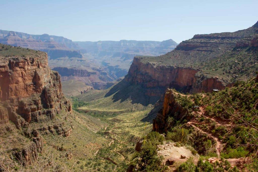
The Bright Angel Trail is one of two corridor trails in the Grand Canyon.
It's 9.5 miles long from the rim to the river, with an elevation change of 4,380 feet.
It runs from the South Rim (near Bright Angel Lodge) all the way to the bottom of the canyon, and then intersects with both the North and South Kaibab Trails via the River Trail.
The Bright Angel Trail runs along a fault line inside the canyon, meaning it has less sweeping canyon views than the South Kaibab. You'll see both desert views and lush green areas along with plenty of flowing water.
A lot of people hike the Bright Angel Trail as part of a loop by hiking into the canyon along the shorter South Kaibab Trail and then out of the canyon along the Bright Angel Trail.
Hiking out of the canyon along the Bright Angel Trail allows you hike in the shade (a major bonus in the desert heat!), and also to refill your water as you go (meaning your pack will be lighter).
Before hiking, check at the Visitor's Center to make sure the water line is working along the Bright Angel Trail. The line occasionally breaks, and if its not working you'll need to carry enough water for the whole trail.
How Hard is the Bright Angel Trail?
Bright Angel Trail is often considered one of Most Dangerous Hikes in America.
Why?
This is a very difficult trail, and the trailhead is in a populated area of the park where people tend to wander onto the trail without planning ahead.
Hiking into the Grand Canyon without planning ahead is an exceptionally bad idea. That said, if you have planned to hike, this is probably the most hiker-friendly trail in the park.
It's well-marked and maintained, relatively shady, and has plenty of water and toilet stops.
Are you planning a hiking trip to the Grand Canyon? Read more about hiking the Grand Canyon, plus check out my tips for training to hike the Grand Canyon and hiking food ideas for the Grand Canyon.
Can I Hike the Whole Trail in One Day?
The National Park Service does not recommend hiking all the way to the river and back in one day.
If you want to hike to the river, you should either make a reservation at Phantom Ranch or get a backcountry permit for camping inside the Grand Canyon.
Otherwise, you can do day hikes on the Bright Angel Trail by starting at the trailhead and going to either the 1.5-mile resthouse (a 3-mile round-trip hike) or the 3-mile resthouse (a 6-mile round-trip hike).
That said, my Grand Canyon day hike recommendation is to hike along the South Kaibab trail to Cedar Ridge or Skeleton Point. South Kaibab will be slightly less crowded and offer better views.
Getting to the Trailhead
I recommend parking at the Visitor's Center and taking a bus to the trailhead. Buses at the Grand Canyon run frequently (at least during peak tourist season).
You can also drive to the Backcountry Information Center (Lot D), and walk 5 minutes to the trailhead.
Hiking the Bright Angel Trail
We hiked Bright Angel Trail as part of a South Kaibab to Bright Angel loop, so this trail guide begins at the bottom of the canyon.
On the second day of our two-day Grand Canyon hike, we woke up early in the morning.
Woke up is exaggerating. I was too full of adrenaline and excitement and nerves to ever fall asleep that night. Stood up is probably more accurate.
We'd successfully hiked down the South Kaibab Trail, spent the night at the Bright Angel Campground, and now we needed to make our way out of the canyon.
We ate breakfast in the dark, packed our bags, and headed away from the Bright Angel Campground towards the Bright Angel Trail.
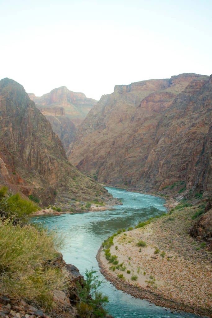
Once we crossed the silver suspension bridge, we began our ascent out of the canyon.
Briefly, as my exhausted legs struggled to move, it occurred to me that hiking into the canyon may have been a terrible mistake.
Fairly quickly, however, I remembered the warning signs plastered all over the Grand Canyon trails: "Down is optional. Up is mandatory."
Since I had no choice, I kept walking. My legs eventually gave up and stopped protesting, and I started to enjoy the hike.

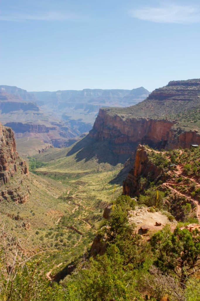
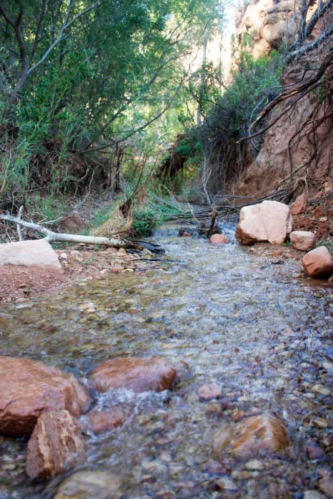
The lower section of the Bright Angel Trail is lovely.
It crosses streams (where I recommend dousing yourself in water), and in a mile and a half, you'll pass the River Resthouse. Keep going towards Havasupai Gardens (formerly called Indian Garden).
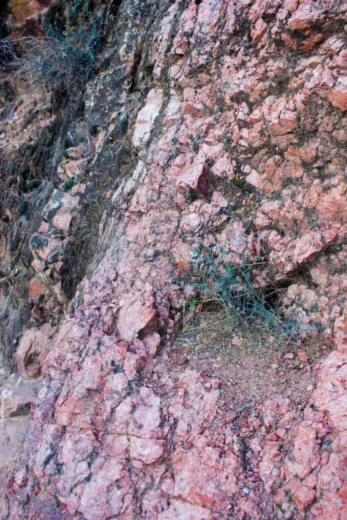
As you hike, make sure to take time to look at rock forming the canyon walls. I know nothing about rocks and even I thought it was gorgeous and fascinating.
The path in between the River Resthouse and Havasupai Gardens starts gradually, but begins to ascend steeply above the canyon floor.
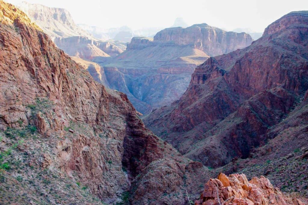
One particularly steep section is known as the Devil's corkscrew.
When we were hiking this section I knew it was steep, but it wasn't until I looked down from above that I realized what we'd hiked.
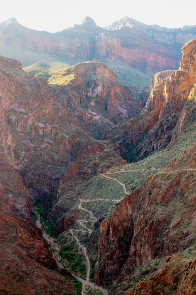
Take a moment to admire the gully and trail below, and then keep moving.
You'll hike past (and through) more streams, and even past a small waterfall.


Eventually you'll arrive at Havasupai Gardens.
You'll know you're there before you see the sign-- it's a lush, green area that looks like a desert oasis.
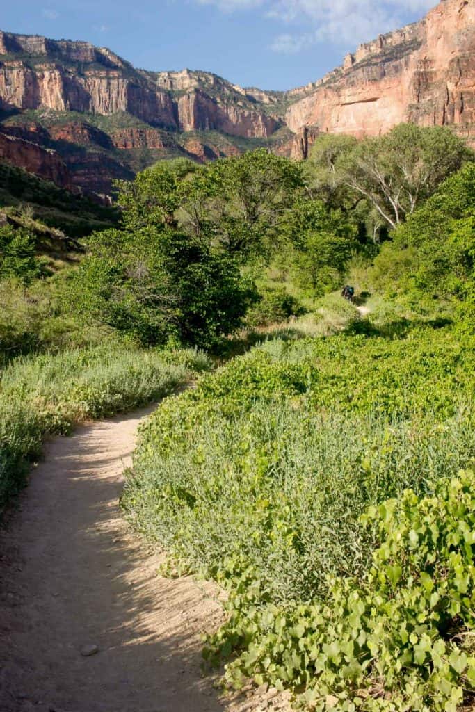
Havasupai Gardens is a nice place to stop, rest, and eat a snack. There's also drinking water and restrooms.
There's also a (reservation-only) campground at Havasupai Gardens, so if you plan ahead, you can stay overnight here.
When you leave Havasupai Gardens, you've got about 4.7 miles to go before you reach the trailhead.
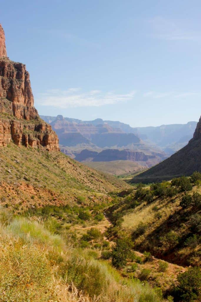
The final four miles of the trail are the steepest. This section of the trail rises about 3,000 feet in elevation, while the lower half of the trail only rises 1,320 feet.
Brace yourself for lots of steep trail switchbacks, and then keep walking. One point seven miles after Havasupai Gardens, you'll reach the 3-mile resthouse.
Stop, refill your water, soak your shirt and hat in water, and then keep moving. When you come to the 1.5-mile resthouse, do the same thing.
Stay hydrated.
For me, the last 1.5 miles were the hardest, and not just because of the trail. This is also where you'll begin to see more people.
People who do not look exhausted at all, because they've just begun their hike into the canyon. We passed ladies in high heels (seriously), families with no water, teenagers in flip-flops, all out for a stroll into the Grand Canyon.
We also met person after person who want to chat.
People who could tell we'd been hiking all day (because of the sleeping pads on our packs, or maybe because we were sweaty and dirty) and wanted to know how the hike was going.
At this point in the hike, I knew that if I stopped to talk, even for a moment, I might not make it out of the canyon. My legs were wobbly; my stamina was fading.
And so, time after time, I smiled and kept walking, while my husband stayed behind to politely respond. If you happen to be one of the people I passed, I apologize if I seemed rude.
On any other trail, or at any other point on the Bright Angel Trail, I would've stopped to compare notes, to ask you what you'd seen, and to answer questions about our hike.
But at this point, I had to keep moving.
And finally, we were there.
When we stepped off the trail, a group saw us and spontaneously started applauding (and made me cry!). And yes, I would do it all over again.
Are you heading to go hiking in the Grand Canyon? Let me know if you have questions or to tell me how your hike went!

Leave a Comment: