


Are you visiting Phoenix? Make sure to check out Arizona's Lost Dutchman State Park and the Siphon Draw Trail! Take this trail to the basin, or continue on to Flatiron!
Sometimes the most beautiful places are hiding just out of view.
Last week, we found one of those places at the Lost Dutchman State Park in Arizona.
The park is about 40 miles east of Phoenix and is home to the Siphon Draw Trail.
If you're visiting Arizona to go hiking in the Grand Canyon or Saguaro National Park, or are hiking in the Phoenix area on Camelback Mountain, Silly Mountain, or the Hieroglyphic Trail, make sure to hit the Siphon Draw Trail too.
Looking for a slightly easier trail in the same park? Check out the Treasure Loop Trail in Lost Dutchman.
How Difficult Is the Siphon Draw Trail?
There are two sections to the Siphon Draw Trail.
The first section is the official, marked Siphon Draw Trail. The second section is a primitive, unmarked trail to the peak of Flatiron (a rock formation in the Superstition Mountains).
The official Siphon Draw Trail is two miles long (one-way), has an elevation gain of about 1,000 feet, and is a moderately difficult trail.
The remaining section of the trail, from the Siphon Draw Basin to Flatiron, is about ¾-mile long (one-way), has an elevation gain of 1,761 feet (almost 2,000 feet!), and is an very difficult trail with significant amounts of rock scrambling.
Do I Have to Pay to Hike This Trail?
Yes.
There's a $7 day-pass fee (for one vehicle with up to four people) to enter the Lost Dutchman State Park. You pay it when you're entering the park.
We camped inside the park, so we didn't have to pay for the day pass.
How Do I Get to the Trailhead?
When you enter the park, simply follow the signs for the day use parking. Ask the park ranger when you check in if you're not sure where to go.
If you're camping inside the park, walk towards the amphitheater for the trailhead.
When Should I Hike the Siphon Draw Trail?
The park is open from sunrise to sunset. Make sure to be back at your car by sunset (especially if you parked in the day use parking lot) because your car could be ticketed if you're there after dark.
Hike when the weather is cool, ideally from October to April (especially if you're continuing to Flatiron). This is a strenuous trail, and hiking in the summer heat is not a good idea.
Avoid hiking this trail when it's rainy, especially during the summer monsoon season. If there's rain in the forecast, I'd be especially cautious on this trail.
We weren't there during the rainy season, but the Siphon Draw basin area seems like a flash-flood danger zone (you can see where the water has stained the rock), and the rock scrambling areas would be treacherous when wet.
What Hiking Gear Should I Bring?
I recommend bringing a trekking pole, even though you'll probably need to strap it to your pack for the rock scrambling sections.
These Kelty trekking poles are my favorite budget pick, because the cork handles are comfy and these poles are extra-sturdy. If you're interested in a higher-end pole, we love these Black Diamond Alpine carbon trekking poles.
Wear hiking shoes or boots with excellent grip, because you'll be hiking over slickrock and rock scrambling. These Keen Pyrenees are my favorites.
Make sure to carry a daypack filled with water and snacks.
I love this REI women's Trail 25 pack for a daypack. (There's also an REI men's Trail 25 pack.) If you're looking for a higher-end pack, this Osprey daypack is my favorite.
Hiking (only) the Official Siphon Draw Trail
We started this hike with every intention of hiking all the way to Flatiron. But for whatever reason, I was feeling exceptionally nervous about the hike that day.
Maybe it's because the reality of hiking almost 2,000 feet of elevation in ¾ of a mile suddenly seemed too daunting. Maybe I didn't sleep well the night before. I'm not sure.
In my trail guides, I like to tell hikers to evaluate their hike before beginning the most challenging sections of a trail, and to turn around if they're just not feeling it. This time, I took my own advice and we turned around at the end of the official trail.
This trail guide begins at the official trailhead and ends at the Siphon Draw Basin. It does not go all the way to Flatiron.
Even so, the official trail ends with spectacular views and I'm glad we made it that far.
When we make it back to the Siphon Draw Trail, I'll try again and (hopefully) update this post with a guide all the way to the top.
How Do I Navigate the Primitive Trail?
If you decide to continue past the basin and onto Flatiron, know that there's a possibility you'll get lost. You should have some basic route-finding skills.
The good news is, you'll also (probably) have a cell-phone signal during your hike. This is also an highly popular trail, so you'll (very likely) be able to ask another hiker if you're confused.
I also recommend stopping at the visitor center and talking to the park rangers. We did, and they were so incredibly helpful.
One ranger showed us a photo album with pictures of the primitive trail to help us know what to look for as we hiked.
Hiking the Siphon Draw Trail
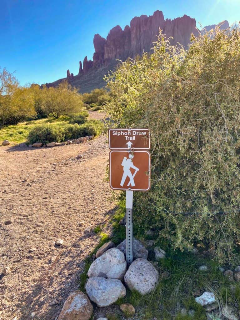
If you park at the day use parking area, you'll take a spur trail to the official trailhead. Our campsite was close to the trailhead, so we just walked on over.
Follow the sign for the Siphon Draw Trail.
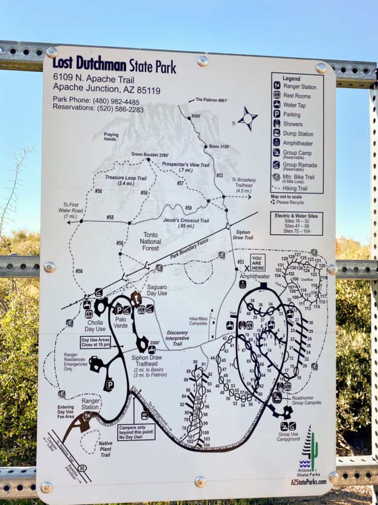
The trail map isn't the most helpful, but it will give you an idea of the elevation changes and distances.
The trailhead is just right of center on the map. Look for the box that says You Are Here.
Start hiking.
I recommend moving as quickly as possible on this section of the trail, especially if you're planning on going to the top of Flatiron.
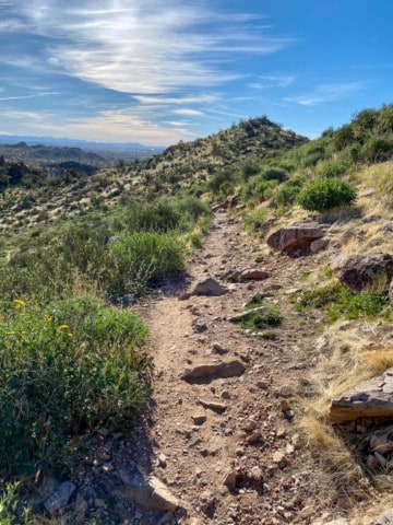
The first mile-and-a-half of the trail is a moderately sloped path with loose gravel. This section isn't technically challenging, even if it is somewhat tiring.
If you plow ahead, it'll give you more time for the harder part of the trail.
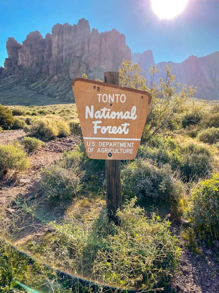
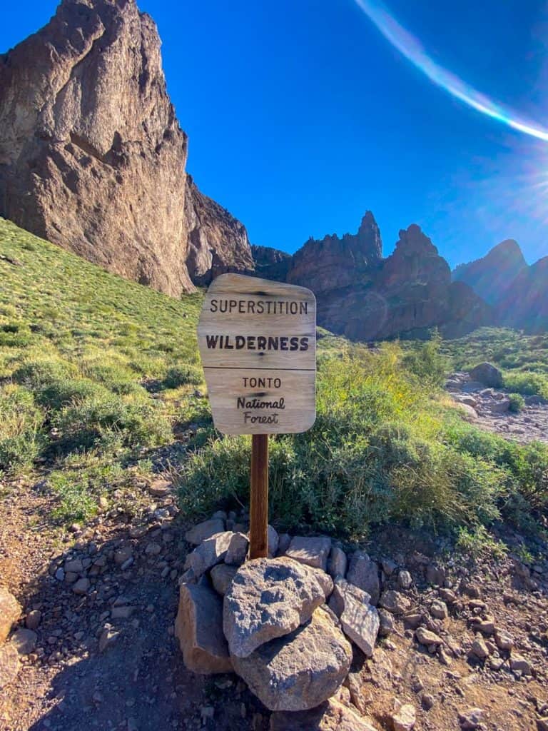
A little over a half-mile in, you'll pass a sign letting you know that you're leaving the state park and entering the Tonto National Forest.
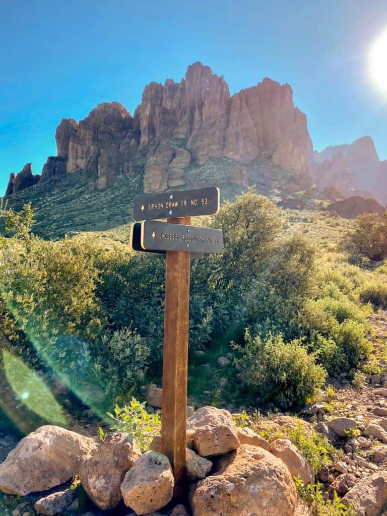
Next you'll pass a trail junction with the Jacob's Crosscut Trail.
Stay on the path for Siphon Draw.
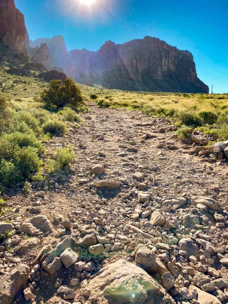
Keep going along the gravel path.
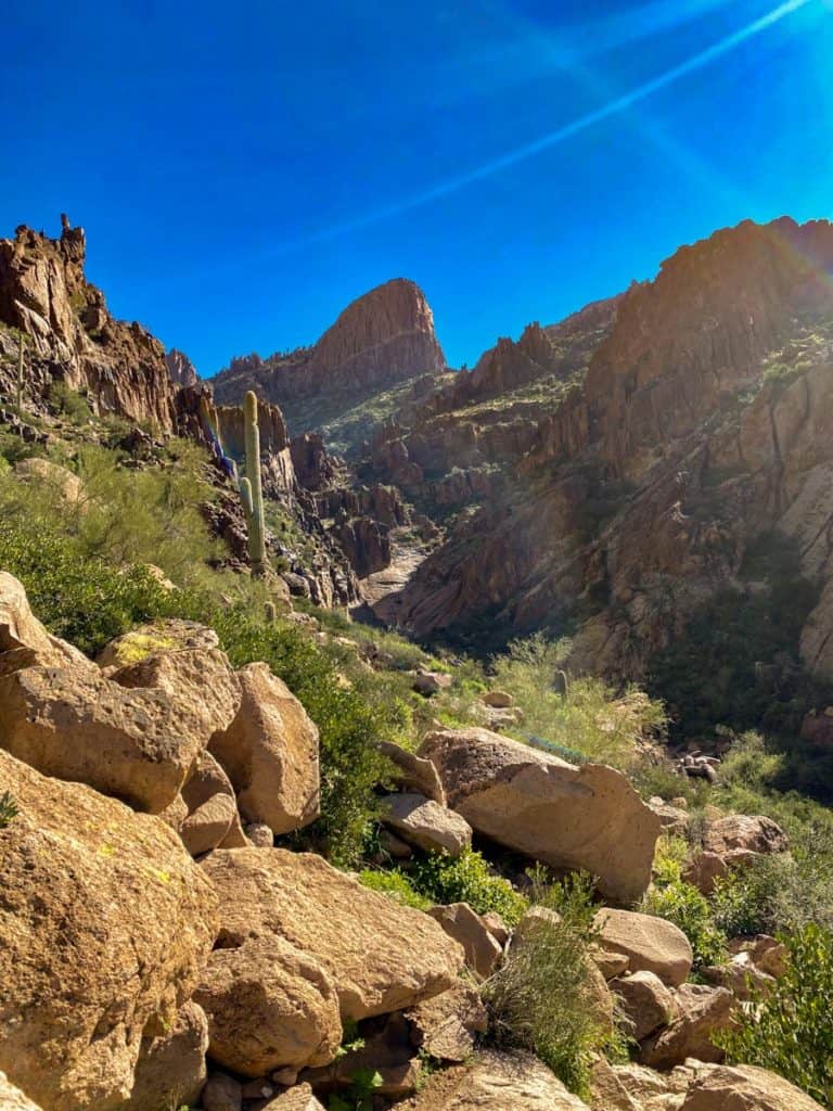
I didn't think this section of the trail was especially interesting (except for the Superstition Mountains in the background), but the scenery will change drastically when you enter the canyon area.
About a mile-and-a-half into your hike, you'll pass a sign for the Superstition Wilderness area inside the Tonto National Forest.
This might be the coolest sign in the universe.
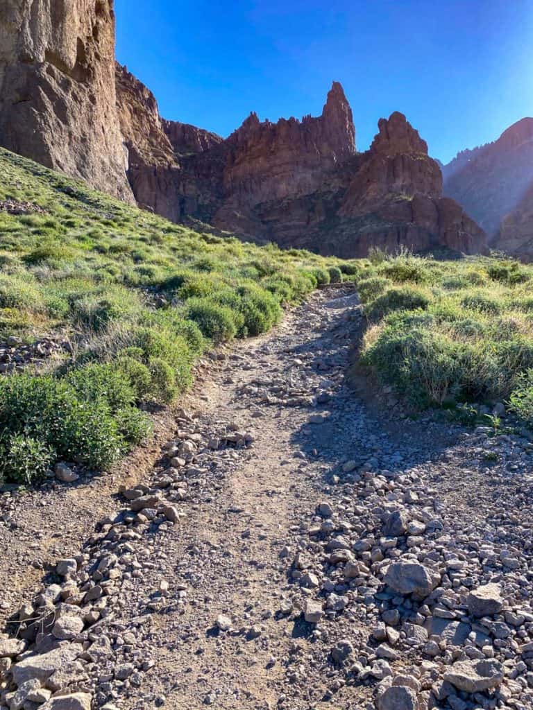
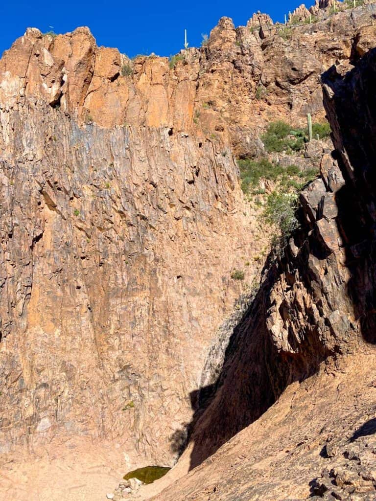
After you pass the Superstition Wilderness sign, you're almost to the canyon area.
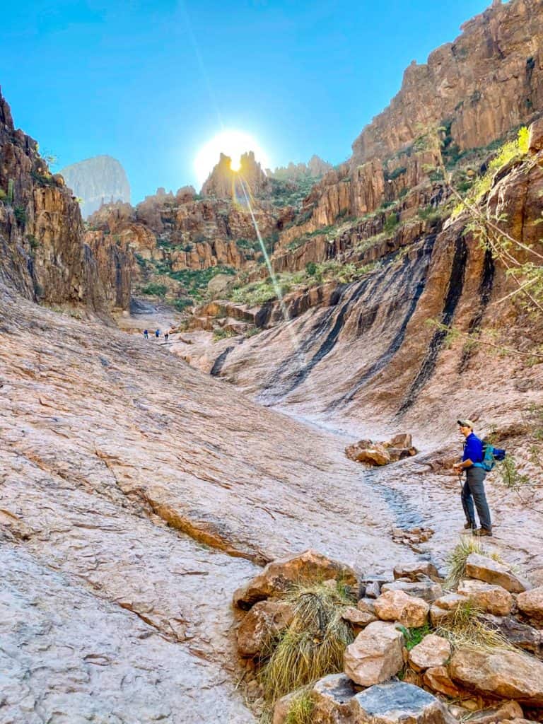
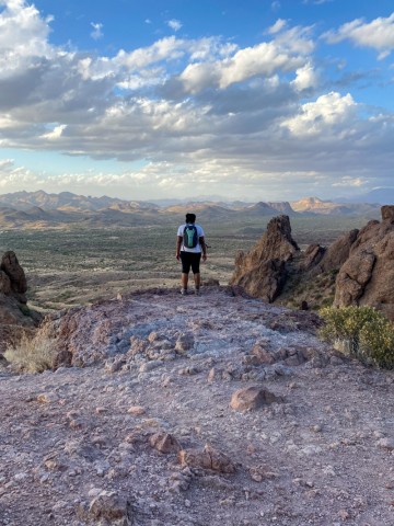
When the scenery starts to change, and you can see the mountains rising up all around you, take a moment to notice the large, angular peak rising in the distance. The one that looks like a battleship or... a flatiron.
That's where the primitive trail ends. All the way at the top of that peak.
Once you enter the canyon area, there's only about a half-mile left on the official Siphon Draw trail.
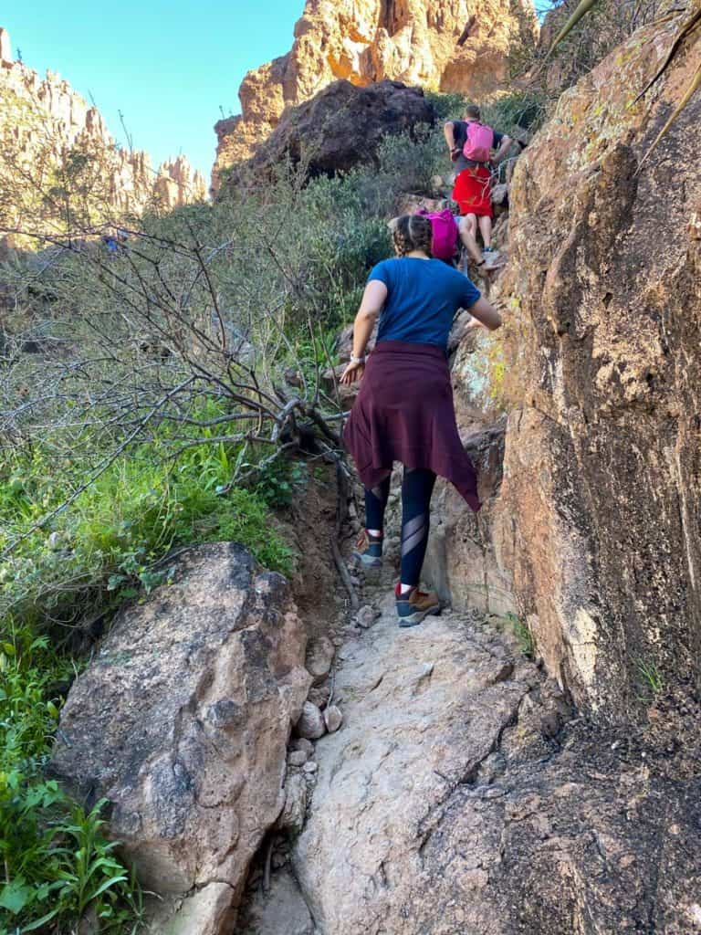
You'll continue to gain elevation, and the trail itself will be less flat and graded. You'll have to navigate around some small boulders.
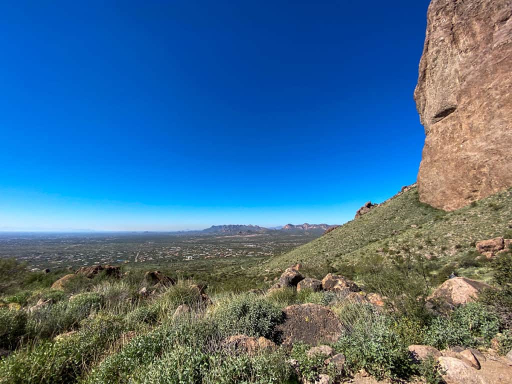
Make sure to turn around and look behind you to see how far you've hiked.
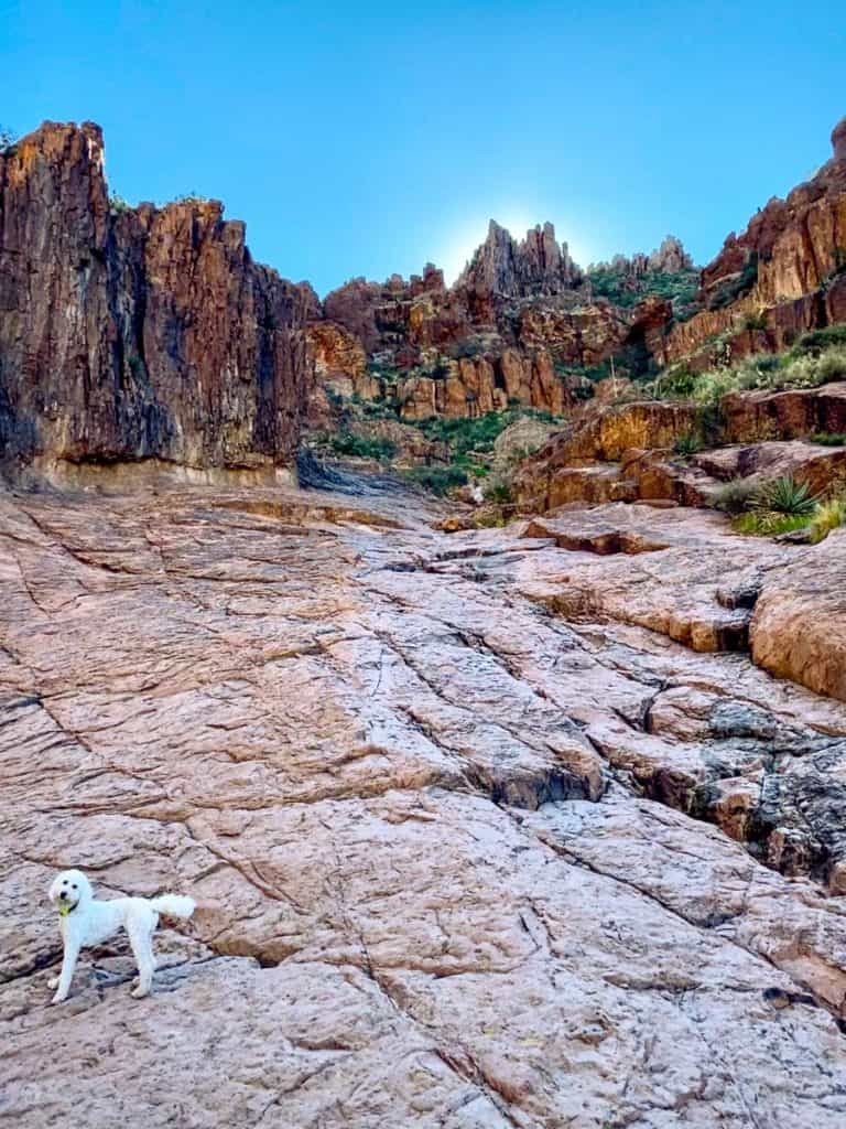
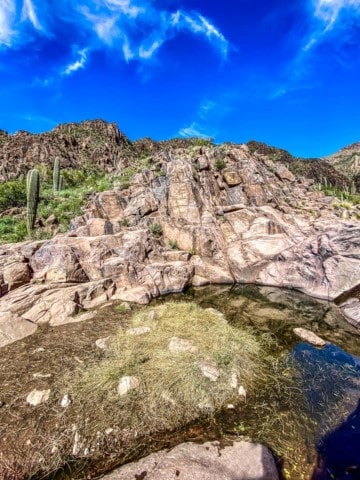
And then, quite suddenly, you're there.
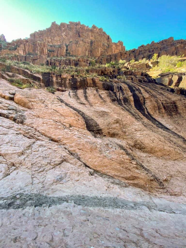
This is the Siphon Draw Basin.
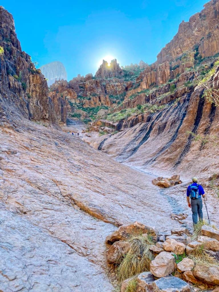
Notice the black streaks where water flows when it's rainy? The thought of hiking through this when it's wet is terrifying. Don't do it.
This is an excellent spot to stop and take a break.
Eat a snack and drink some water.
Look around.
In the back left side of the basin, there will probably be a pool of water. If it's been raining recently, you might see a waterfall.
If you decide to keep going, or if you're undecided and want a better look at the Flatiron, walk up the basin.
Towards the top of the basin, the path becomes very sandy and steep. This is the area that freaked me out the most, and my fear of heights (and falling) got the better of me. This section is the reason I didn't continue much farther.
Once you reach the top, look for an arrow on a rock on the top right of the basin. The arrow marks the way.
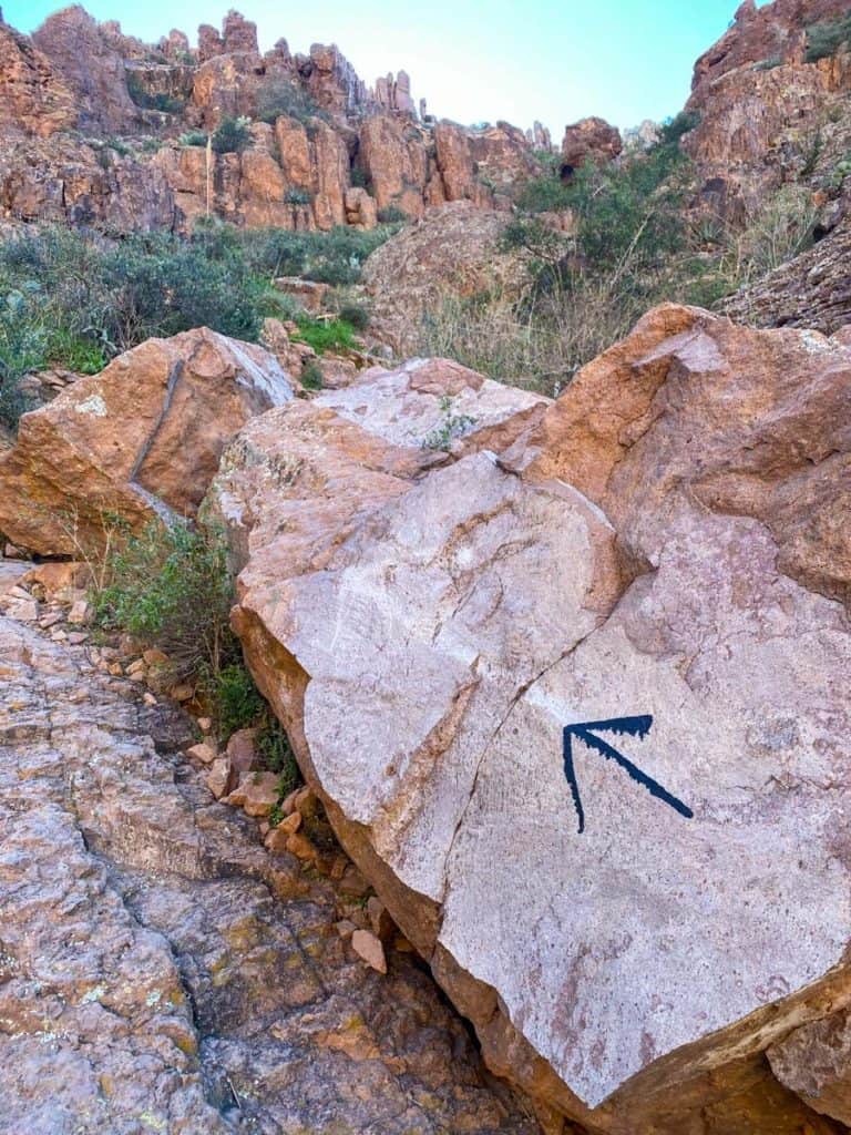
Navigate along the rocks and continue to the upper basin.
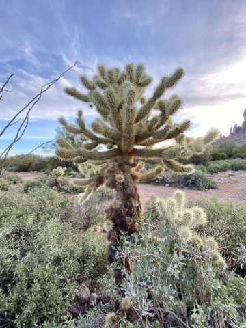
Step carefully, and if you're moving over to let other hikers pass, watch out for cacti along the path. I saw a hiker almost faceplant into a cactus.

When you reach the upper basin, you're about ¾-of-a-mile from the top of Flatiron. The remaining path rises about 2,000 feet in elevation and is primarily a rock scrambling trail.
Remember that coming down a rock scrambling path is usually just as hard (or harder) than going up. Make sure you have the energy to do both.
If you decide to keep going, power on to the top, tread carefully, and then let me know how it went!
bill says
excellent map guide. however I didn't know you were afraid of HEIGHTS! INTERESTING. SO AM I, yet I fly.
Sarah Trenalone says
Yup, I am! Go you, fly high!! 😀
Theodore says
Nice post. I decided to try it 09/25/21. I use to be more afraid of heights but slowly over coming them over the years. Anyways, much harder to complete then I thought. But worth it. Took me 5hrs (11-16:00). 2hour 50minutes up. 30 min break at top. 1hour 40minutes back down. Kept getting lost up trying to stay in line with peak (eye on the prize)
Sarah Trenalone says
Sounds like an amazing time. So glad you enjoyed!