
Are you visiting Carter Caves State Park in Olive Hill, Kentucky? Make sure to check out the 4C's trail, a cross-country trail that includes two natural arches, two swinging bridges, and two waterfalls!
Recently, we've been driving to Berea, Kentucky to hike on the East Pinnacle and West Pinnacle trails, but today we headed to Carter Caves State Park to hike the Carter Caves Cross-Country trail (4C's trail).
The 4C's trail is a loop trail that features two natural arches, two waterfalls, and two swinging bridges. The final 1.75 miles of the trail follows a section of my other favorite Carter Caves trail, Three Bridges Trail.
Looking for more nearby trails? Check out Bernheim Forest and Natural Bridge in Kentucky, or visit the New River Gorge (West Virginia) or the Great Smoky Mountains (Tennessee).
4C's Trail Information
This trail is listed as a moderately difficult trail. There's nothing technically challenging (like rock scrambling) on this trail. It's simply long.
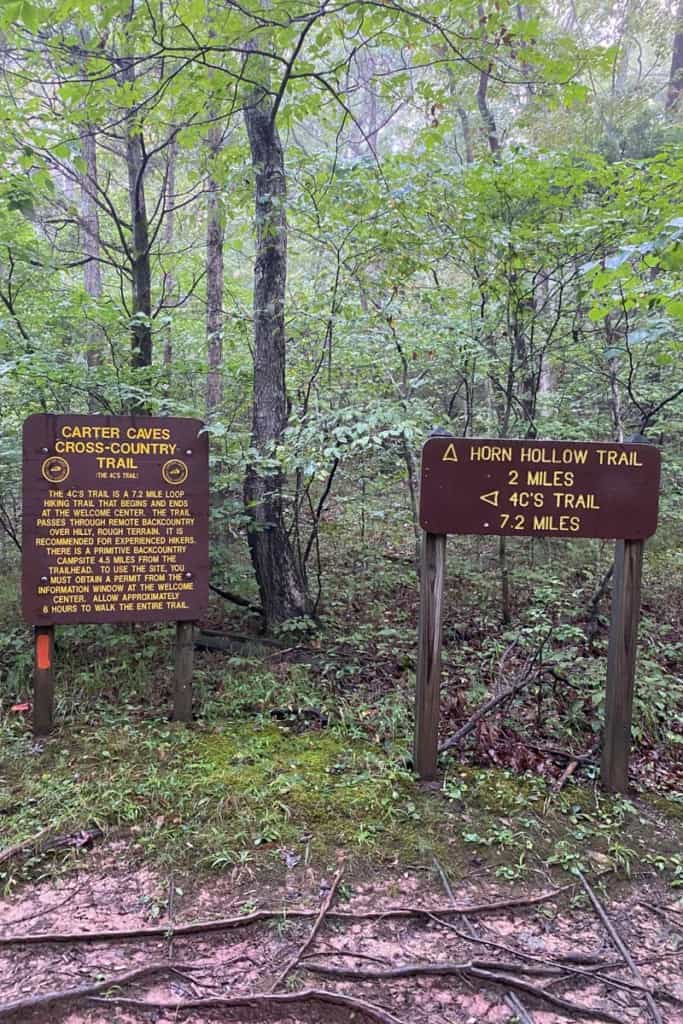
The actual length of the trail is a little unclear. The trail signs say the trail is 7.2 miles, but it's definitely longer than that. The Kentucky State Park website lists the length as 8.3 miles with a 1,177-foot elevation change.
So basically, the exact numbers are unclear, but the trail is long with a decent amount of elevation change.
We finished this trail in four-and-a-half hours, but the park service recommends budgeting at least six hours to finish the trail.
Weather Conditions + the 4C's Trail
There is one section of this trail near the dam that will (likely) be impassable after heavy rains.
If you know water levels in the area are abnormally high, or if there's just been a heavy rainstorm, save this trail for another day.
What Gear Should I Wear or Bring?
I recommend bringing along trekking poles. I love these Kelty cork-handled poles, and also these higher-end Black Diamond Alpine carbon trekking poles.
The pole will help you navigate the terrain and knock spiderwebs out of the way. Seriously, I think I knocked down about a hundred spiderwebs on this hike. My apologies to the spiders.
It's also a good idea to bring along water, snacks, and a first aid kit. I love using this Osprey daypack or this hydration vest.
Part of this trail is in the Tygarts State Forest, outside of the Carter Caves State Park boundary. If you're hiking during Kentucky's hunting season, you should either avoid this section of the trail or wear bright, reflective clothing.
Staying Found on the 4C's Trail
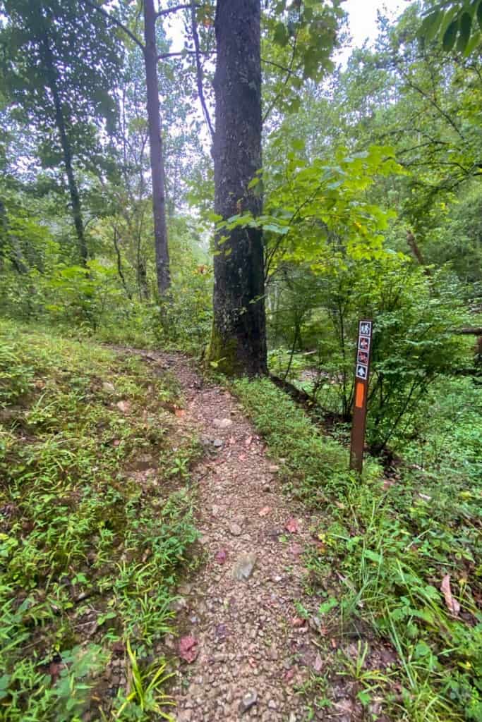
The 4C's trail is well-marked with orange blazes (marks on trees or rocks). You'll also see metal 4C signs along the path.

That said, there are lots of unmarked spur trails along this path. There is no trail map at the trailhead or on the trail information sign.
If you don't want to go inside the Welcome Center for a paper map, check out the park map here. Zoom in on the 4C's trail and screenshot it in sections (to make it easier to read).
Note that on the trail map, the final section of the trail only lists the Three Bridges Trail, but you'll see the 4C's orange trail blazes while you hike.
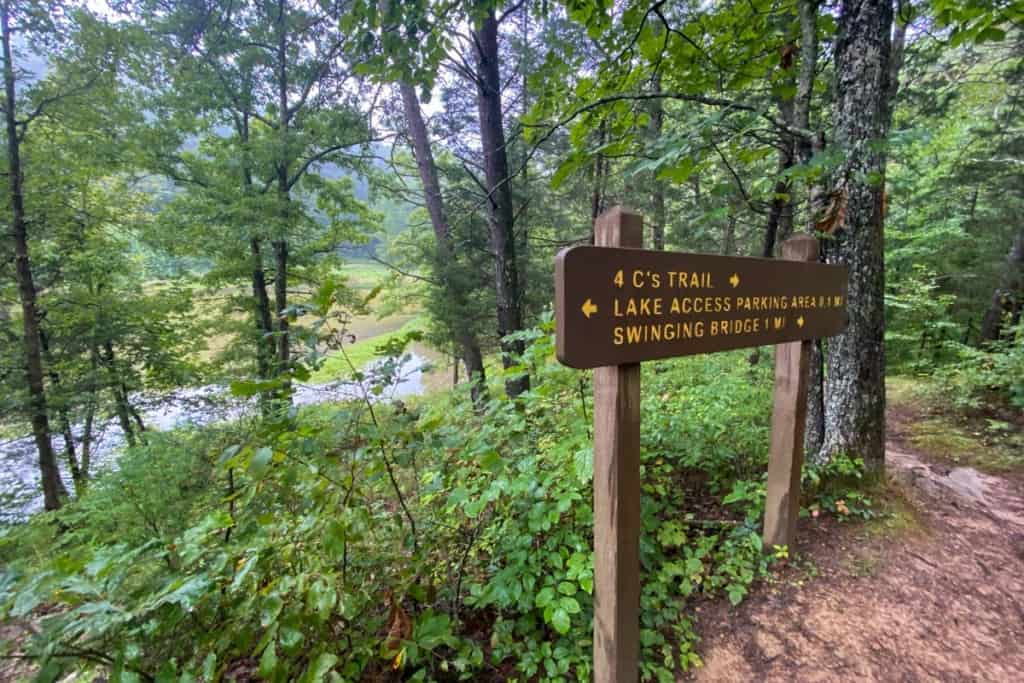
Getting to the Trailhead
Drive to the Carter Caves State Park Welcome Center.
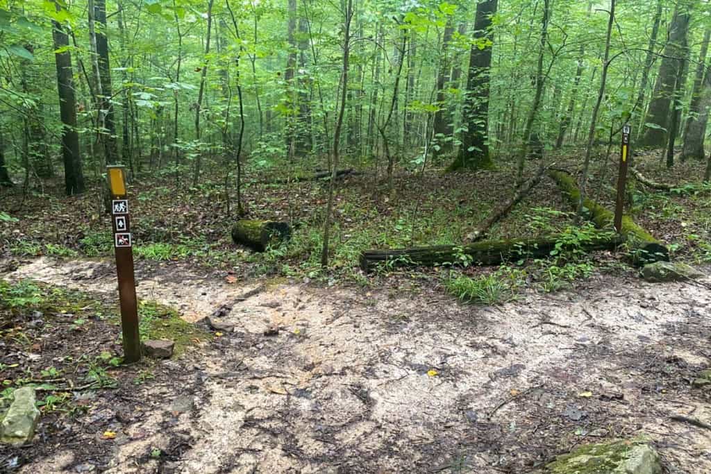
Walk to the far end of the parking lot (the side farthest from the road), and look for the trailhead sign for X-Cave.
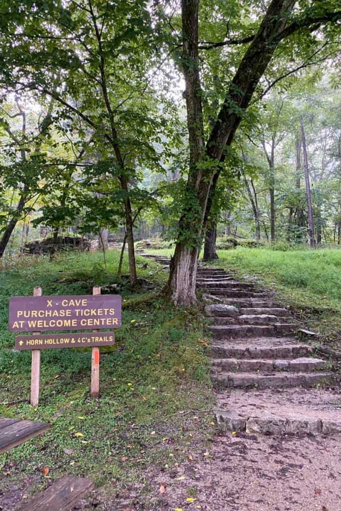
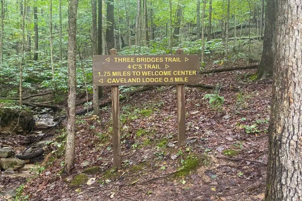
Follow the trail signs for the 4C's trail. You'll quickly arrive at the 4C's trail sign.
Begin hiking, taking care to look for the orange blazes as you go.

The Bat Preservation Area
Soon, you'll enter the Bat Preservation Area.
Make sure to stay on the path (and don't bring pets!).

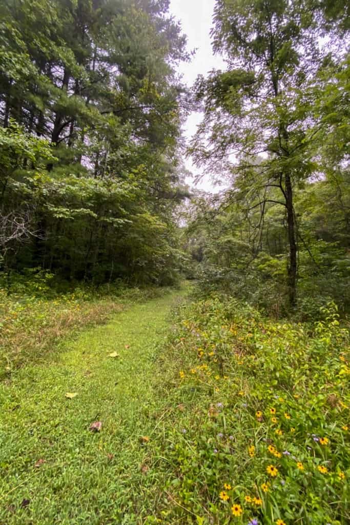
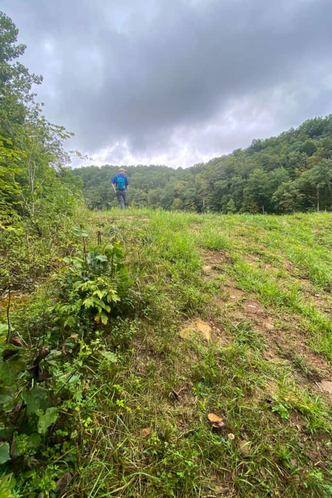
Near the end of the Bat Preservation Area, you'll reach a meadow.
Take a moment to enjoy the wildflowers here.

Tygarts State Forest
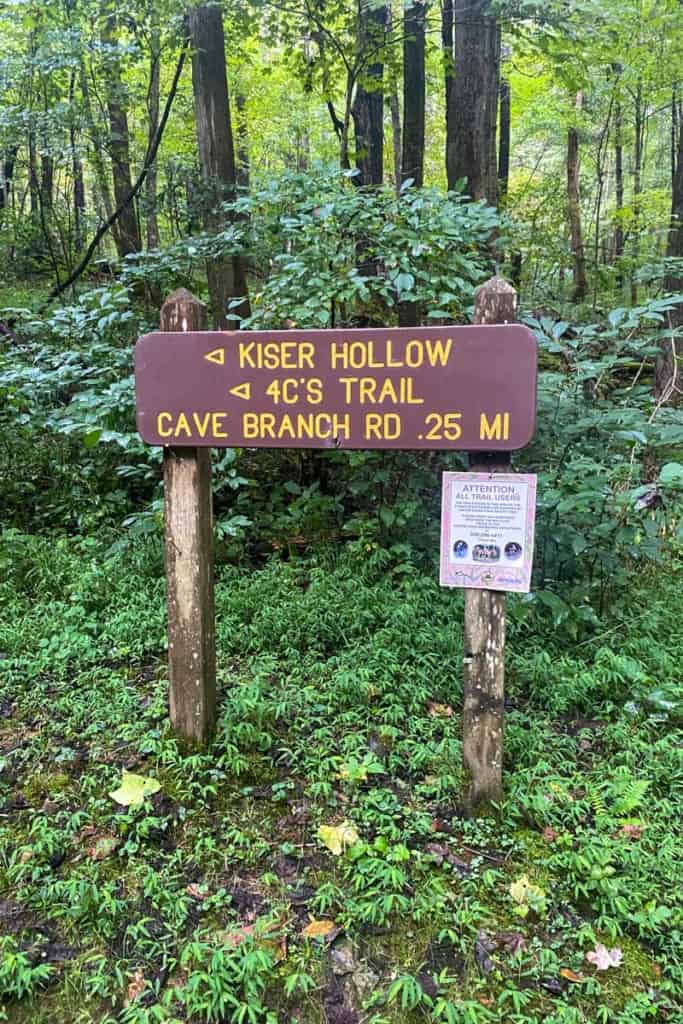
When you reach the Kiser Hollow trail junction, you're entering Tygarts State Forest.
This is the section to be cautious in during hunting season.
Continue following the signs for the 4C's trail.
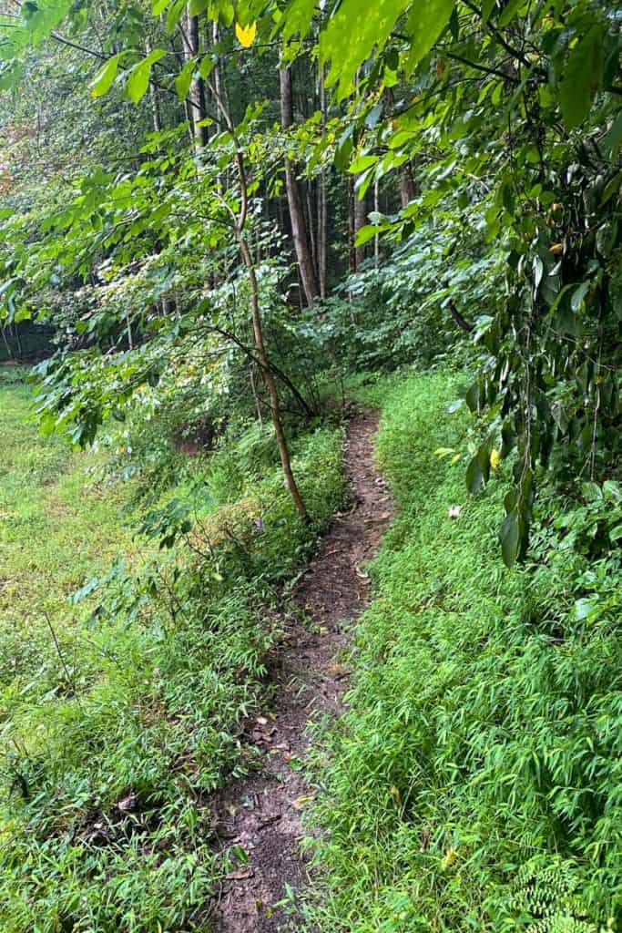
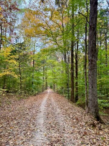
Be aware that the section of the trail in Tygarts State Forest is also used as a horse trail, so the trail is a little rough, especially if it's been raining recently.
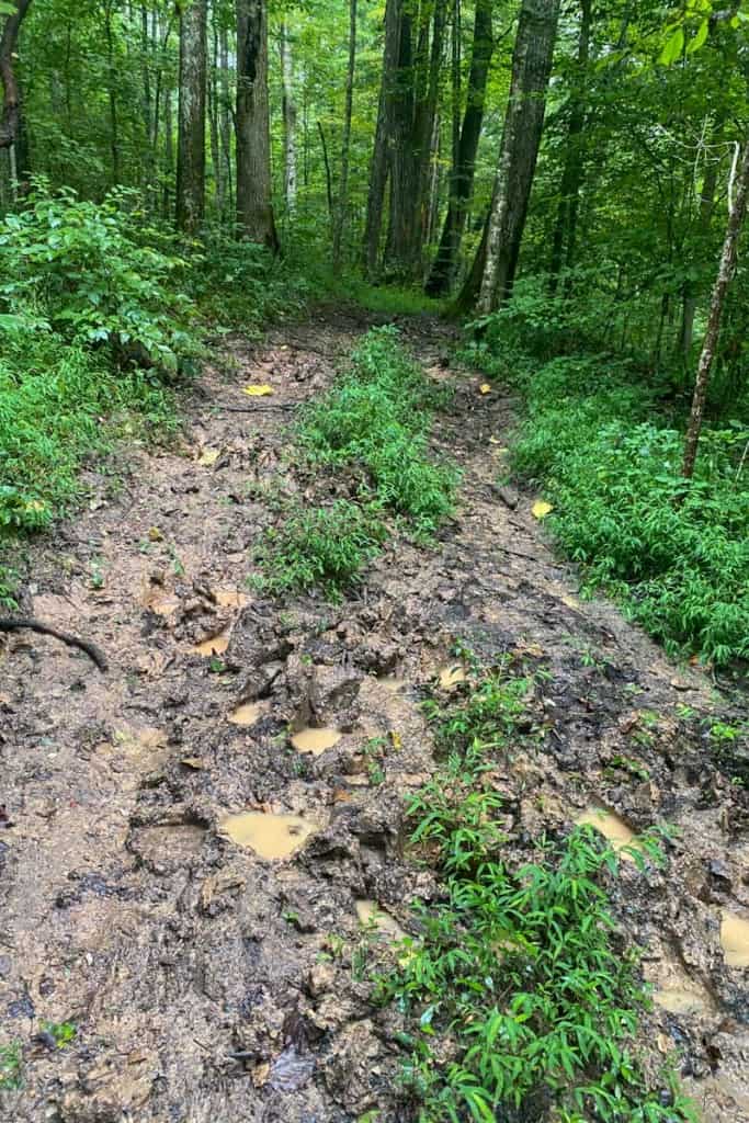
Just keep on hiking despite the mud. The trail gets much better!
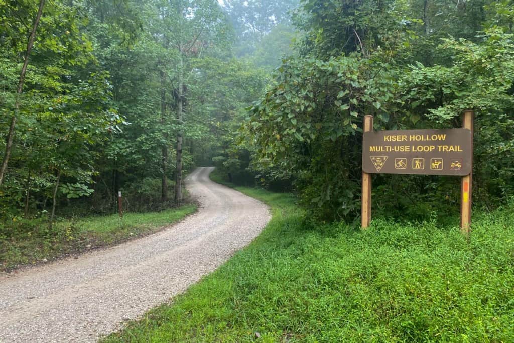
When you reach a gravel road, you're crossing out of Tygarts State Forest and back into Carter Caves State Park.
The trail continues across the road where the brown trail marker is. In the photo below, you can see the trail marker on the left side of the picture.
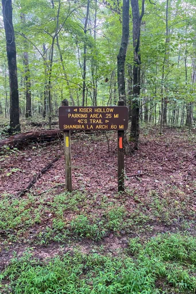
4C's Trail to Shangra La Arch
When you reach the trail junction with Kiser Hollow, turn right to stay on the 4C's trail.
You're heading towards Shangra La Arch.
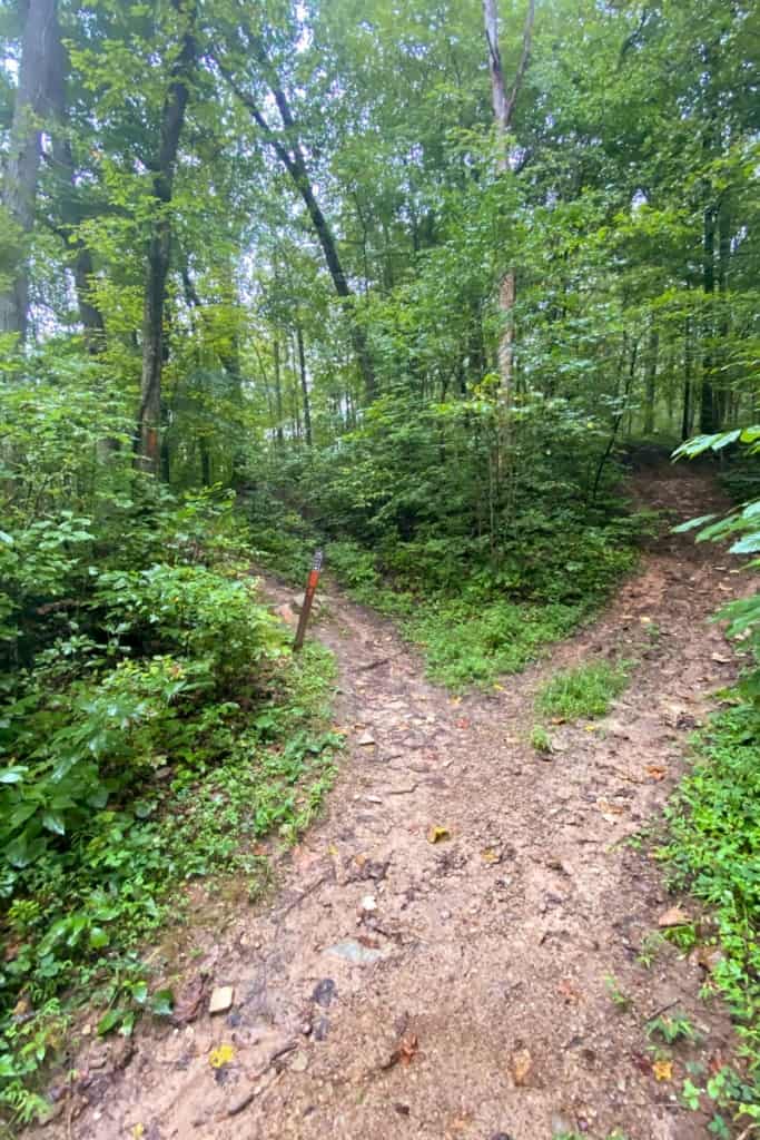
When you reach an unmarked trail junction, go left to stay on the 4C's trail.
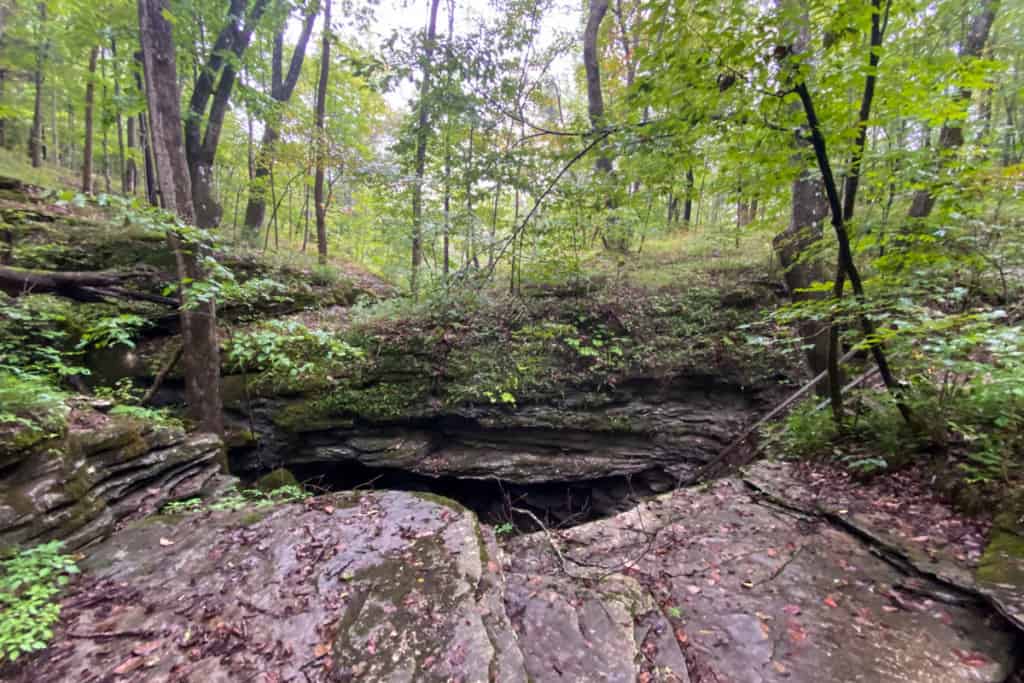
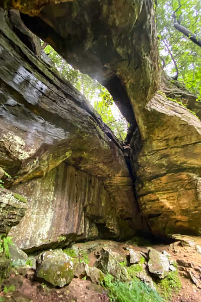
When you arrive at the arch, it won't look like much at first.
You can see in the photo below that it will simply look like a crack in the rocks.
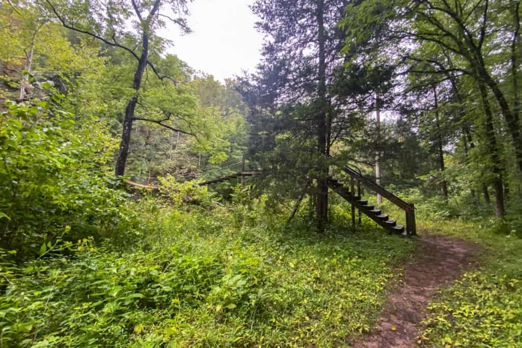
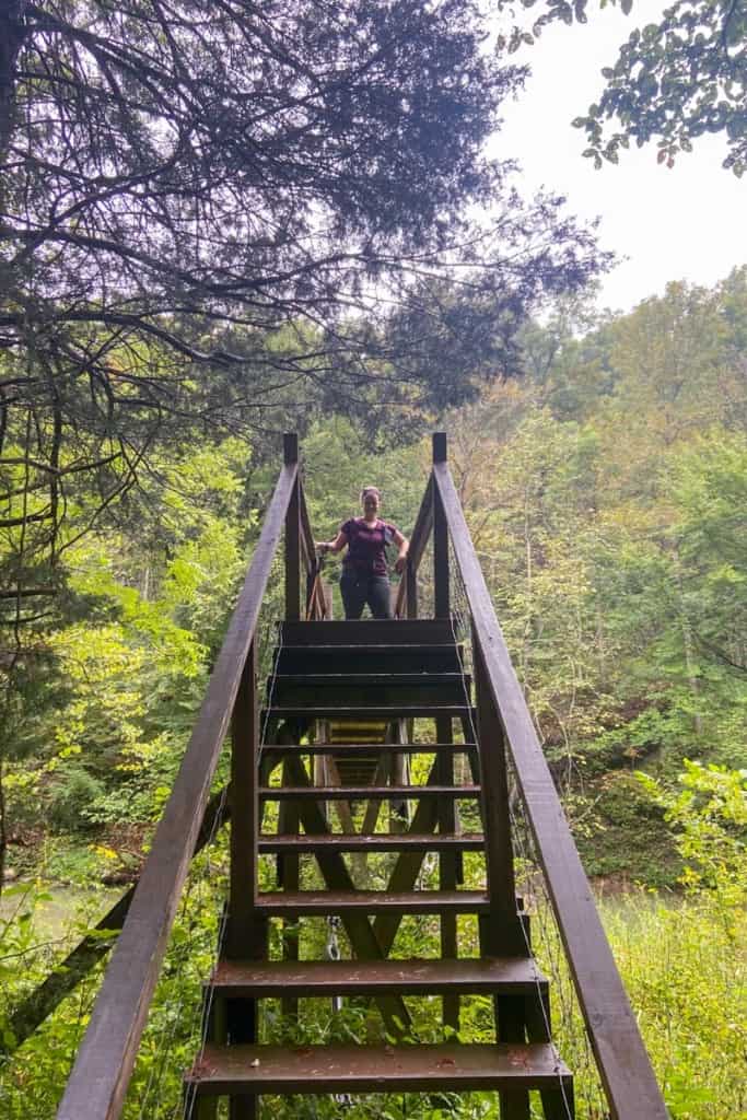
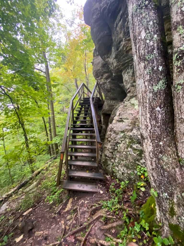
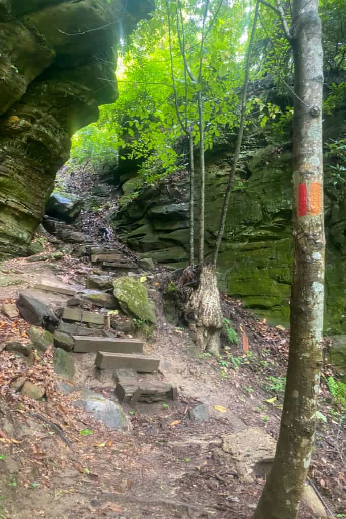
Walk to the right side of the arch, and you'll see a wooden staircase with orange trail blazes.
The trail goes down the stairs and through the arch.
This used to be one of the scariest flights of stairs I've ever taken, with slick planks all resting at different (not flat) angles.
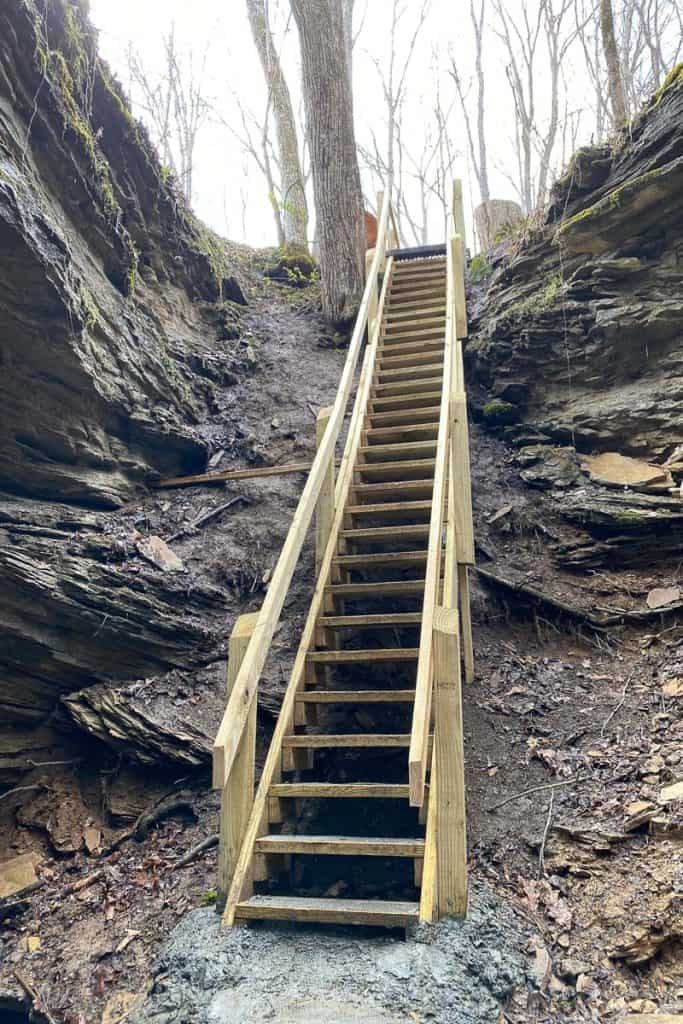
Happily, there is a new set of stairs, pictured above. They are much safer and easier to navigate, and there's even mesh over the planks to keep them from being slippery.
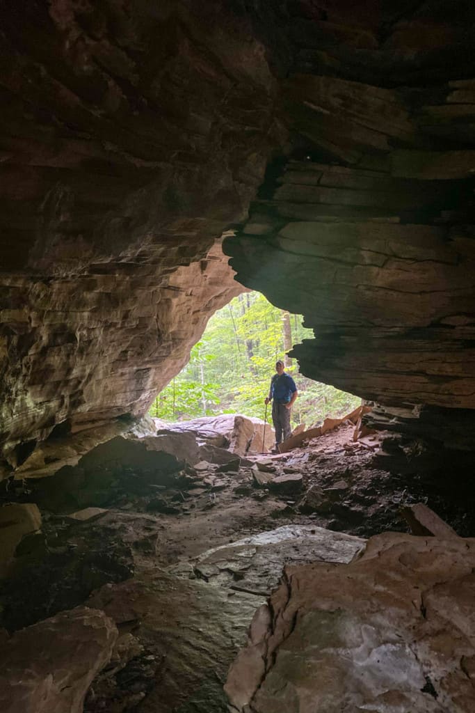
Once you climb down the stairs, you can walk right under Shangra La Arch. It kind of looks like a cave.
Be aware of your surroundings as you walk, and don't linger under the arch. Stone arches seem stable but are constantly eroding.
You can see in the photo below that there have been small rockfalls inside the arch.

Once you're on the other side of the arch, the trail continues to the left.
In other words, you don't have to climb back up the stairs. Yay!
Through this section of the trail, keep an eye out for orange blazes on the rocks to lead the way.

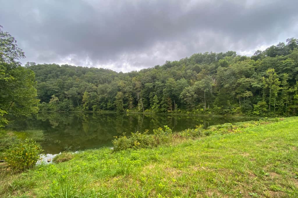
The next trail junction will be near the lake.
Turn right to head towards the first swinging bridge.
This section of the trail comes to a junction with a watery bank on the left.
If you need to filter water (we use a Sawyer Mini water filter), this is a great spot to do it.
However, the trail actually continues to the right of the trail junction.
Follow the orange trail marker, not the unmarked path on the right.
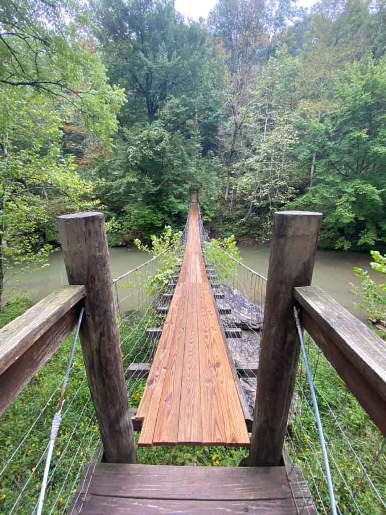
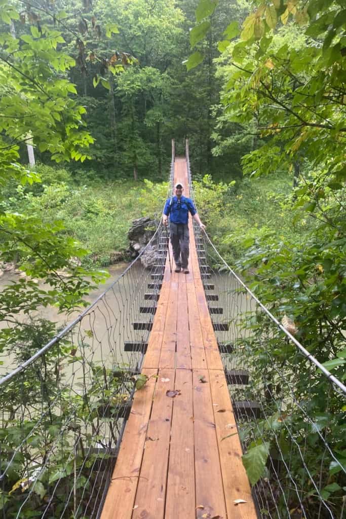
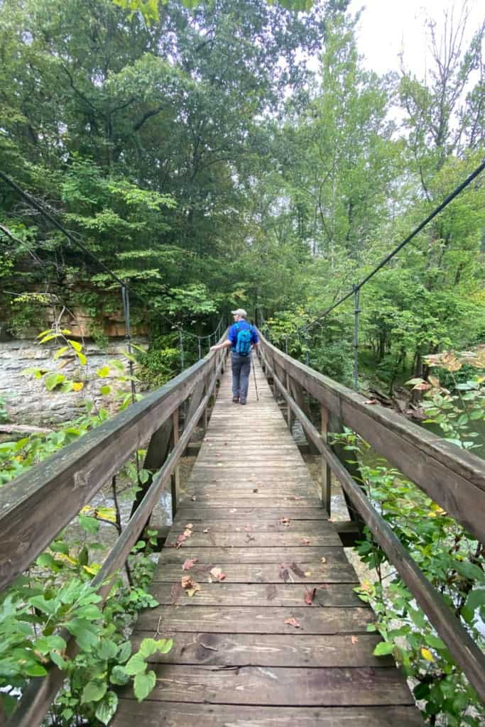
4C's Trail to the Swinging Bridge
Soon, you'll arrive at the first swinging bridge.
The stairs are easy to spot!
Guys, this bridge is really fun!
It does actually swing as you walk across it, so step carefully!
The Trail to the Dam
As you hike, you'll pass a few more (well-marked) trail junctions. Stay on the 4C's trail.
You'll pass the Johnson Homeplace Backcountry Campsite. You need a permit to stay here.

Make sure to take time to look around.
There were lots of mushrooms along the trail when we were there!

As you get closer to the dam (and its two waterfalls!), you'll hear the first waterfall before you see it.
Your first glimpse of a waterfall will be from above.
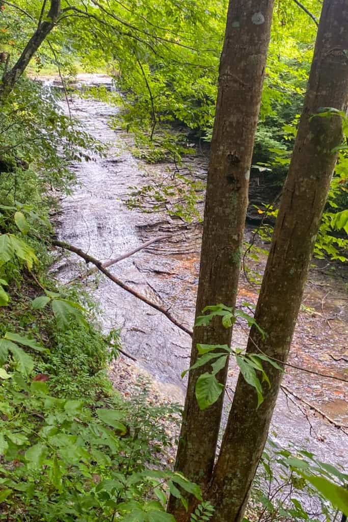
The trail continues into a field, and then wraps around backwards towards the waterfall.
The first time we hiked this trail, I didn't realize we were going to get a closer look at the waterfall, so this was exciting!
Follow the path back towards the waterfall.
Step carefully: the rocks will probably be slippery.
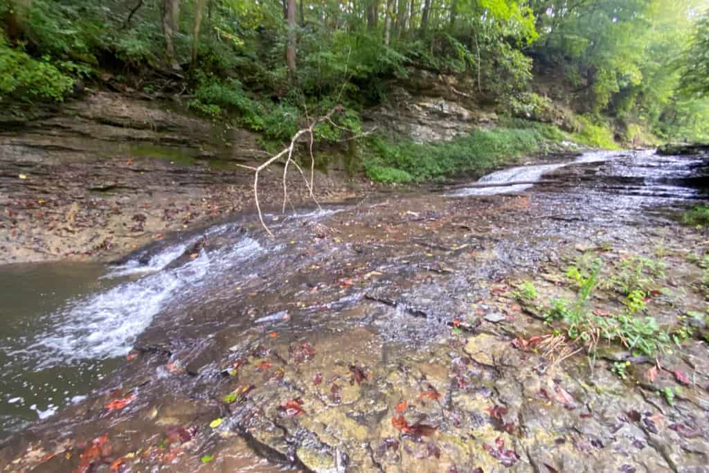
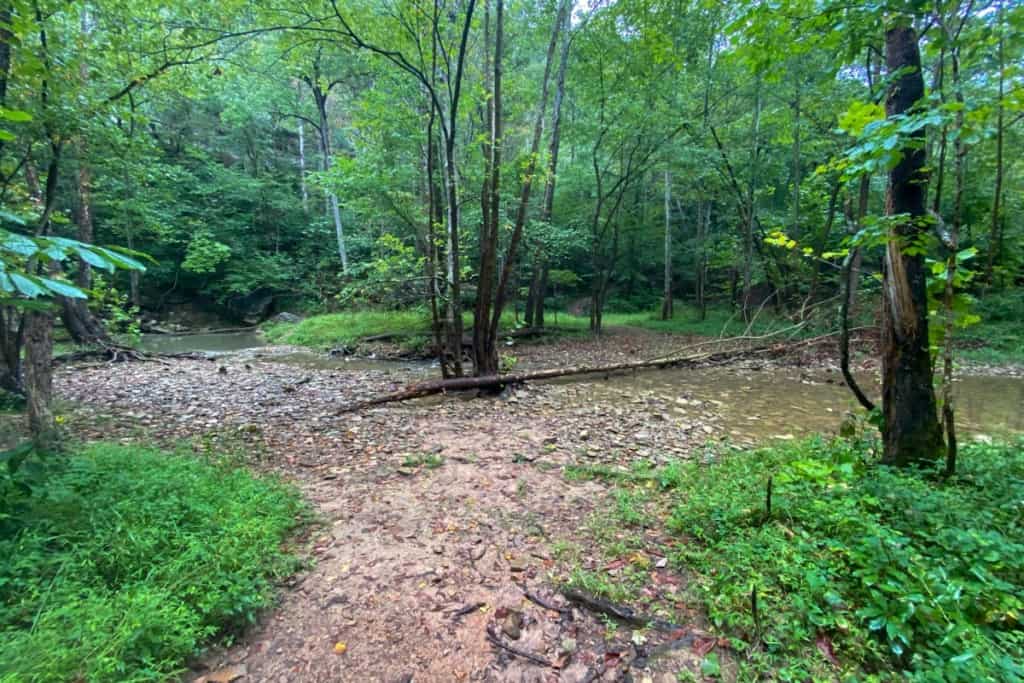
As you hike, you'll come to a stream crossing. You can choose to either step carefully across slick rocks or just walk right through the water.
I opted to walk through the water. I also slipped and fell. Oops.
You can see the water that I walked through in the photo below.
The stream crossing seems like it could very easily flood after a heavy rain, making this section of the trail impassable.
I wouldn't attempt this trail after a heavy rain.
After the stream crossing, the trail veers right and goes uphill.
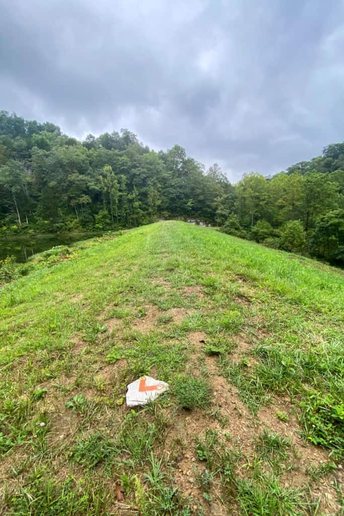
Keep going to hike to the top of the dam.
This is an open field with a tall, grassy man-made hill (the dam). Stand on the dam for a view of the lake.
At the top of the dam, there's a rock with an orange blaze pointing across the dam.
Follow the arrow.
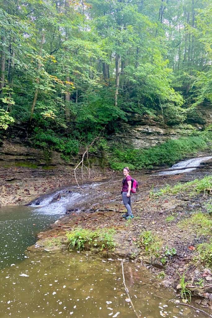
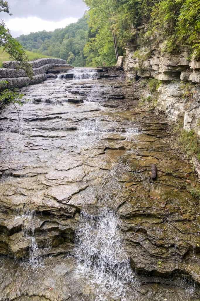
Once you cross the dam, you'll arrive at the second waterfall.
This one looks a little more obviously man-made, but it's still beautiful.
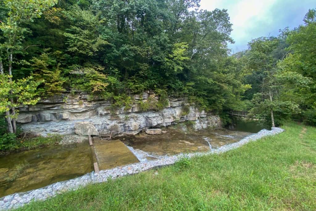
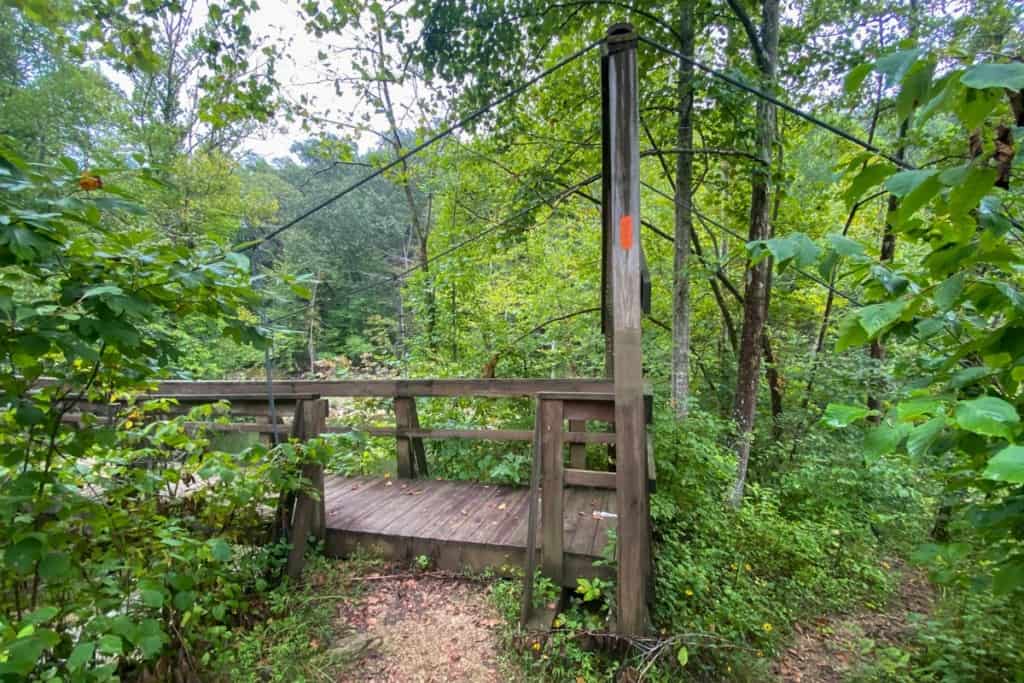
The trail follows the waterfall to another swinging bridge.
Cross the bridge for a better view of the waterfall.
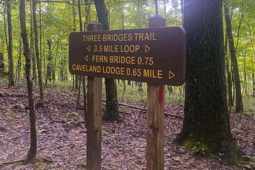
4C's Trail + the Three Bridges Trail
At this point, you're getting close to the Three Bridges Trail junction.
You'll pass a large rocky wall, and then climb a set of wooden stairs before reaching the junction.
When you reach the trail junction, go right to stay on the 4C's trail. You've got 1.75 miles left to go.
I feel like I should also mention that this is the halfway point in the Three Bridges Trail loop. If you choose to go left, simply follow the red trail blazes instead of orange. You'll get different views but exit the trail at the same point after hiking the same distance.
That said, this trail guide follows the official trail to the right.
The trail signs will no longer mention the 4C's trail, but the trees will still have orange blazes.
Follow the signs towards Fern Bridge.
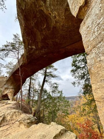
Fern Bridge is named after the ferns growing all around it, and it is a gorgeous natural arch.
It's also the last major scenic point on the trail.
Continue following the orange (and red) blazes.
Be aware that there are still some challenging stairs and elevation changes ahead.
The trail ends across the street from the welcome center. Cross the road and you'll be back at your car!


Leave a Comment: