
Headed to the Pinnacles in Berea, Kentucky? Check out our trail guide for East Pinnacle trail and the Eagle's Nest and Buzzard's Roost trail spurs.
This week my husband and I laced up our hiking boots and headed to Berea, Kentucky to hike The Pinnacles.
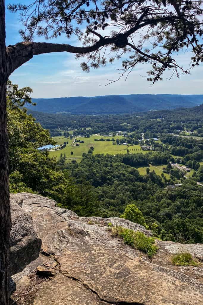
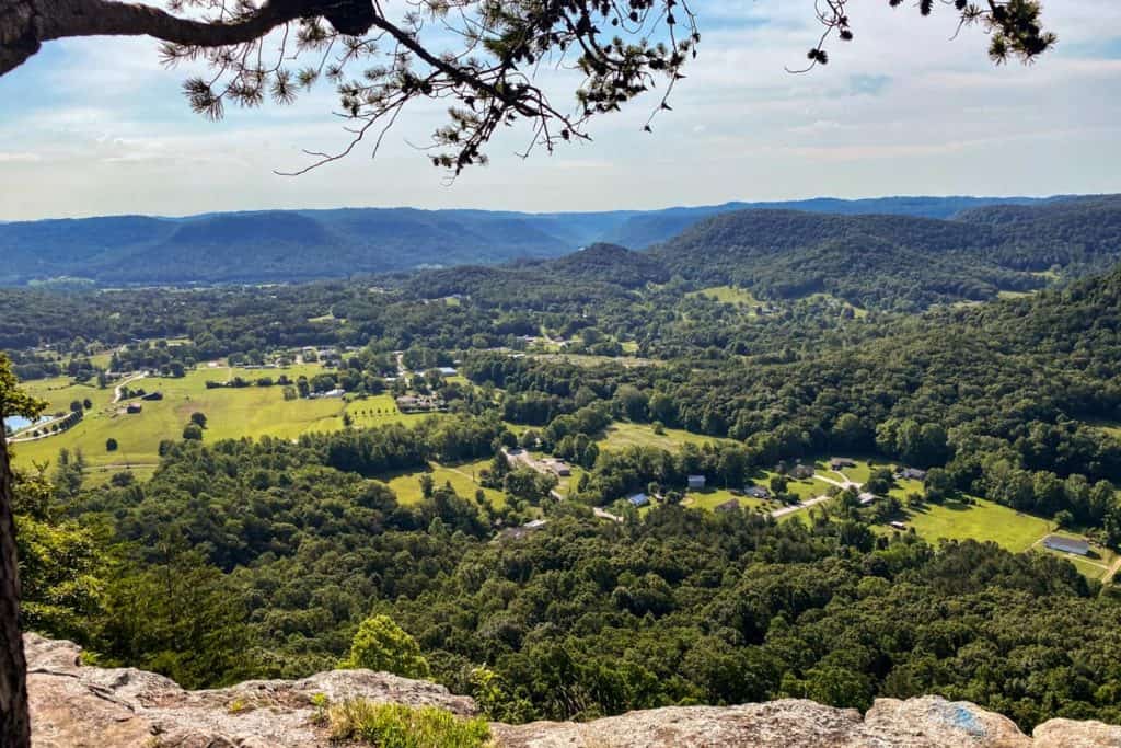
The Pinnacles in Berea is located about forty miles south of Lexington, Kentucky, and (in my opinion) has some of the most gorgeous overlooks in the state.
The Pinnacles trails are a winding, connected loop of trails. On our most recent trip, we intended to hike the entire Pinnacles trail loop, but the heat, humidity, and our less-than-trail-ready legs made the decision for us, and we stuck to the eastern side of the trails.
This trail guide covers the trail from the main trailhead to East Pinnacle, Eagle's Nest, and Buzzard's Roost.
We hiked to the West Pinnacle and then out to Robe Mountain and Basin Mountain on other trips.
East Pinnacle Trail Information
If you follow the trail guide laid out here, you'll be hiking approximately 4.8 miles along a moderately difficult path.
The trail itself is well-maintained and well-marked with trail signs at the intersections.
The Berea Forestry Outreach Center labels most of the trails easy or moderate, and in this section the reason the trails are moderate is the trail elevation change.
It was hard to find exact numbers for the elevation change on this trail (I saw lots of different estimates), but know that you are hiking uphill (and then back downhill). My phone estimated an elevation change of about 600 feet.
That said, you can definitely make this shorter by skipping one or both of the spur trails, but know that getting from the trailhead to East Pinnacle is probably the hardest part of this trail.
Once you've climbed up to the ridgeline, the hike to Eagle's Nest and Buzzard's Roost aren't difficult.
If you want to shorten the hike, I recommend going to East Pinnacle and Eagle's Nest, and then skipping Buzzard's Roost.
When the trees have leaves, the leaves partially obscure the view from Buzzard's Roost. This spot probably has the best views in fall and winter.
Getting to the Trail
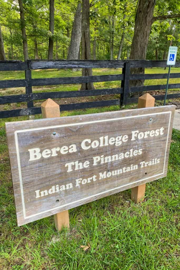
The main trailhead parking lot is at Berea's Forestry Outreach Center at 2047 Big Hill Rd, Berea, KY 40403.
Our GPS was a little bit off for the parking lot location, and we had to drive a little farther than it said. If you're coming from Berea and you reach the intersection of Highways 21 and 421, you've gone too far.
Hiking the East Pinnacle Trail
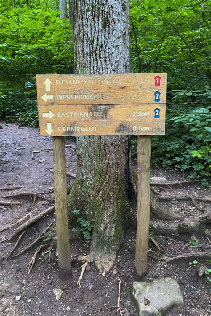
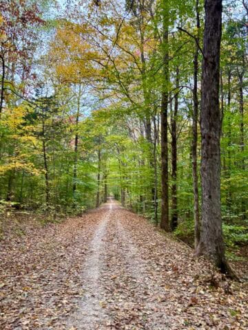
Start at the parking lot, and follow the paved trail until you reach the trail information board.
When you reach the information board, I recommend snapping a photo of the trail map.

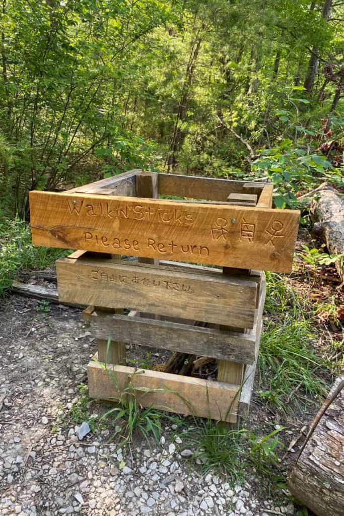
As you walk, you'll pass a bin for shareable walking sticks.
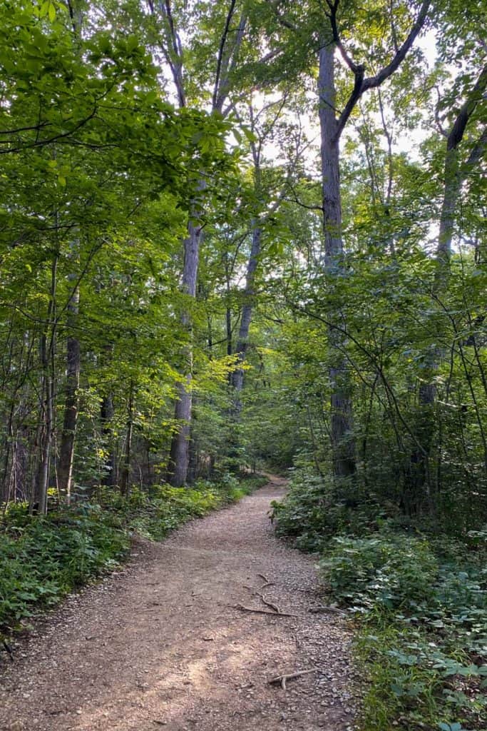
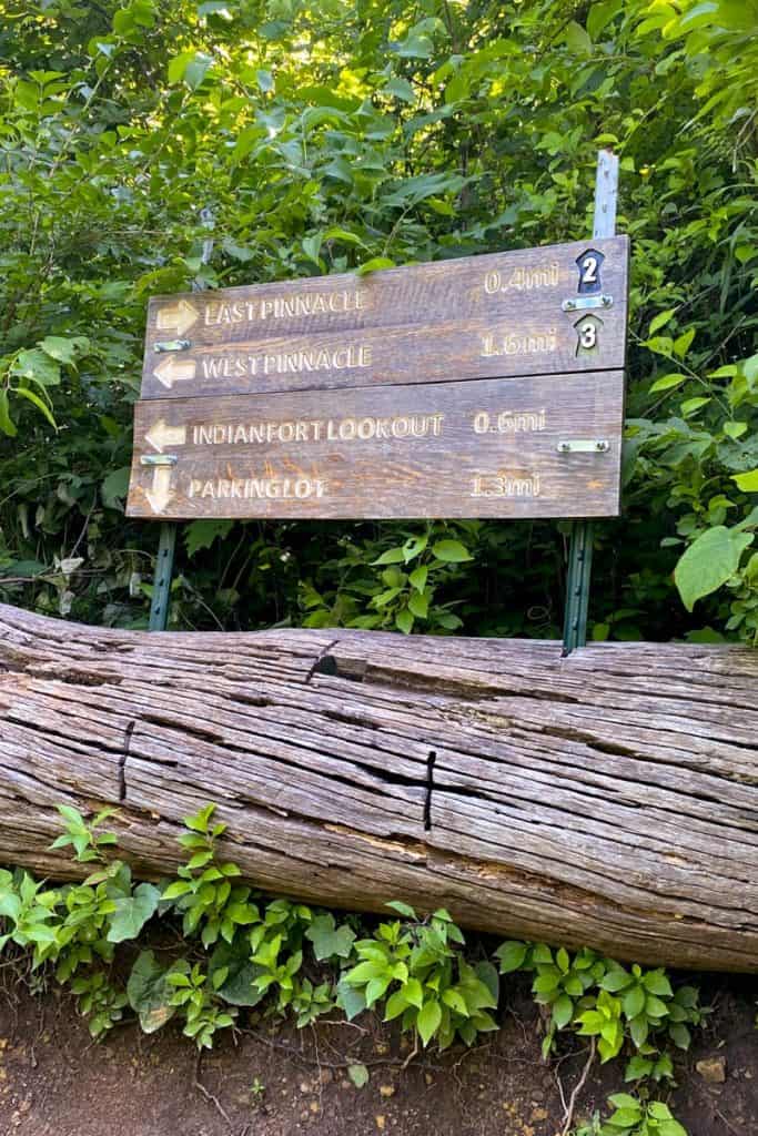
Keep walking until you reach the first trail sign.
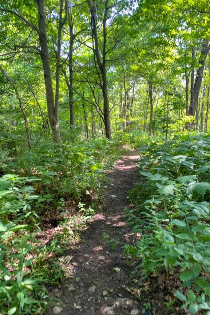
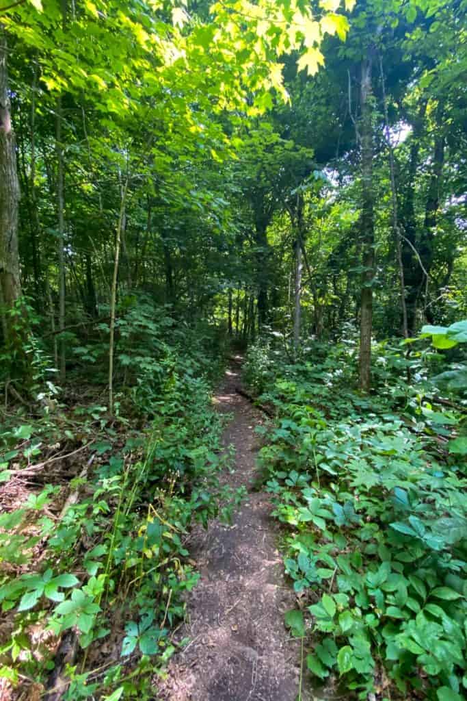
This section of the trail is easy and flat.
In about half a mile, you'll come to an intersection with a trail marker.
Head right on the blue trail towards East Pinnacle.
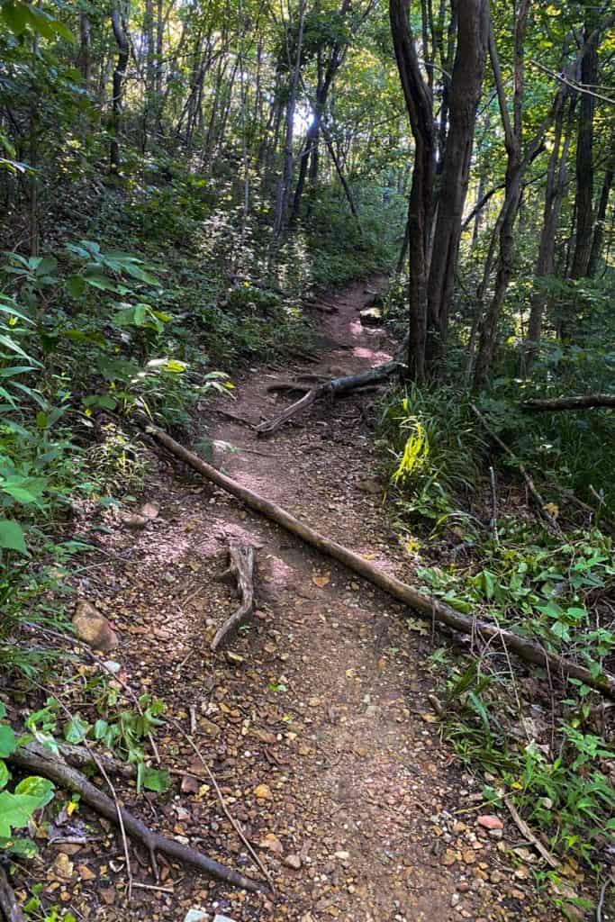
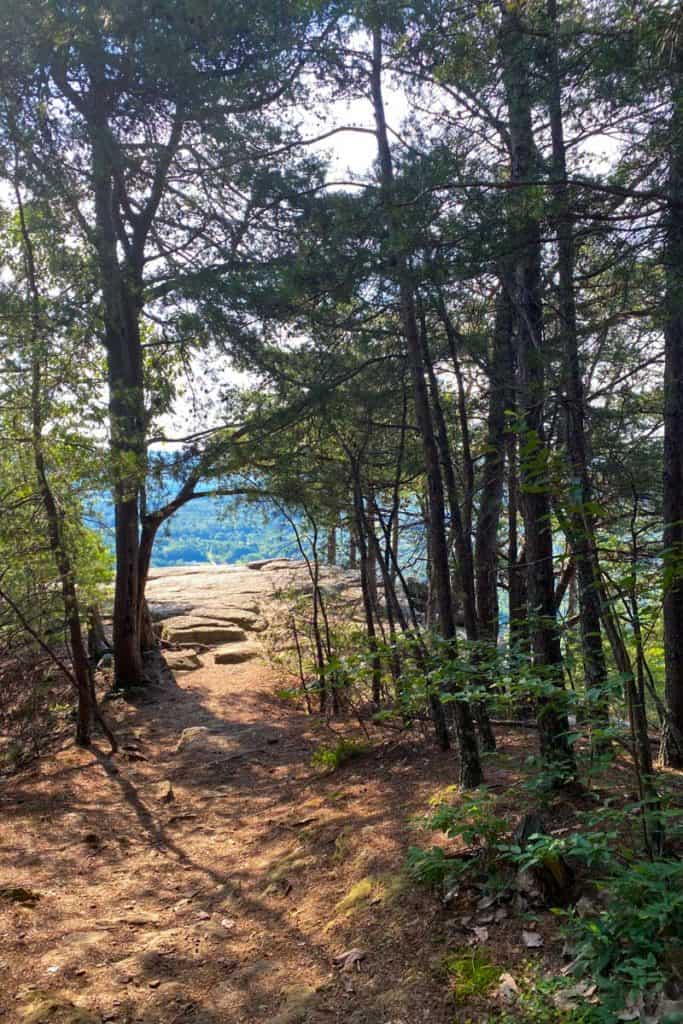
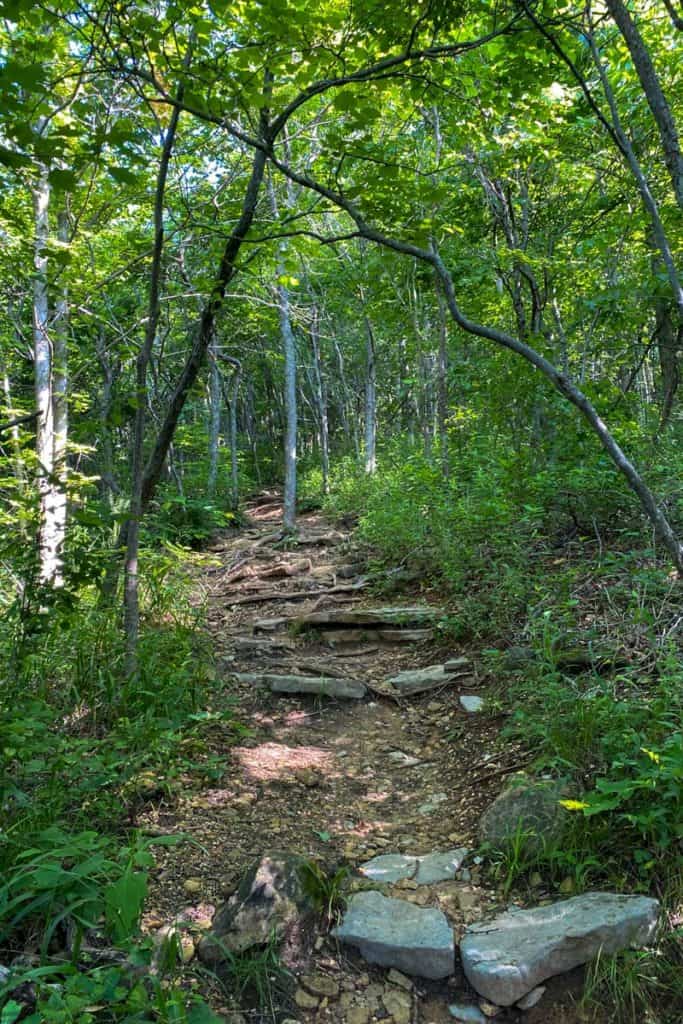
This trail is well-maintained, but you will need to watch your step for tree roots and rocks on the trail.
The hike to East Pinnacle starts off easy, but quickly becomes steep as you hike towards the ridge.
When you reach the next trail marker, keep following the signs for East Pinnacle.
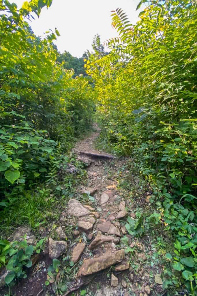
The trail keeps rising, but not as steeply as before.
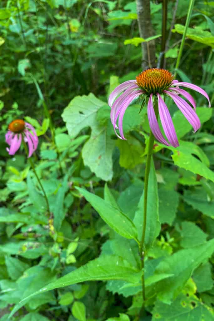
You'll pass through a wall of tall weeds. Take a moment to enjoy the flowers in this section of the trail.
As you hike, you'll begin to pass lots of overlooks.
These overlooks are not East Pinnacle, but they're gorgeous spots to take a break!
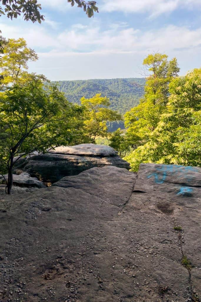
We chose to keep hiking past the overlooks and headed on to the main overlook.
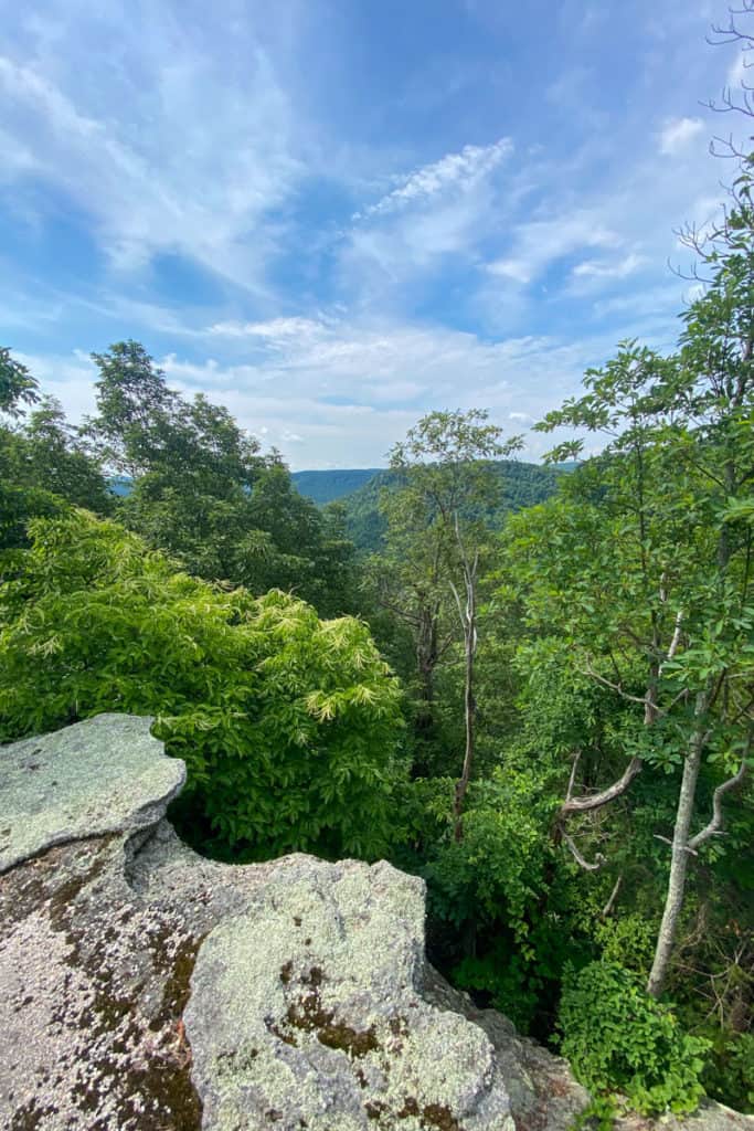
You'll begin seeing more pine trees, and then suddenly, you're there.
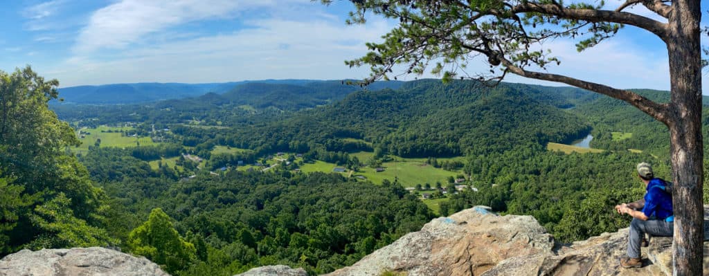
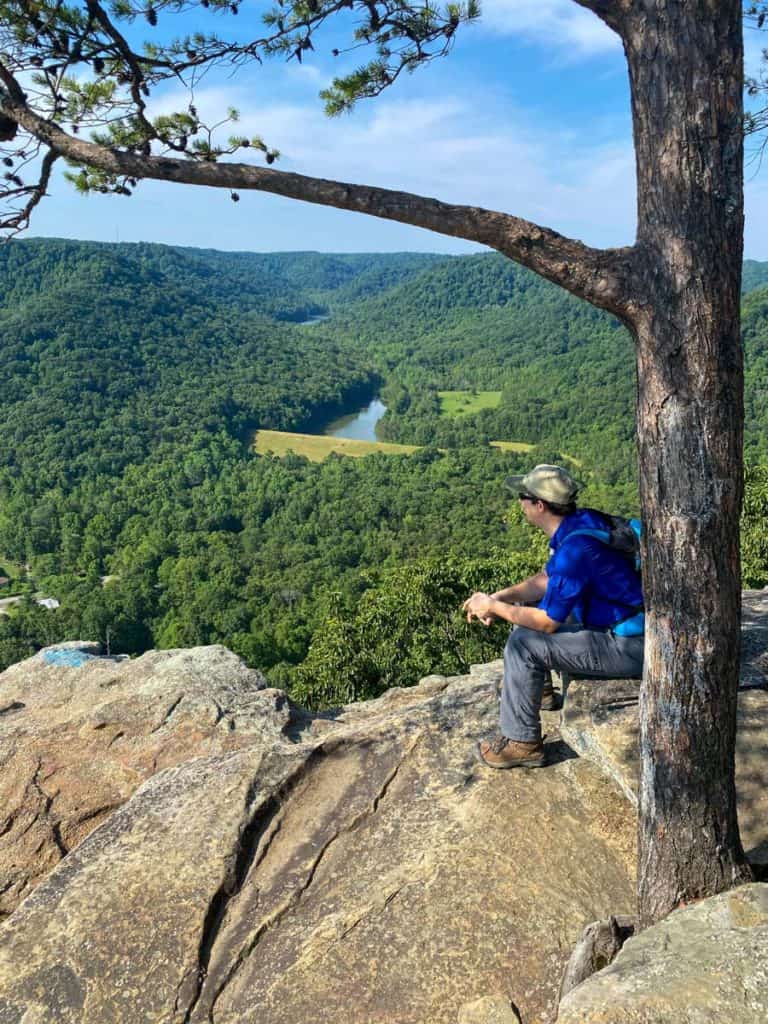
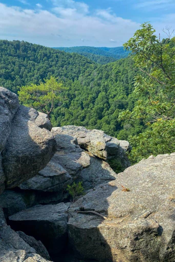
This is the East Pinnacle overlook.
It's a good place to take a break, enjoy the view, and eat a snack.
When you're ready to move on, turn around and head back the way you came. When you reach the trail marker, follow the signs for Indian Fort Lookout and West Pinnacle.
This section of the trail is fairly steep and rocky.
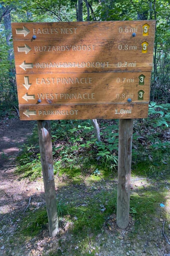
When you reach the next trail marker, turn towards Eagle's Nest.
The Eagle's Nest trail spur is a relatively easy section of the trail, and it's worth it to see the view.
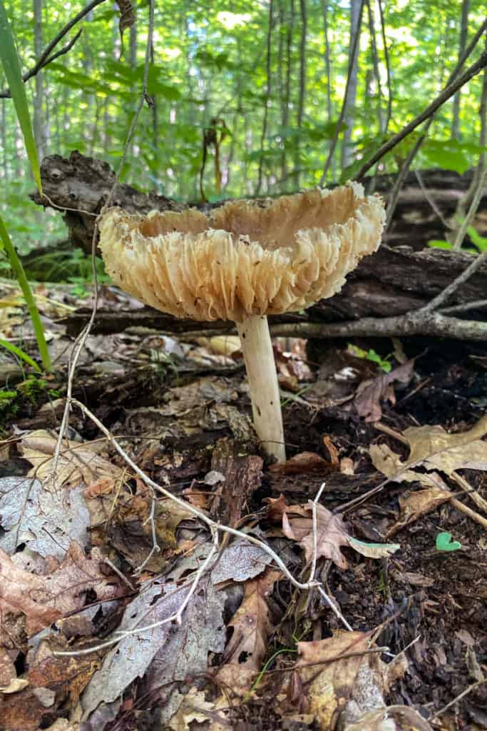
As you hike, take time to look around.
Each time I've hiked the Pinnacles, I've found really interesting mushrooms. (Not for eating, just for smiling.)
Soon, you'll reach another trail marker.
Follow the signs for Eagle's Nest.
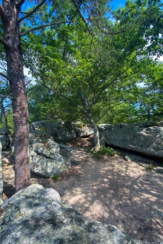
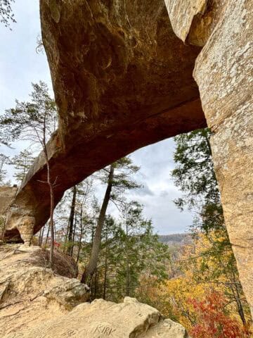
Eagle's Nest is a gorgeous overlook with large boulders.
It's also a great place to bird watch.

When you're ready, turn around and walk back the way you came. At the trail marker, turn towards Buzzard's Roost.
I mentioned this before, but I'll say it again. Buzzard's Roost was pretty, but when the trees have all their leaves, you won't have the same spectacular views as at the previous two overlooks.
If it's summertime, or if your legs are getting tired, you can also simply follow the directions back towards the parking lot.
Like the trail to Eagle's Nest, this is a relatively easy trail.
Buzzard's Roost has more views of the valley down below, even though the views are sometimes partially obscured by the trees.

Take your time here, and when you're ready, retrace your steps back to the last trail marker.
Follow the signs back to the parking lot. When you come to an unmarked intersection, you can go either direction because the trail simply loops around a group of trees.
Make your way all the way back down and back to your car, and then start planning your hike to the West Pinnacle trail!


Debra LittleJohn says
This was so helpful! I was feeling unsure about attempting this hike but your detailed description and photos inspired me to try it! Thanks for your work!
Alisha Trenalone says
We hope you have a fantastic time! So glad the post is helpful 🥰
-Alisha at Champagne Tastes