A Bryce Canyon scenic drive can take you to some gorgeous overlooks in this national park! Here's an idea for a route not to miss.
Bryce Canyon can be a hiker's paradise for sure, with gloriously scenic trails like the Queens Garden Navajo loop and Mossy Cave.
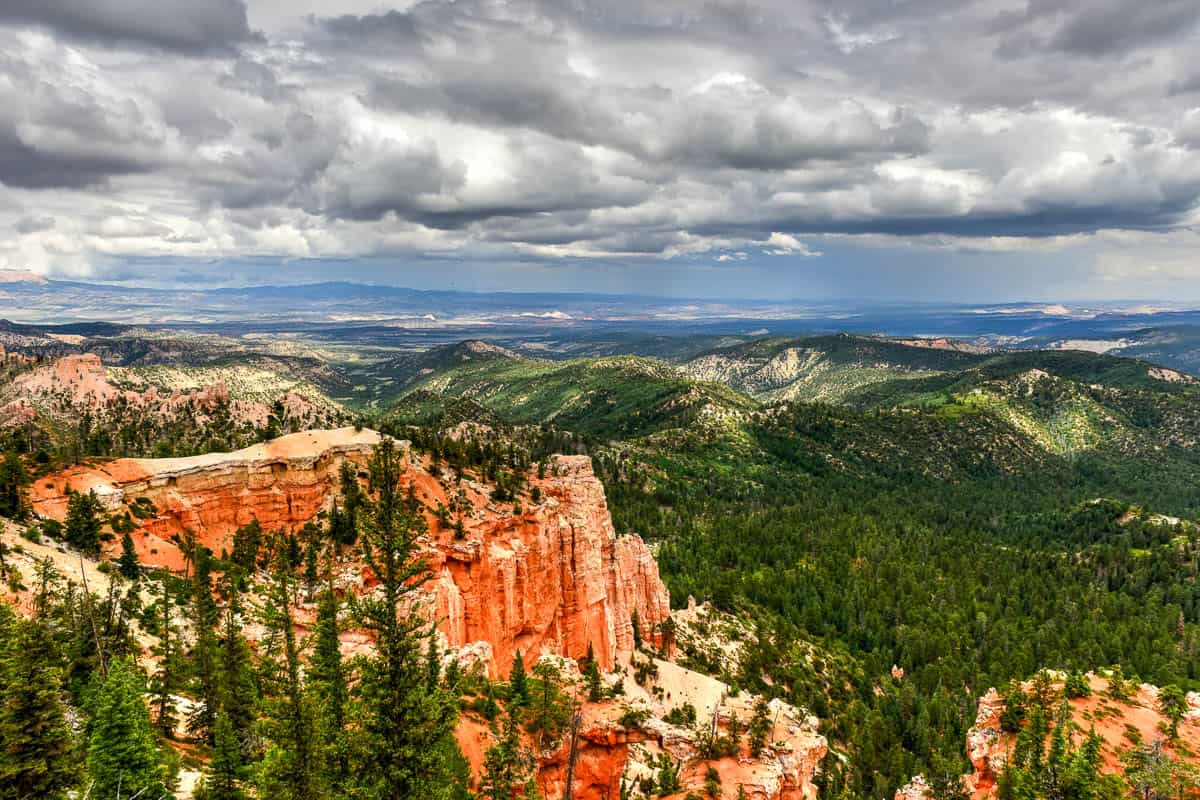
But if you're limited in the amount of walking you can do, or you just want an overview of the park before exploring on foot, the Southern Scenic Drive in Bryce Canyon also makes for a gorgeous outing.
Here's a glimpse at what you can see on a Bryce Canyon scenic drive.
How Long Is the Bryce Canyon Scenic Drive?
Highway 63, the main road through Bryce Canyon, is about 18 miles in length from the park entrance to Rainbow Point.
Though it only takes 40 minutes or so to drive one way, you'll want to allow a few hours for the entire out-and-back drive, depending on how long you spend at each overlook.
The viewing areas are easier to pull into coming from the south, so the park website advises first driving all the way to Rainbow Point/Yovimpa Point. From there you can take a leisurely tour back northwards to all the stop-offs.
Some of the overlooks are a short walk from the parking pull-offs, with a paved pathway of 100 to 200 feet. Other overlooks are directly attached to the parking area, with no extra walkway.
A good Bryce Canyon map will come in handy.
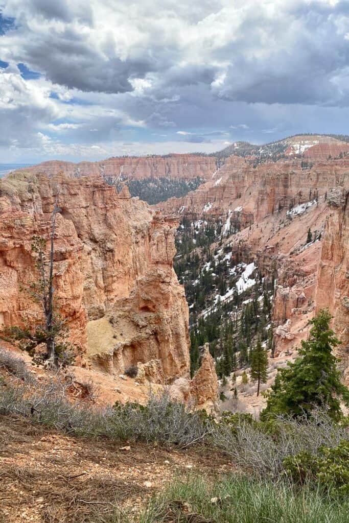
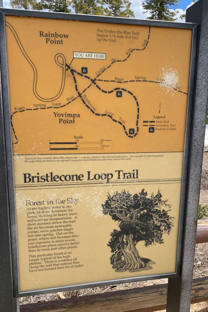
Rainbow Point/Yovimpa Point
At Rainbow Point, you'll be at the highest elevation in the park — over 9,000 feet.
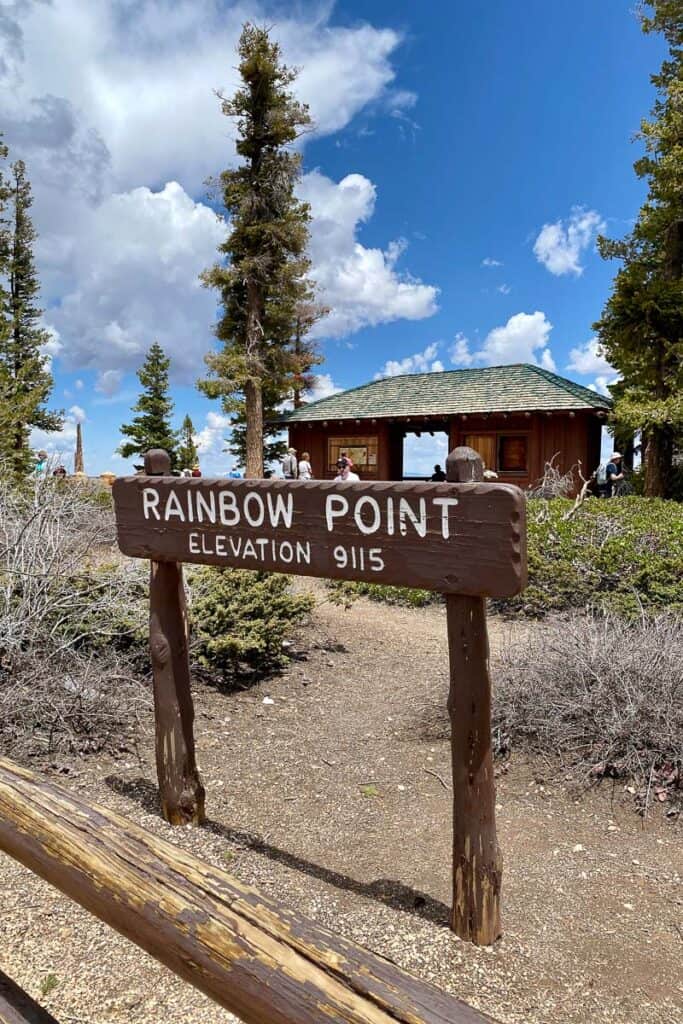
Highway 63 comes to an end here at Rainbow Point, with a parking lot, restrooms, and a short paved path along an overlook area.
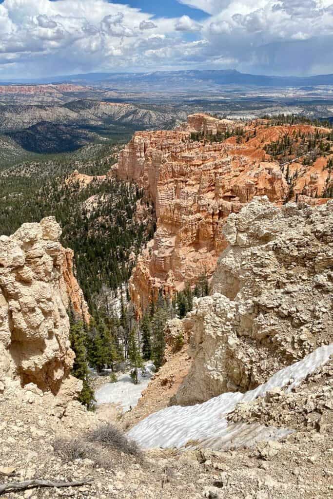
The southernmost view is at Yovimpa Point, which can be reached via a quarter-mile paved walkway from Rainbow Point.
A few hiking trails begin in this area, including Bristlecone Loop (one mile), Riggs Spring Loop (8.5 miles), and Under the Rim (a multi-day backcountry hike).
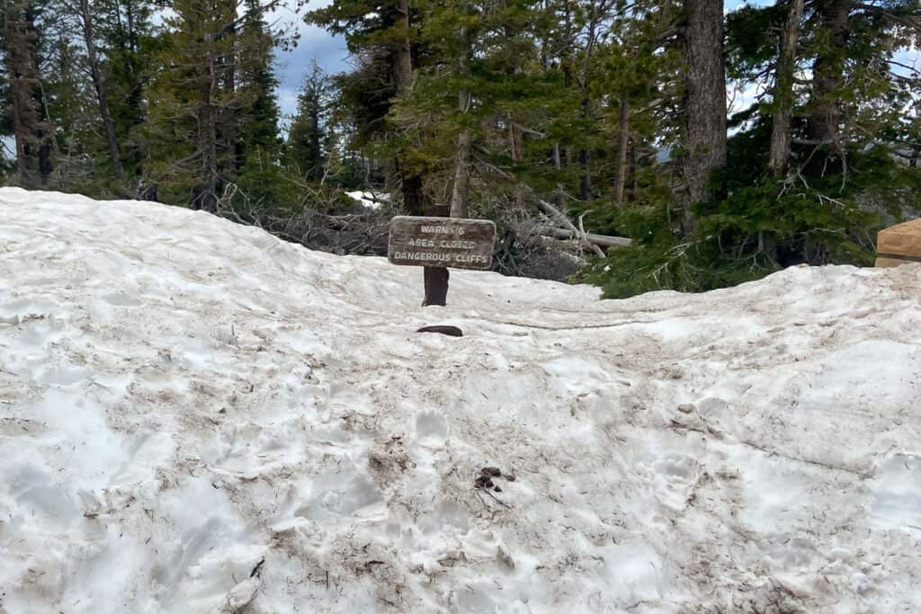
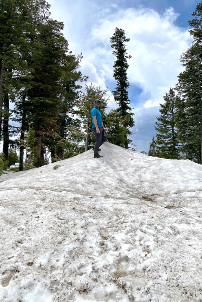
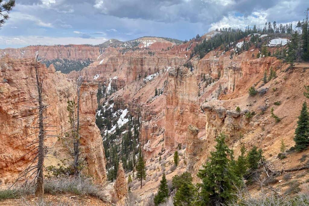
When we visited in May, there was still quite a snowpack!

Black Birch Canyon
Just over two miles from Rainbow Point, and you're at the overlook for Black Birch Canyon. There are no birches in this area – but aspen trees may have led to the naming confusion!
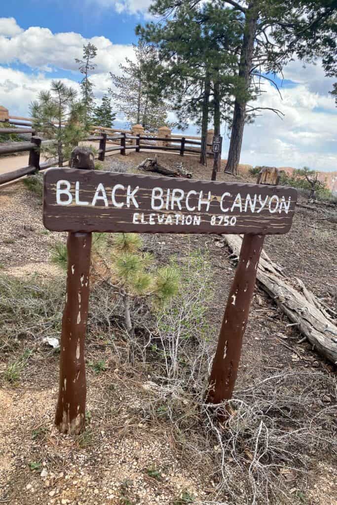
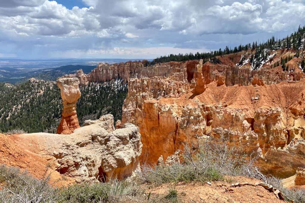
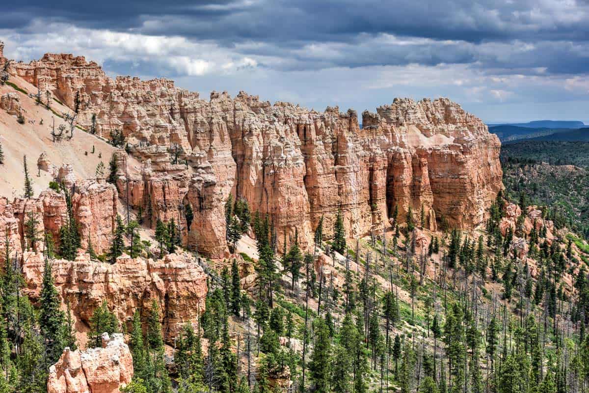
Black Birch Canyon is a great spot to see lots of eroded rock features within natural amphitheater-like valleys. You may also possibly catch a glimpse of the distant Navajo Mountain and the Henry Mountains.
Ponderosa Point
Just under a mile north of Black Birch Canyon, you'll reach Ponderosa Point. It's named for all the pine trees at the base of the canyon.
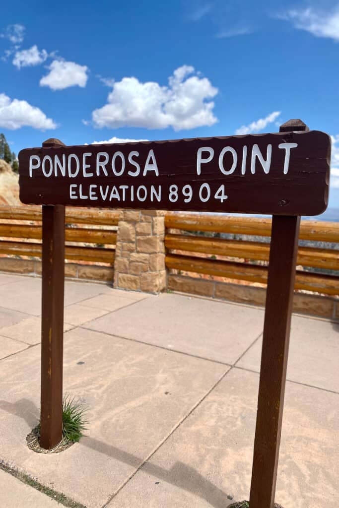
There's a connecting trail from Ponderosa Point to Agua Canyon that's about a mile and a half. Agua Canyon is also the next stop on this Bryce Canyon scenic drive.
(If you do want to get out of the car and do a little hiking, be sure to check out trail conditions first! Trails can be closed for rockslides, snow, or other problems.)
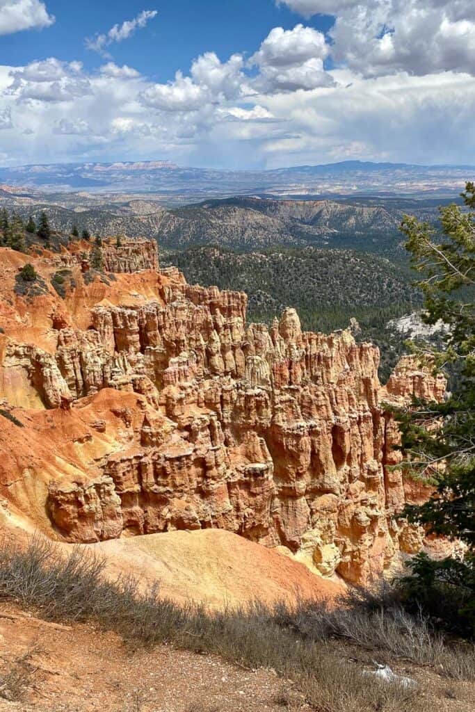
Agua Canyon
Just over a mile's drive from Ponderosa Point, Agua Canyon features a couple of rock formations called "hoodoos," which are tall, thin columns that sometimes have a blocky-looking top.
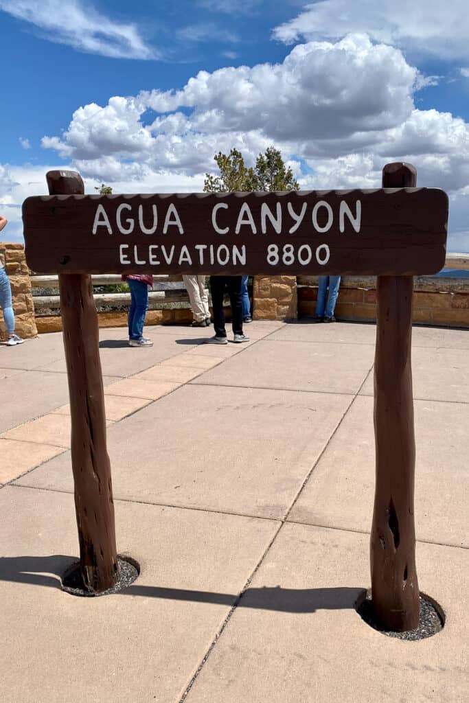
The hoodoos at Agua Canyon are called The Hunter and The Rabbit.
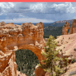
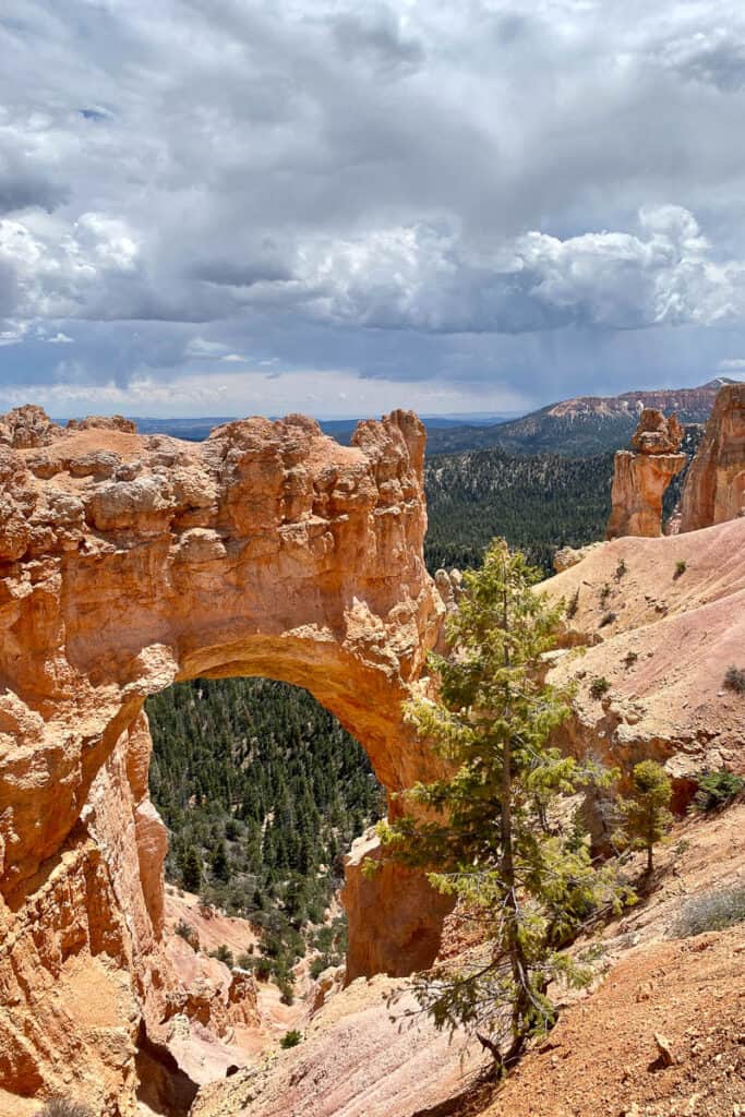
Natural Bridge
Another mile and a half north is Natural Bridge, which is less of a bridge and more of an arch.
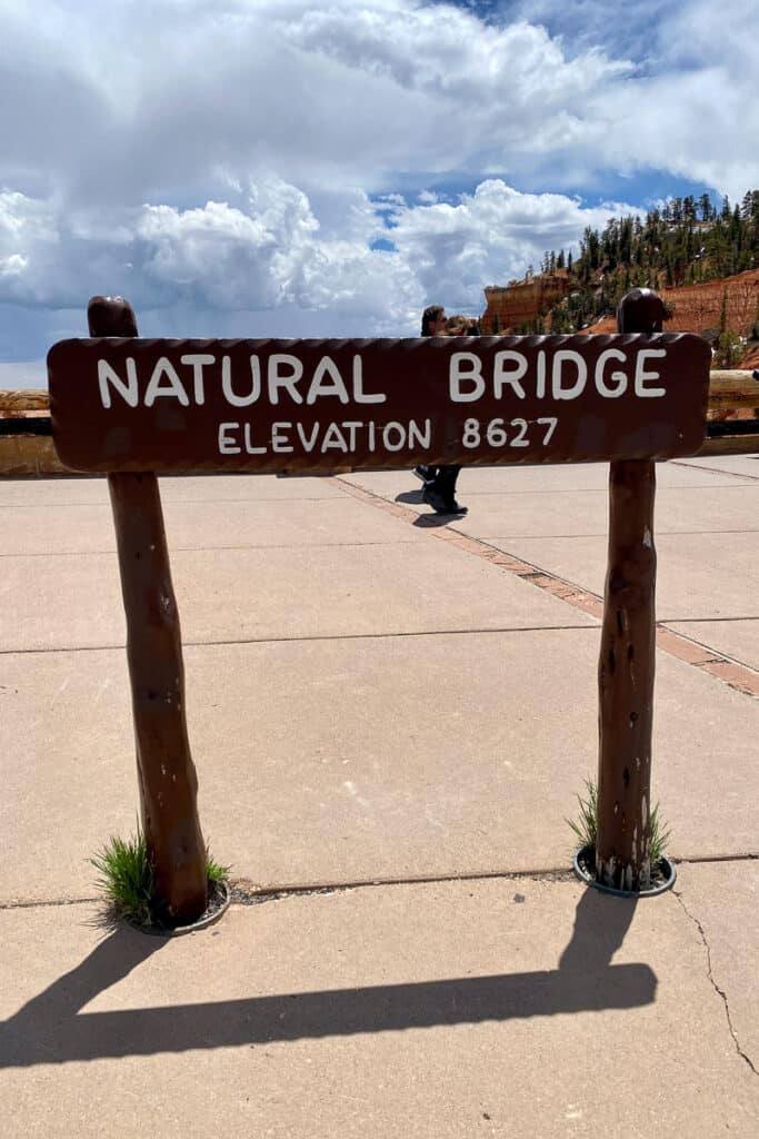
It's one of the most picturesque features on the drive.
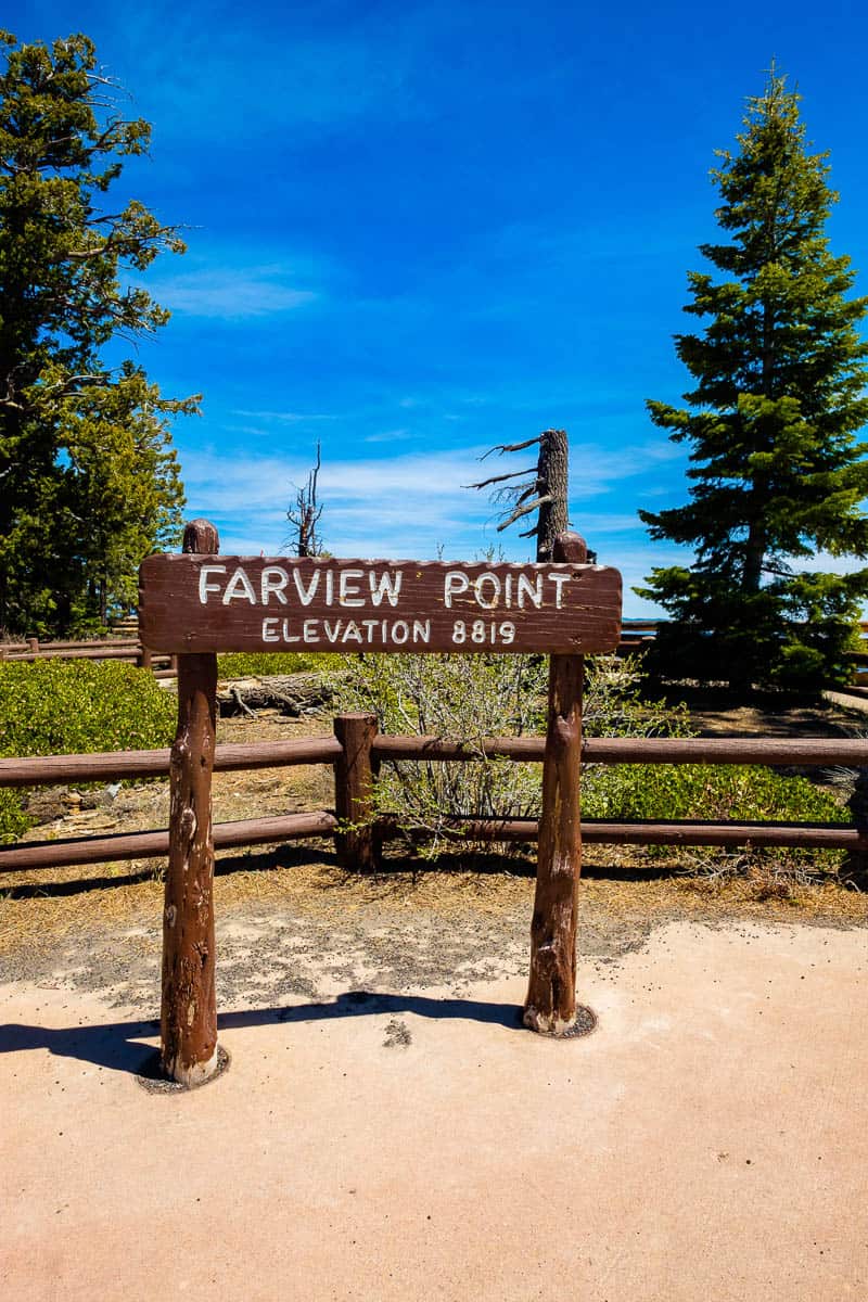
Farview Point and Piracy Point
Nearly two miles on, Farview Point gives you great views of plateaus. Visibility is amazing on some days, stretching well over 100 miles. A short series of paved walkways brings you up to the rim of the canyon.
A nearby dirt trail (1,000 feet long) leads you to Piracy Point. Is it called that because the buttes look like pirate ships? Or is it geological, referring to something called "stream piracy," where water gets diverted from its original path? It's unclear – so I guess it's up to you!
Swamp Canyon
Another four-and-a-half miles by car, and you're at the Swamp Canyon Overlook. Nothing in Bryce Canyon feels particularly swampy, to be honest, but Swamp Canyon does have more moisture than average because of its creeks and spring.
The Swamp Canyon Loop Trail is four miles and begins and ends at this overlook.
Bryce Amphitheater
The above-mentioned overlooks make up the official "Southern Scenic Drive."
However, if you continue on northwards to the park entrance, you'll enter the section of the park known as the Bryce Amphitheater.
Taking a detour down Bryce Point Road, you can also check out Paria View (which faces sunset), Bryce Point (one of the most expansive views of the amphitheater), and Inspiration Point (with upper and lower level views).
Back out on Highway 63, you'll finally come back to Sunset Point and Sunrise Point, which boast an army of hoodoo formations and other rocky features.
Sunrise Point is where you'll find the park's general store, as well as other visitor facilities.
Drive on north past the Visitor Center and take a one-mile detour down Fairyland Spur Road. Fairyland Point brings you even closer to some of those spire-like hoodoo formations you've seen throughout the park.
At this point, you've driven all the major highlights that can be seen on or near Highway 63. It's probably time for a bite to eat — maybe at the casual eatery Showdowns, which we really enjoyed, or from one of the other food options we found near the park.
Have you explored Bryce Canyon by car, or do you have plans to? Let us know in the comments!
Leave a Comment: