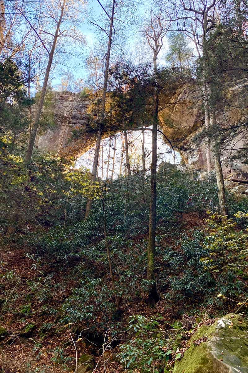
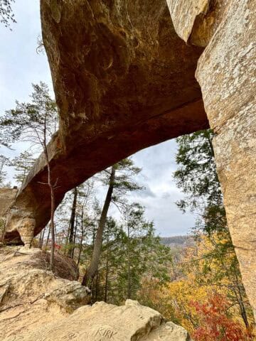
Gray's Arch is one of the most impressive arches in Kentucky's Red River Gorge. Hike to the arch, and then loop back on the Rough Trail for overlook views!
This past fall, we went on a camping trip in Kentucky's Red River Gorge.
When we arrived at the Koomer Ridge Campground a few hours before the rest of our group, we decided to take a short hike to a gorgeous arch.
Gray's Arch is a popular hiking destination in the Red River Gorge area. The arch itself is impressive, and we had fun on the trail!
Looking for more things to do in the Red River Gorge? Try visiting Hanson's Point, Rock Bridge, Silvermine Arch, or Natural Bridge State Park, take a tour with Red River Gorge Underground Kayaking, and then visit Miguel's Pizza or RedPoint BBQ for a meal.
How Long and Difficult Is Gray's Arch Trail?
For the shortest option (a 2.3-mile hike with a 298-foot elevation change) you can hike directly to the arch and then head back the way you came.
For a slightly longer trail loop (a 3.4-mile hike with around a 580-foot elevation change) start on the Gray's Arch trail, and then turn right onto Rough Trail and the Rush Ridge Trail to make an even more scenic trail loop.
Either option is considered moderately difficult. The second, longer option is slightly more difficult than the first.
For a list of easy to moderate trails in the gorge, see this guide.
Staying Found on the Gray's Arch Trail
I recommend either bringing along a paper trail guide, such as Hiking Kentucky's Red River Gorge or this Red River Gorge Trail Guide, or following along with a digital trail map (such as AllTrails).
This is an especially good idea if you take the longer trail loop. We found some of the trail junctions on the long loop to be unclearly marked.
What Trail Gear Should I Bring?
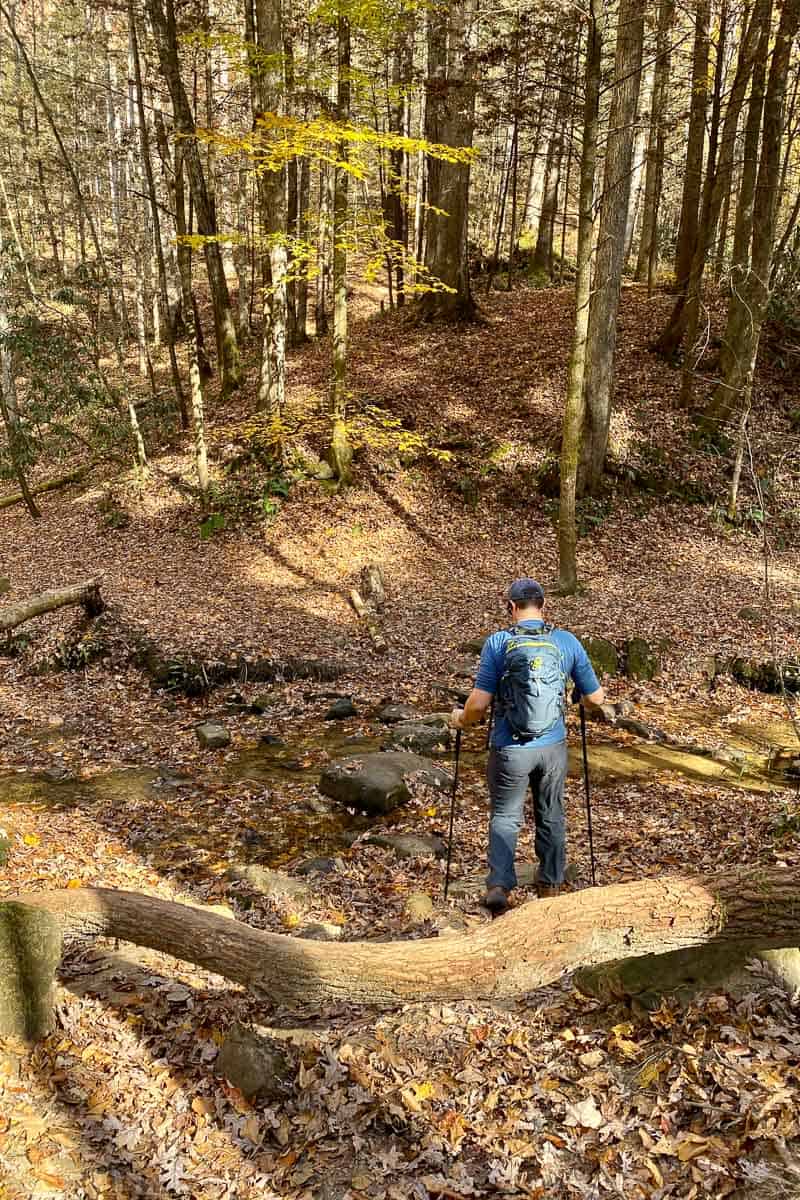
I was happy I brought one of my Black Diamond women's trekking poles. My husband uses these Black Diamond Alpine carbon trekking poles.
It's also a good idea to wear sturdy hiking boots, and to bring along plenty of water and snacks, especially if you're hiking this trail in the summer heat.
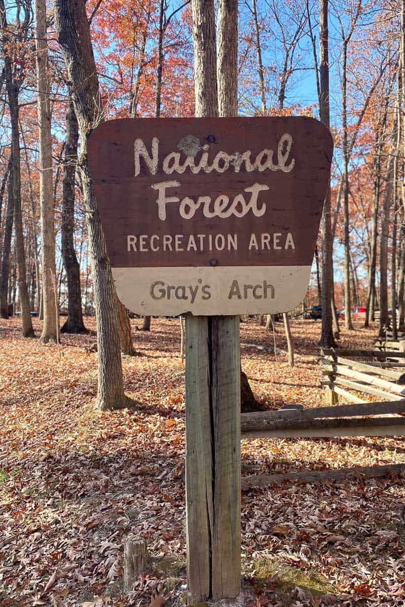
Getting to Gray's Arch Trailhead
Park at the Gray's Arch Recreation Area, a picnic area and parking lot at the trailhead.
This lot is fairly large but does fill up on busy days. When we went recently (on a Friday afternoon), we got the last available spot.
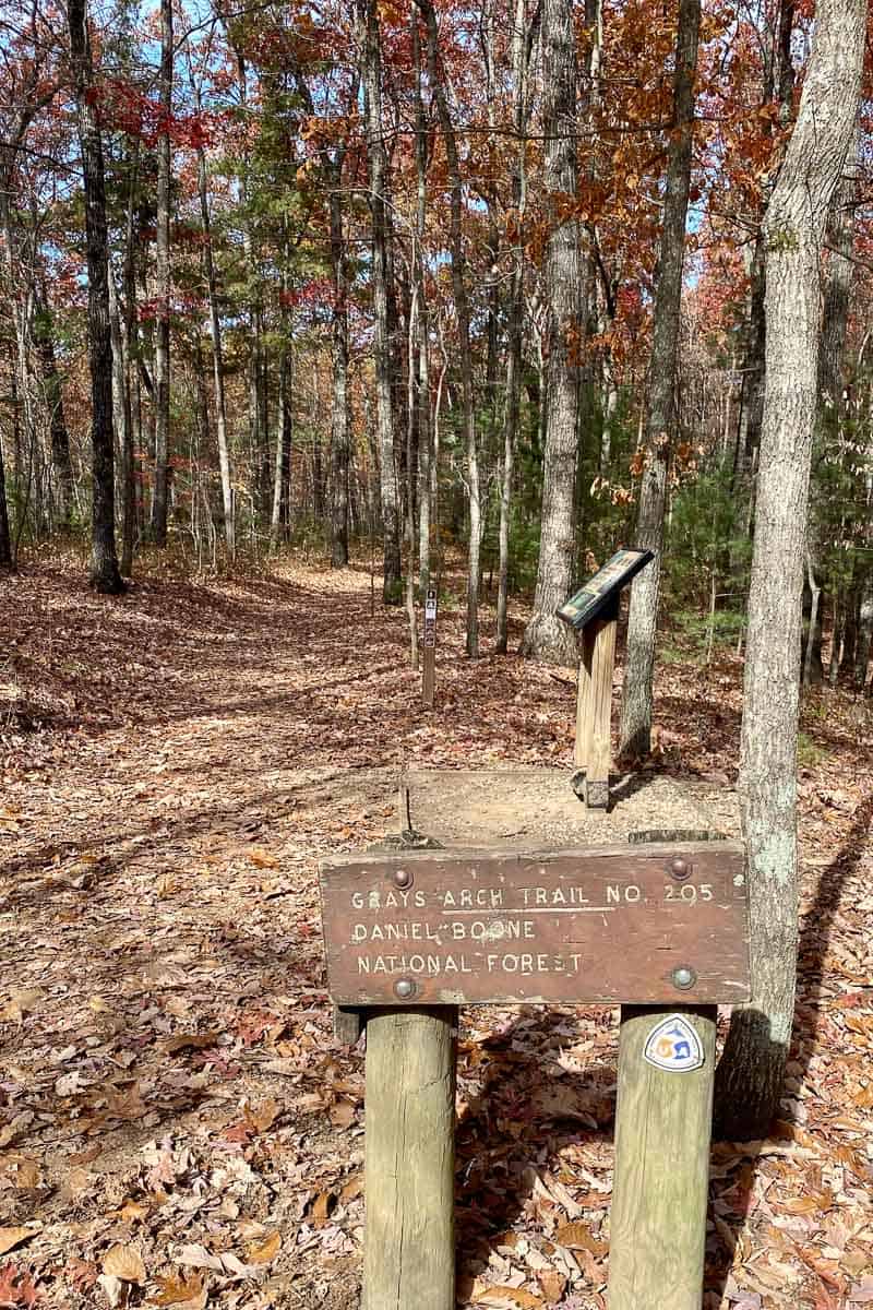
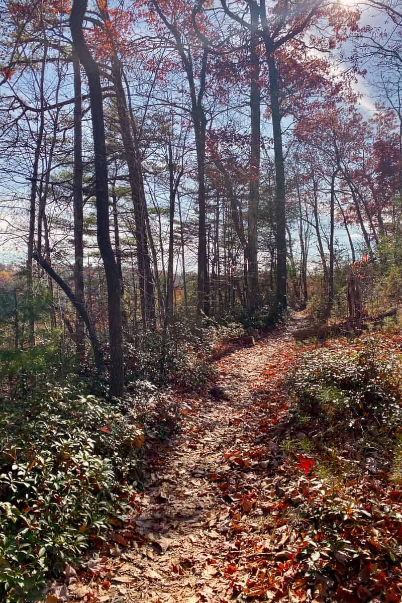
Hiking to Gray's Arch
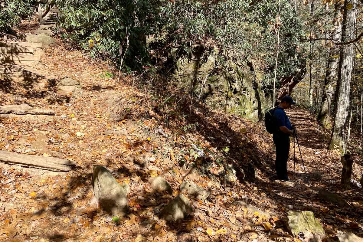
Start at the trailhead parking area. The trail starts off pretty easy. When you reach the first trail junction, follow the sign for the arch .
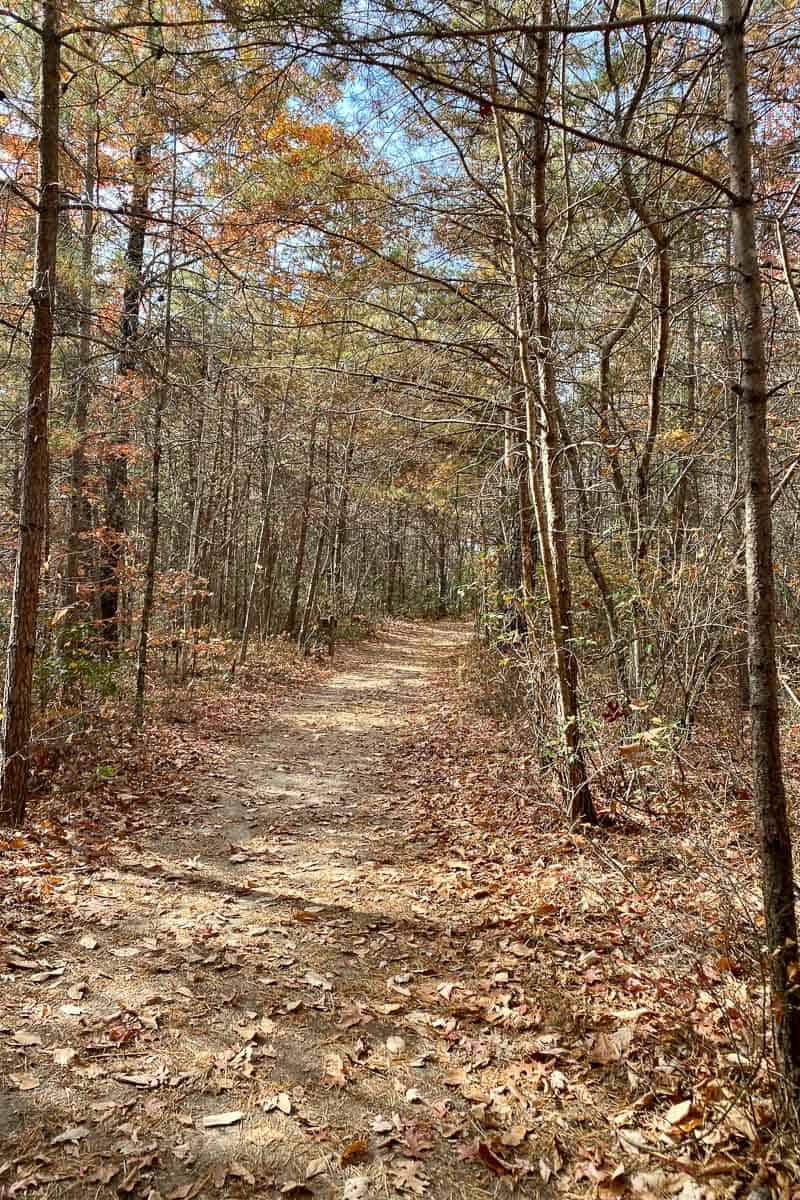
For much of the trail before you reach the arch, you’re hiking on a gradual downhill path.
The trail seems pretty easy getting to the arch, but you're actually descending quite a bit.
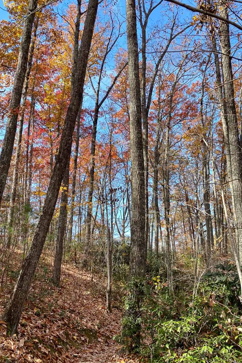
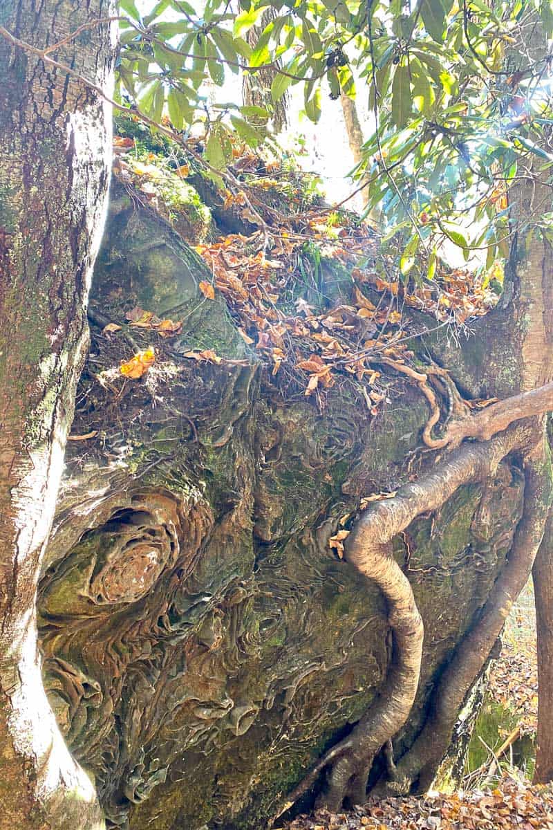
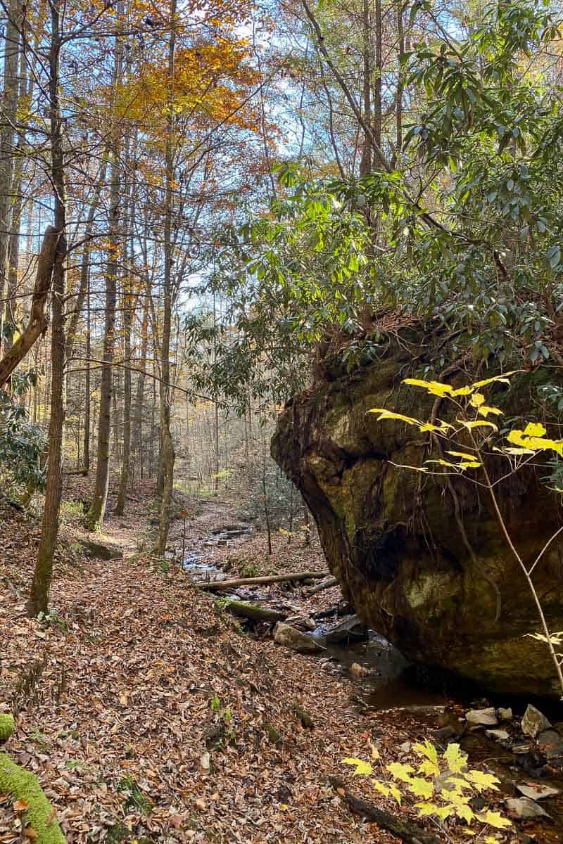
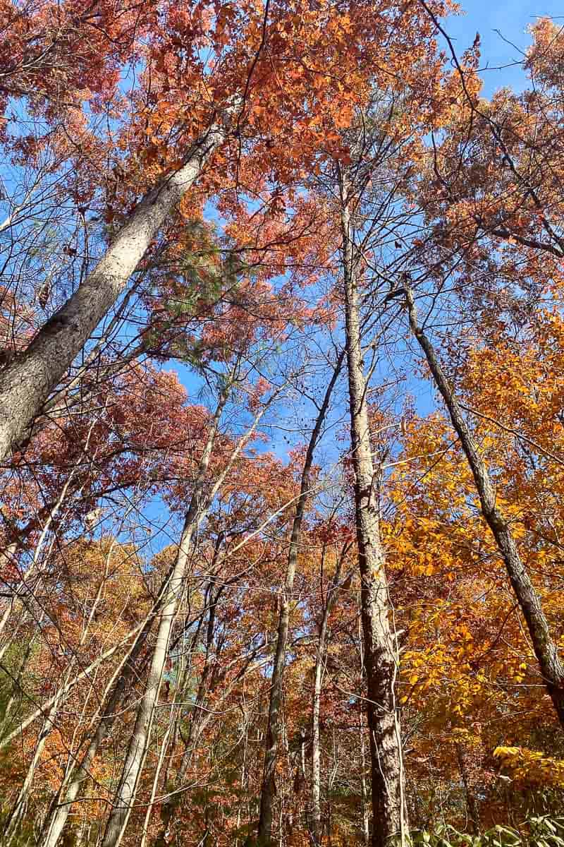
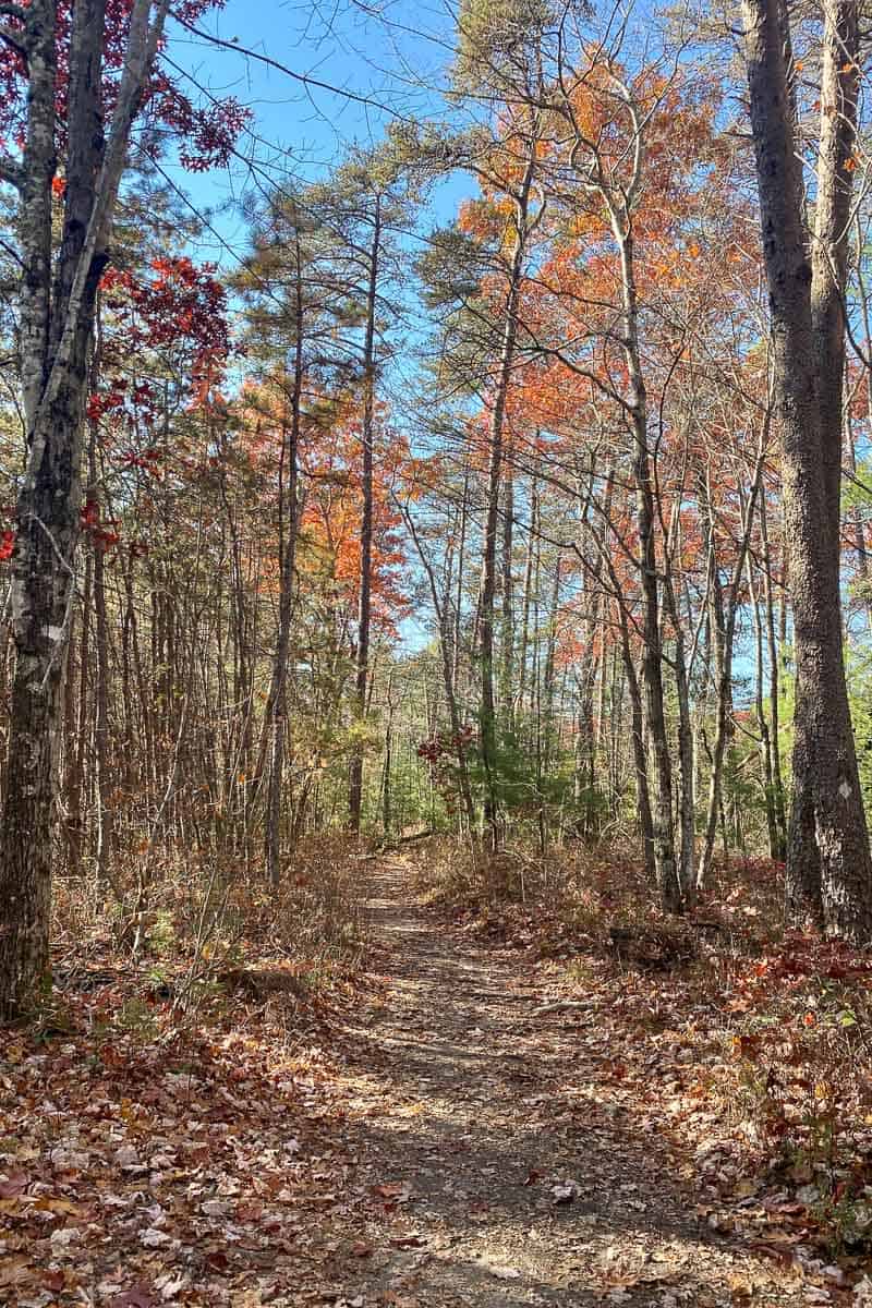
You’ll pass some interesting rock formations, and if the leaves have begun to fall, you might get a glimpse of the arch from afar.
In summer the arch is hidden until you’re almost upon it.
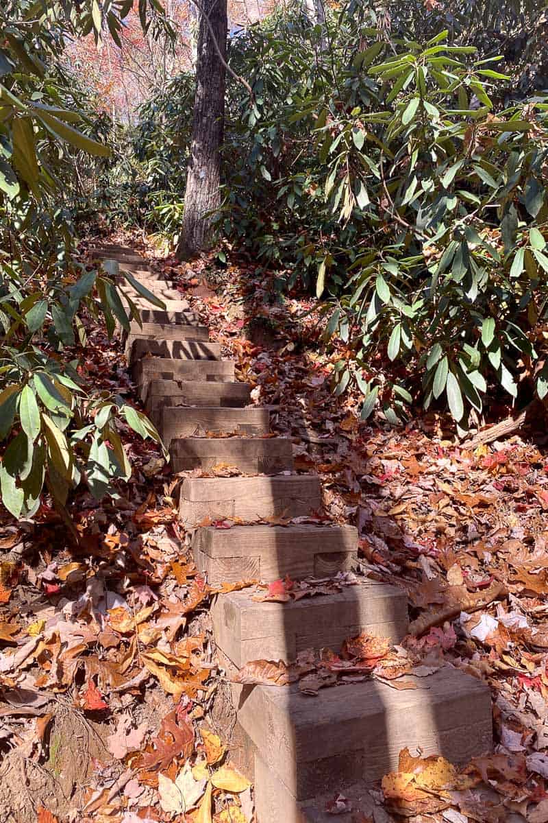
When you reach a set of stairs, you're almost there.
This is when you’ll start descending steeply, walking down multiple sets of stairs.
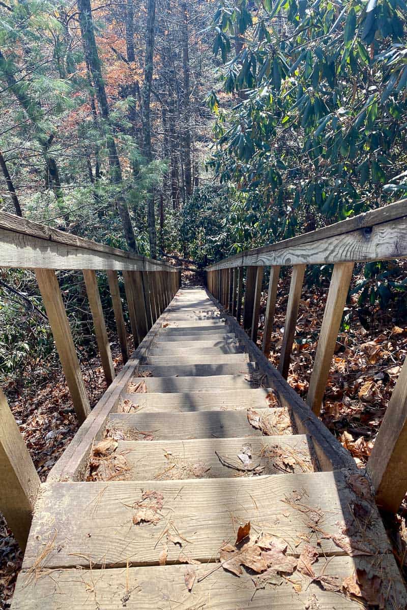
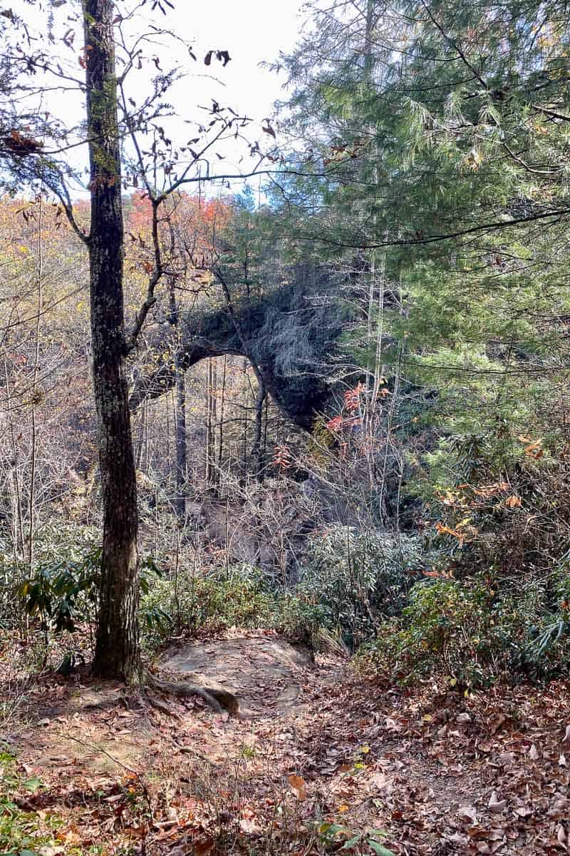
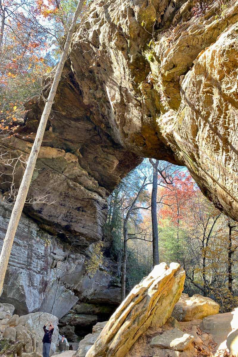
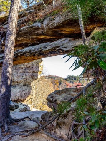
At the bottom of the stairs, turn right to view the arch. At this point, you're actually turning onto Rough Trail (although there's not a clearly marked sign).
Don't ask me why the arch trail doesn't go all the way to the arch.
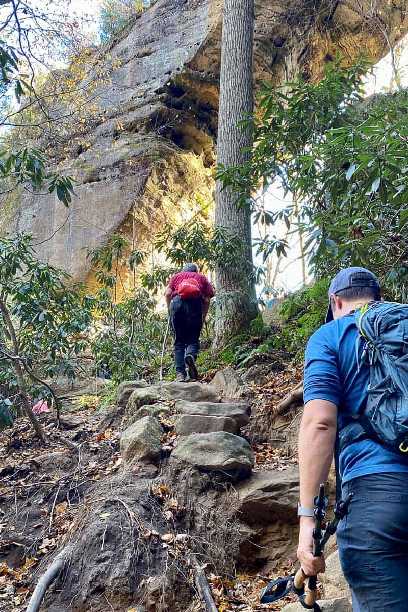
The climb to the bottom of the arch got a little crowded while we were there.
It's a rocky hike uphill that may or may not count as a rock scramble, but definitely counts as the most challenging point yet on the trail.
If it's a busy day, this is the spot where you may have to wait.
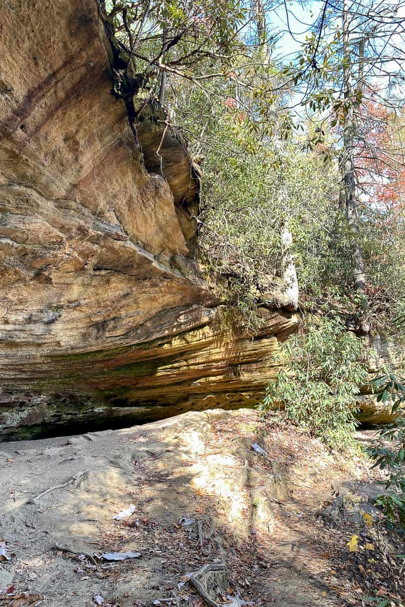
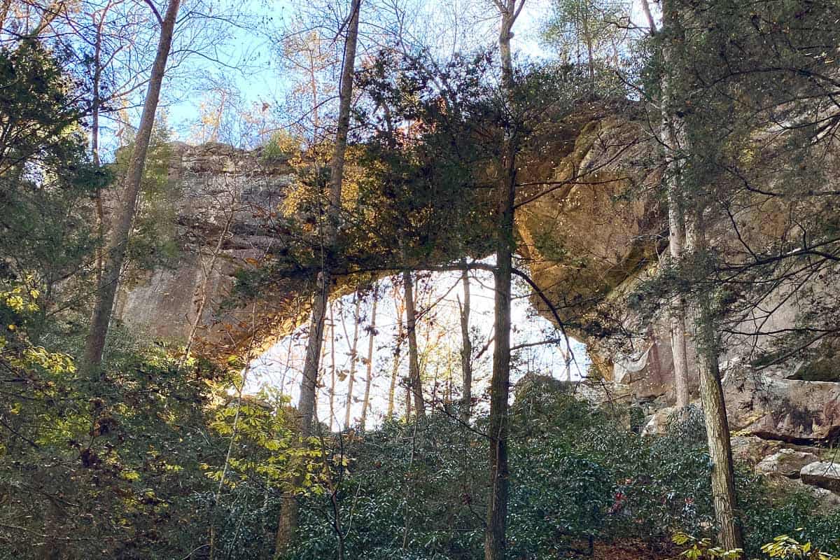
Once you’re at the arch, spend some time and look around!
This is a pretty impressive arch, so enjoy it.
At this point, you can either turn around and go back the way you came, or you can take a slightly longer loop back. We opted for the longer loop.
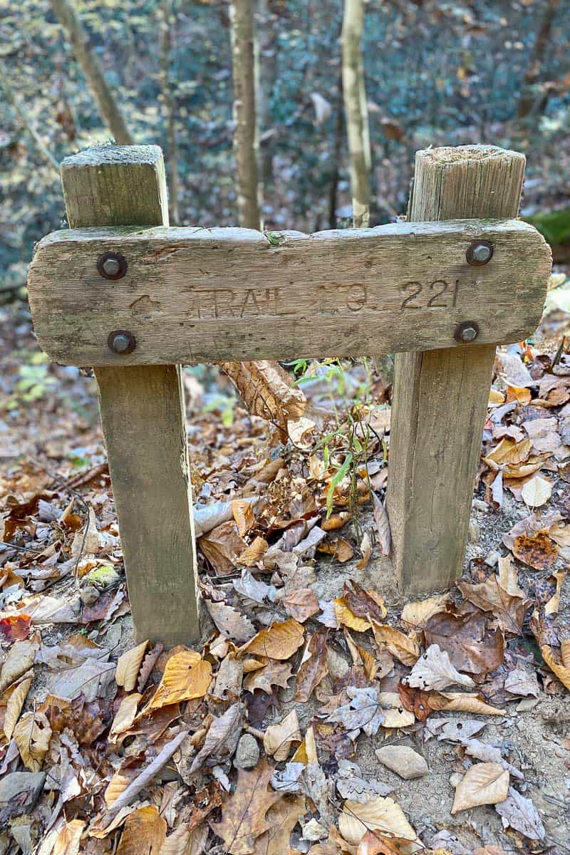
Rough Trail (221)
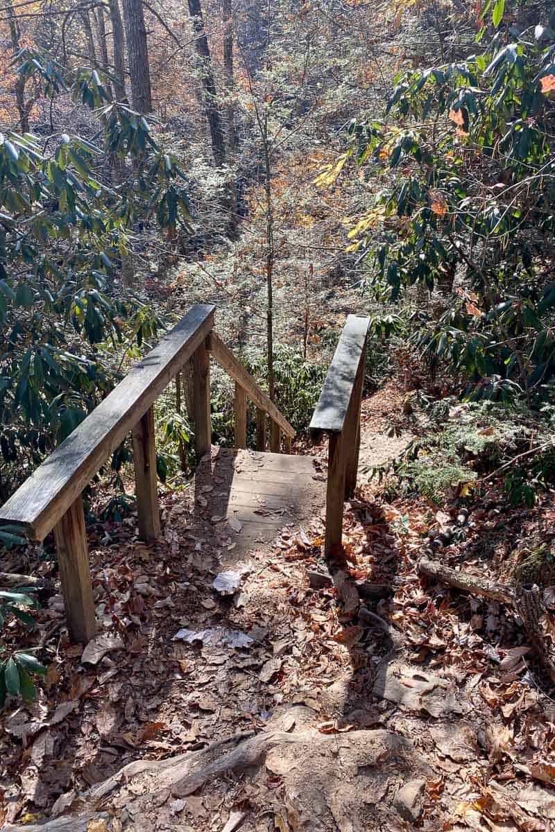
For the longer loop, head back the way you came until you reach the lowest staircase.
Just before the staircases, there’s a trail to the right — Rough Trail (Trail 221).
This trail passes more interesting rock formations and has multiple creek crossings.
All of the creeks were low when we visited, so the creek crossings were easy.
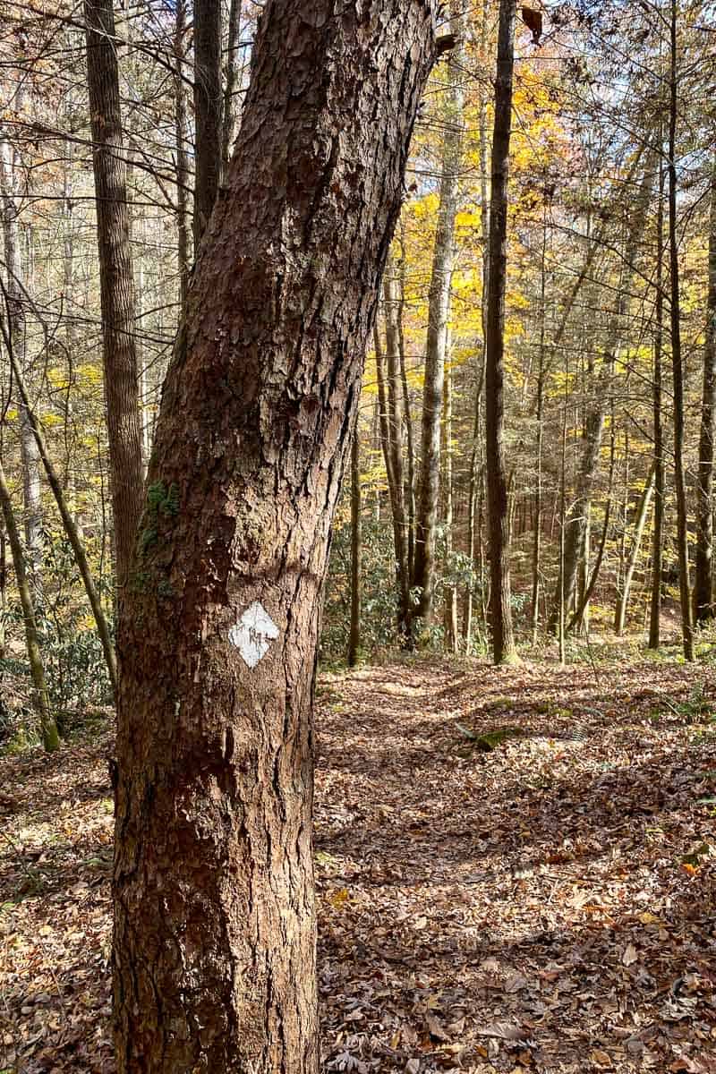
Rough Trail is (like many trails in the Gorge), marked with white diamond trail blazes.
Anytime you're uncertain which way to go, look for the diamonds on trees.
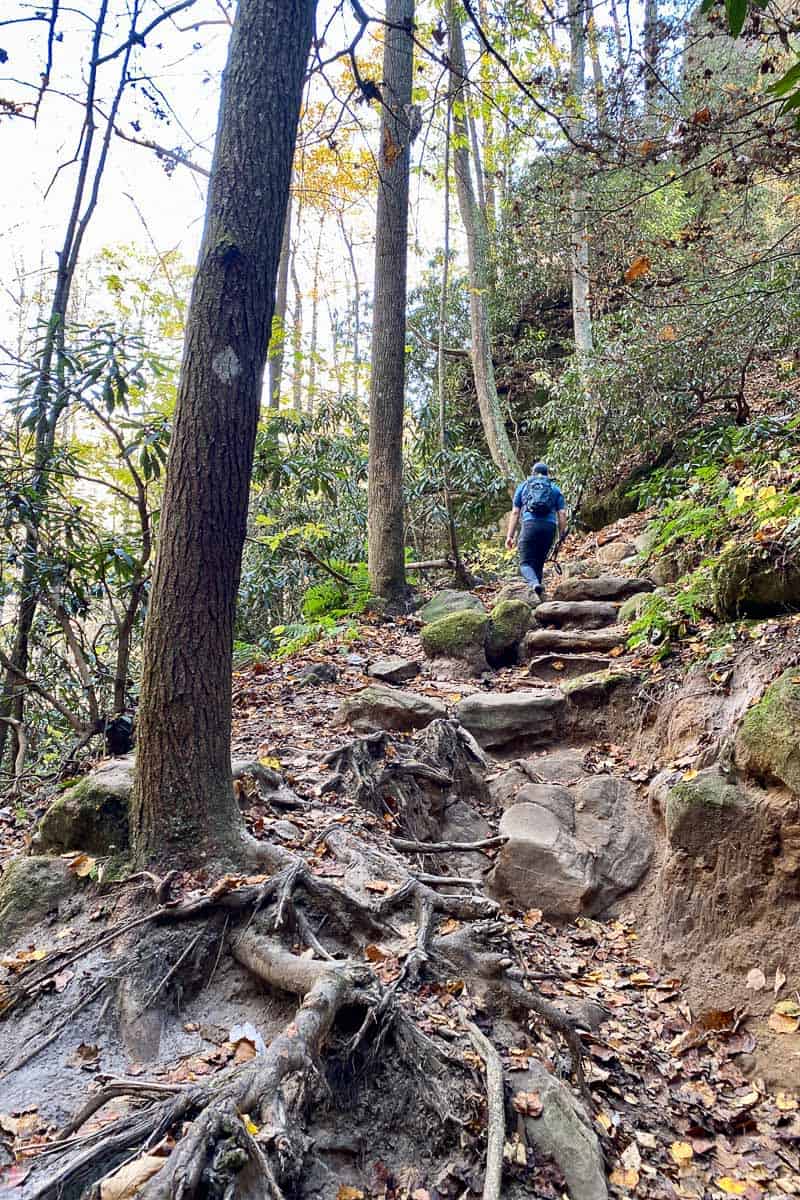
And of course, because you went downhill earlier, you’ll now have to go up.
When you reach the steps, you begin to ascend steeply.
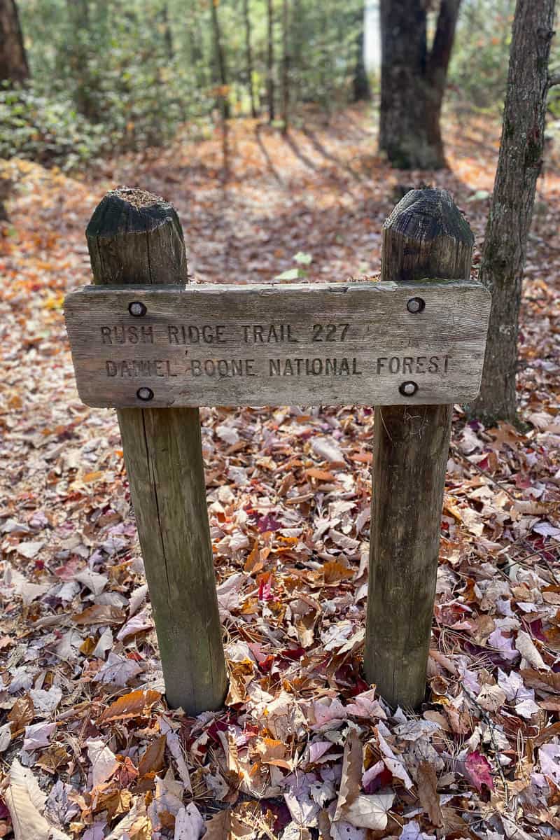
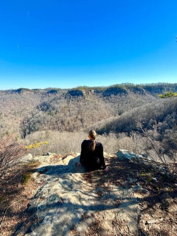
Rush Ridge Trail (227)
Eventually you’ll reach the trail junction with the Rush Ridge Trail (Trail 227).
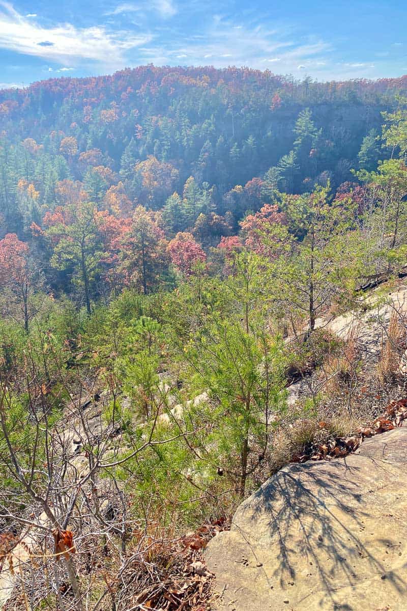
This section of trail is much easier since you’re already on the top of the ridge.
It’s also pretty with lots of overlooks.
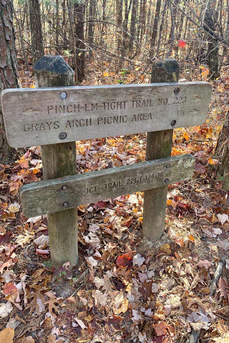
Pinch-Em-Tight Trail (223) + Back to the Trailhead
When you reach the Pinch-Em-Tight Trail, you’re almost done!
Follow the signs for the Picnic Area.
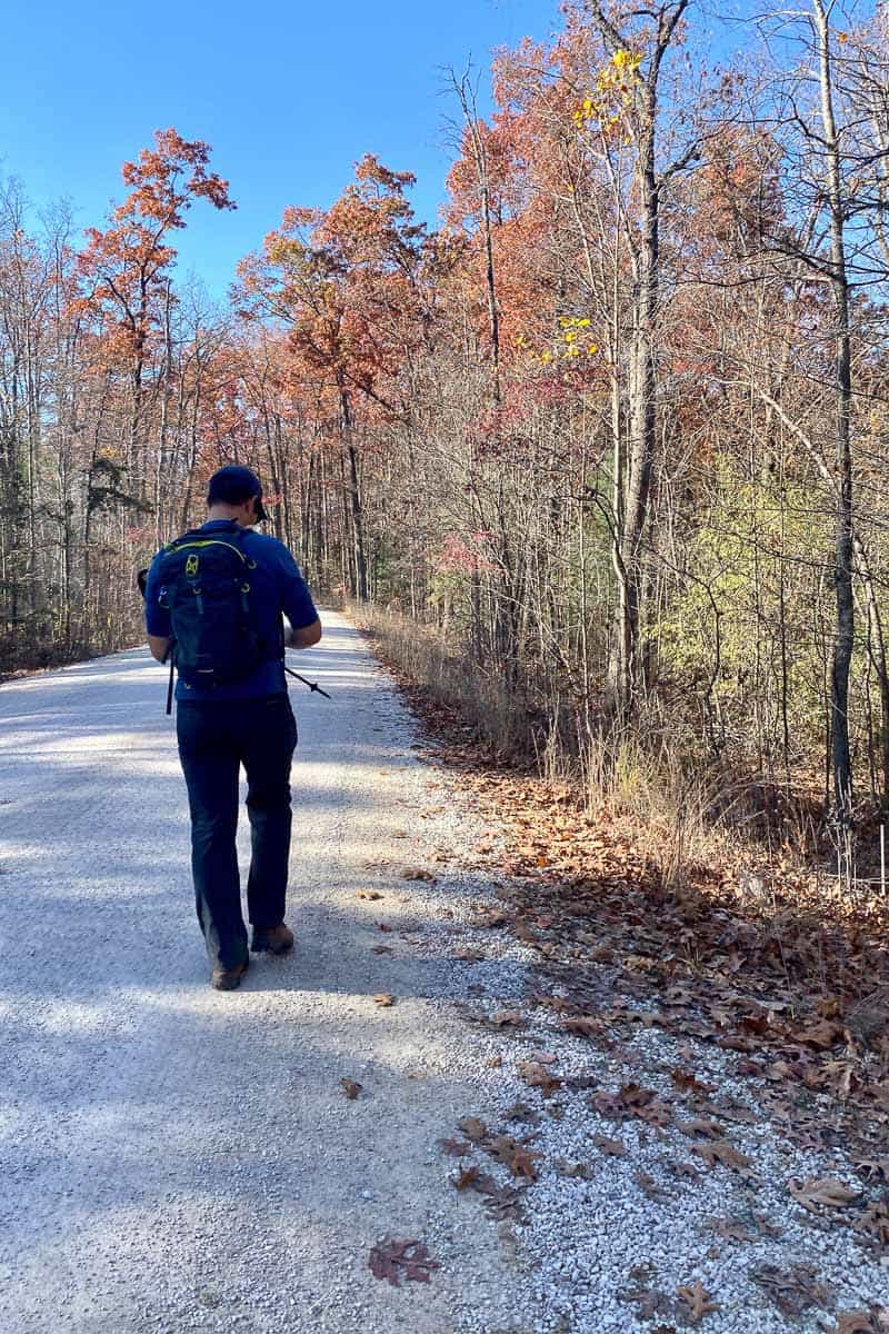
You’ll exit the trail onto a gravel road.
Turn right and you’ll quickly see the trailhead parking area where you started.
What are your favorite trails in the Red River Gorge? Let us know in the comments!

Leave a Comment: