
One popular scenic hike in Kentucky's Red River Gorge is the Auxier Ridge, Courthouse Rock, and Double Arch Loop. This trail guide can help you plan!
The Auxier Ridge Trail in Kentucky's Red River Gorge makes for a beautiful day out exploring.
Not only will you see Courthouse Rock and get sweeping views of Red River Gorge, you can also continue on to see Double Arch!
Here's what to know before you attempt this loop trail.
Is Parking Difficult at the Auxier Ridge Trailhead?
Auxier Ridge trailhead parking is on Tunnel Ridge Road in Stanton. This is an extremely popular trailhead and there’s often not enough parking. It's also where you would park to hike Jailhouse Rock.
If you’re visiting on a weekend, come early. Make sure to only park in designated areas. We saw cars parked in non-approved areas, and yes, they got issued parking tickets.
On one visit, we arrived too late and the parking area, as well as the overflow lots, were all full. A park ranger was turning away cars.
It’s a good idea to have a backup hike in mind in case there’s no parking. On that particular day, we decided to hike Hanson's Point, another trail with sweeping views of the gorge. Need more ideas? Here are 15 things to do near Red River Gorge.
How Difficult Is This Trail?
The hike from the Tunnel Ridge parking lot along the Auxier Ridge Trail to Courthouse Rock is 2.1 miles one way (so, 4.2 miles if you go back the same way) and moderately difficult. There is some elevation change, but this section mostly follows the ridge.
Be prepared for some (fairly easy) rock scrambles along the trail.

To reach Courthouse Rock, you'll descend quite a few stairs, but even if you only hike from the trailhead to the overlooks (skipping the stairs and Courthouse Rock), this is a gorgeous hike.
If you opt to hike on towards Double Arch, this section is difficult. The trail immediately becomes much more rugged and has more elevation gain.
In total, this entire loop (Auxier Ridge to Courthouse Rock to Double Arch back to the parking lot) comes in at around six miles.
What Gear Should I Bring?
Water and a snack!
Also, I was very happy I brought my trekking pole.
Staying Found on Auxier Ridge
The actual trail is pretty clearly marked; however, there are multiple unmarked trail spurs along the way — some to overlooks, and some to backpacking campsites.
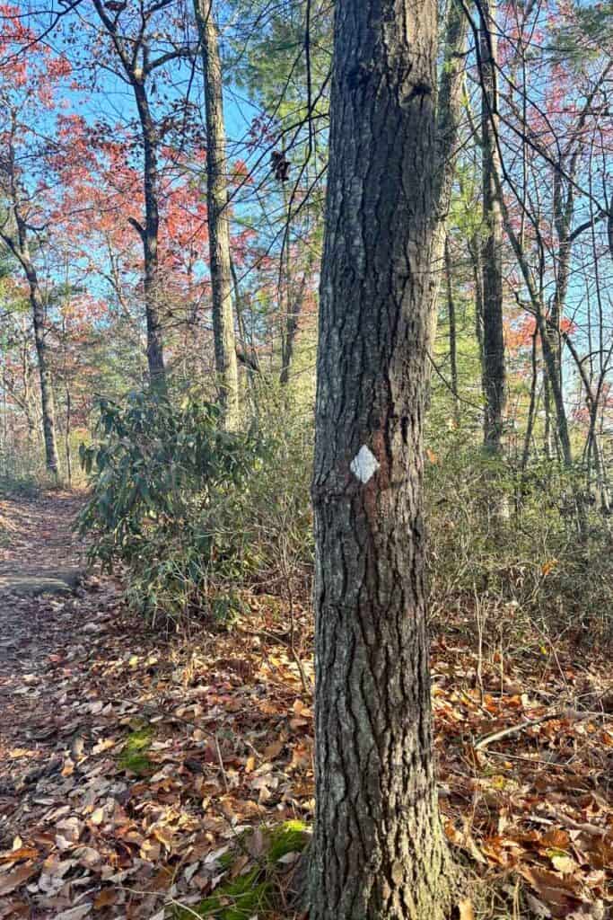
I recommend downloading a trail map before you go. I used my Garmin InReach mini 2 map, but you could also download the AllTrails map.
If you want more comprehensive trail maps and descriptions of the area, I recommend the books Red River Gorge Trail Guide (for official trails) and Hinterlands (for unofficial user trail descriptions). I use these books together when planning trips in the area.
I’m Afraid of Heights: Should I Do This Trail?
It depends. There are several areas with cliff exposure, but I never felt like I was in danger of falling.
Even the narrower Wizard’s Backbone was still relatively wide. (See photos below in the trail description.)
However, if you’re absolutely petrified of heights, this likely isn’t the trail for you.
Hiking Auxier Ridge Trail to Courthouse Rock
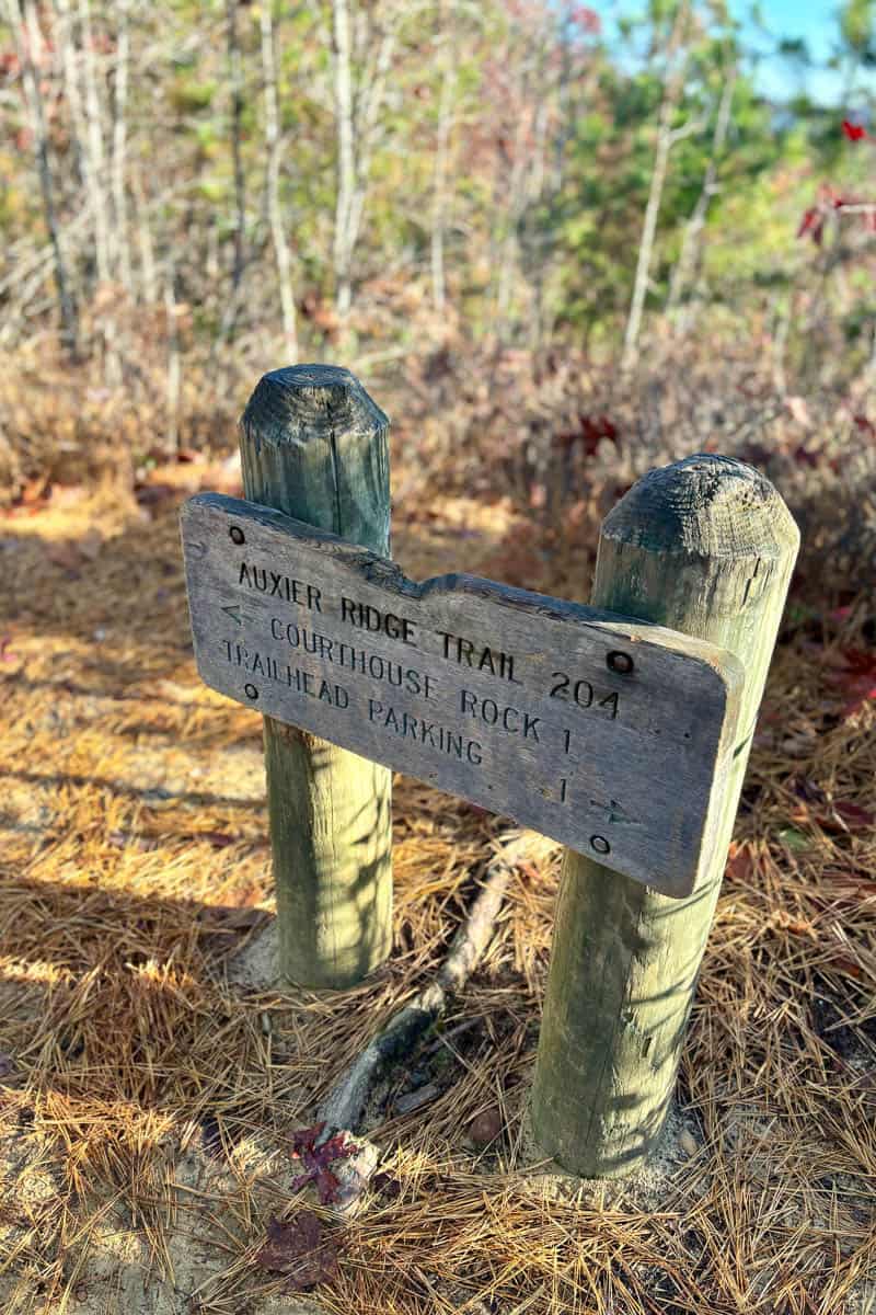
From the trailhead parking area, follow the sign for Auxier Ridge.
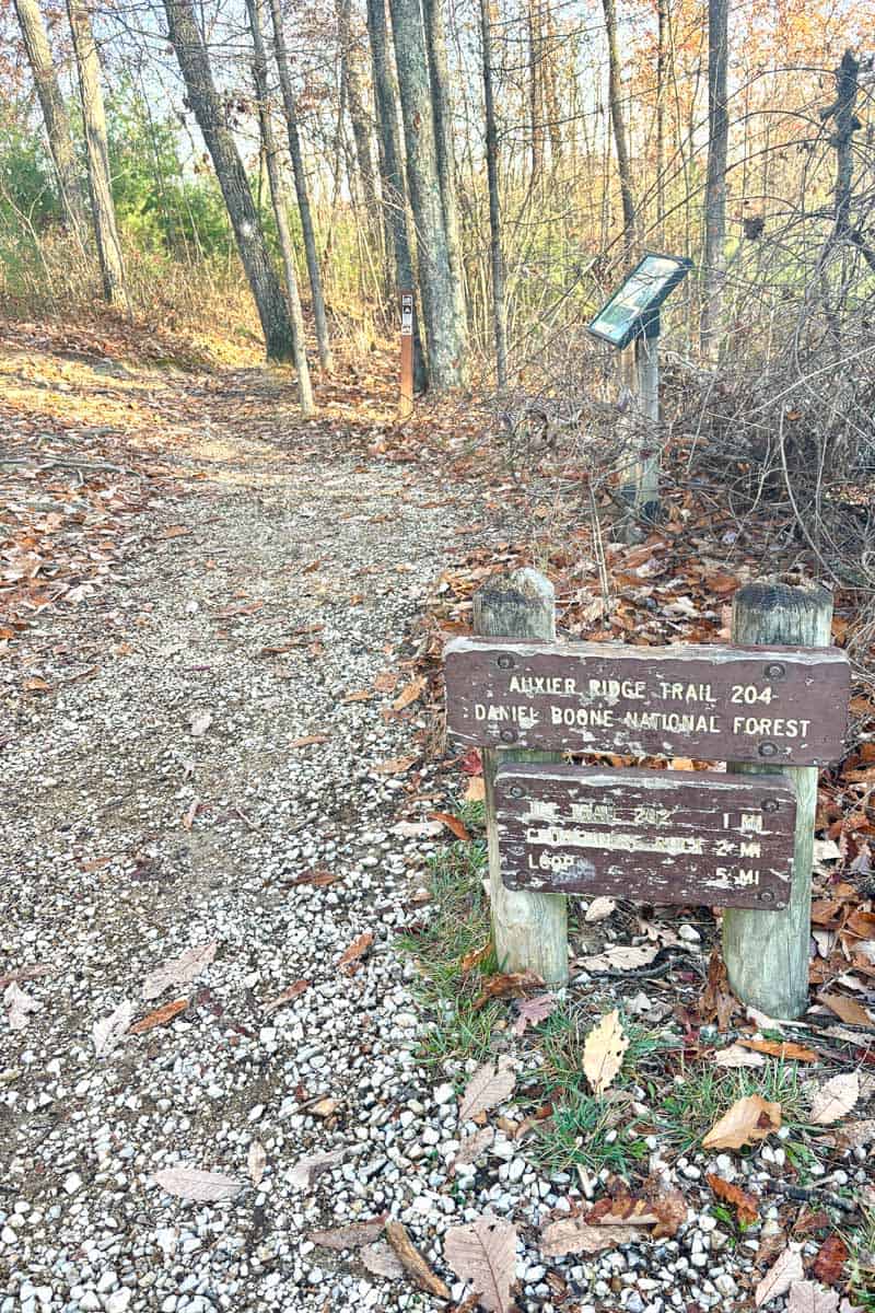
The trail immediately splits: stay to the right.
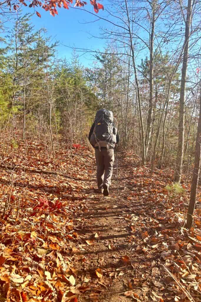
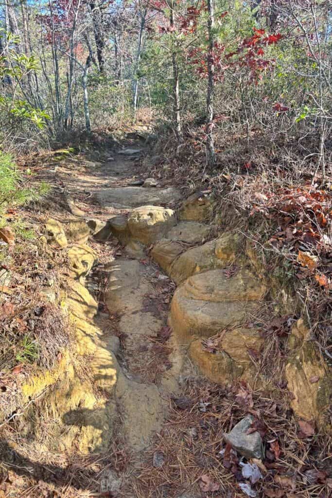
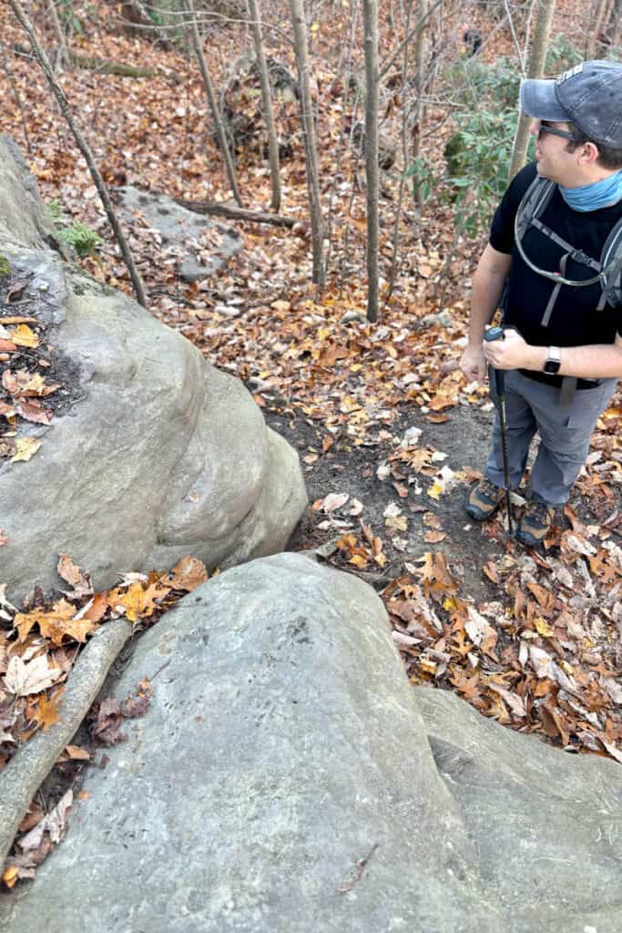
As you hike, you’ll need to watch your footing over rocky terrain.
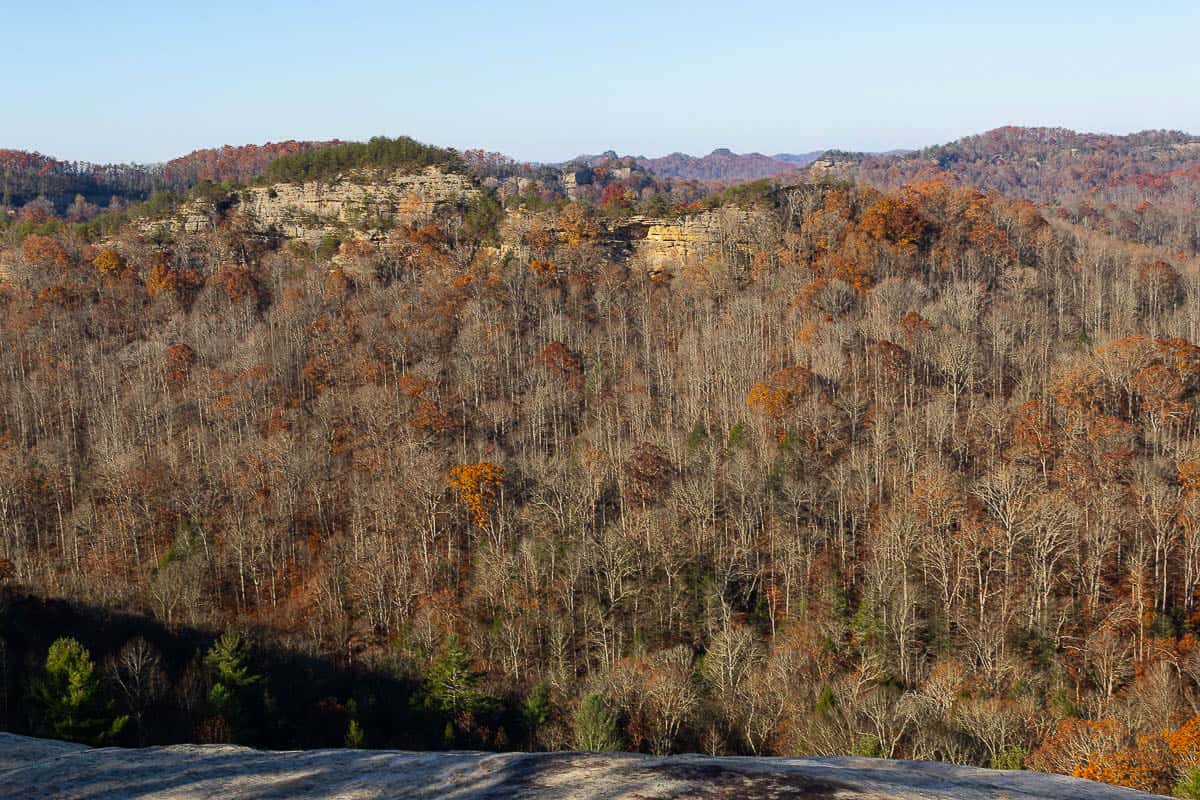
Pretty quickly, you’ll start seeing spur trails to some gorgeous overlooks.
About one mile in, the trail intersects with the Courthouse Rock Trail (#202). Stay to the right (on #204), unless you have a good map and want to take a different (longer and more difficult, but possibly less crowded) path to Courthouse Rock.
We opted to stay on Auxier Ridge instead of veering onto Courthouse Rock Trail.
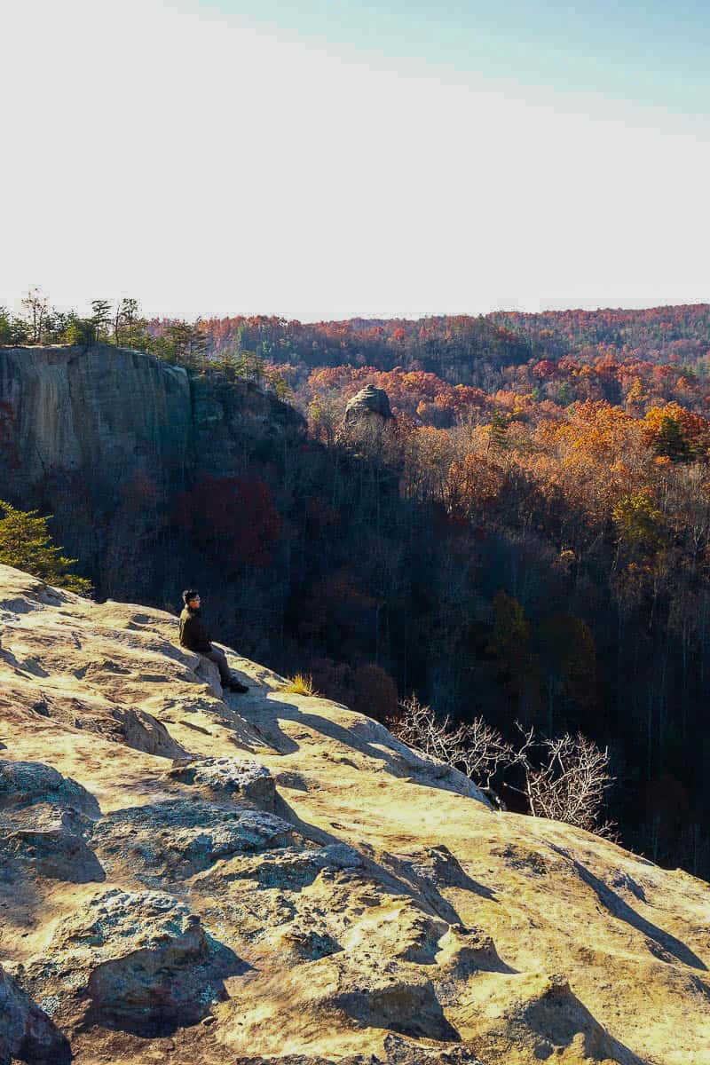
We stayed to the right on Auxier Ridge, and quickly arrived at the Wizard’s Backbone, a rocky stretch with drops on both sides.
It wasn’t extremely narrow, but watch your footing: erosion has been at work here.

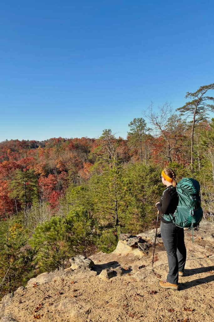
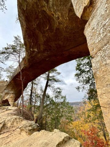
This stretch of the trail is gorgeous , and opens up to a rock shelf with fantastic views.
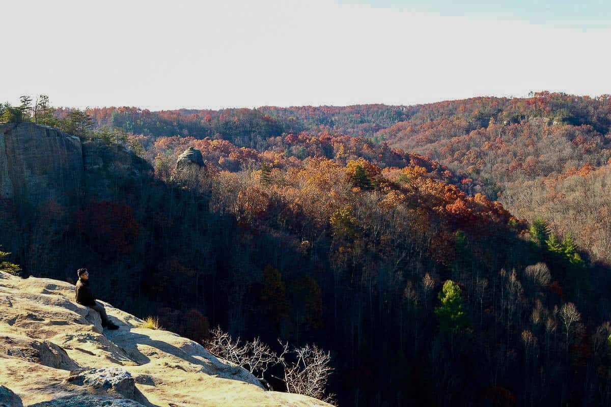
From this lookout, you can see Double Arch in the distance (near the top center of the image below).
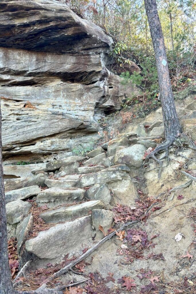
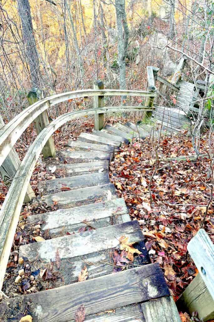
Follow the rocky trail, and you'll soon arrive at the long staircases down to Courthouse Rock.
Lots and lots of stairs.
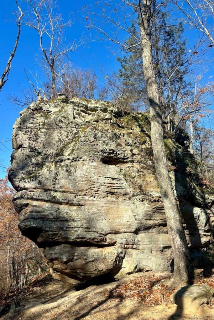
Take a few minutes to walk around the rock.
The path to the right seemed to go farther, but we didn’t see a way to walk all the way around, or any easy scramble up.
If you like, you could turn around and go back the way you came. Or, continue on towards Double Arch.
Courthouse Rock to Double Arch
If you want to keep going, follow the signs for Double Arch. This section of the trail is considerably more difficult, so if you aren’t up to it, turn back to the way you came.
To get to Double Arch, you'll next be taking Trail #203 (Auxier Branch) until you reach a trail spur.
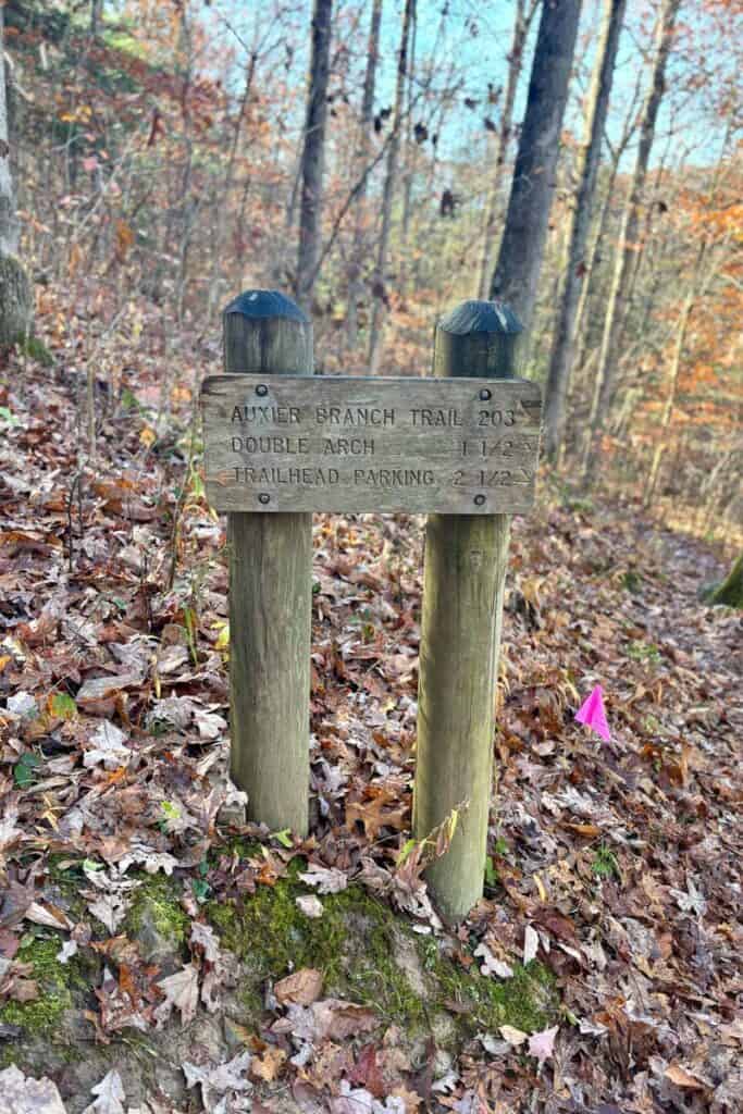
Courthouse Rock to Double Arch
On the way from Courthouse Rock to Double Arch, you’ll immediately need to scramble down some rocks.
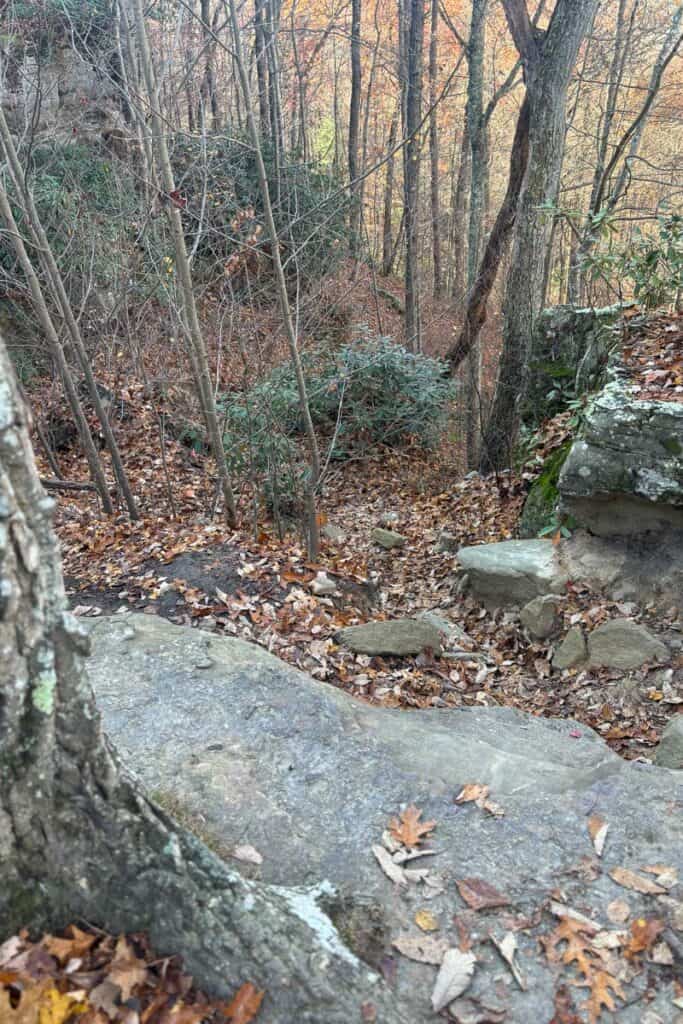
At this point, you'll be heading downhill off the ridgeline.
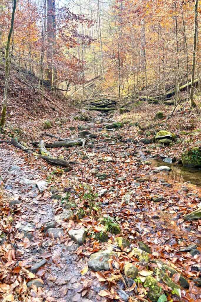
Keep going past a pretty area with a stream.
Continue hiking along the stream until the trail begins to rise again.
The path begins to climb, and eventually you’ll reach the spur trail to Double Arch (#201).
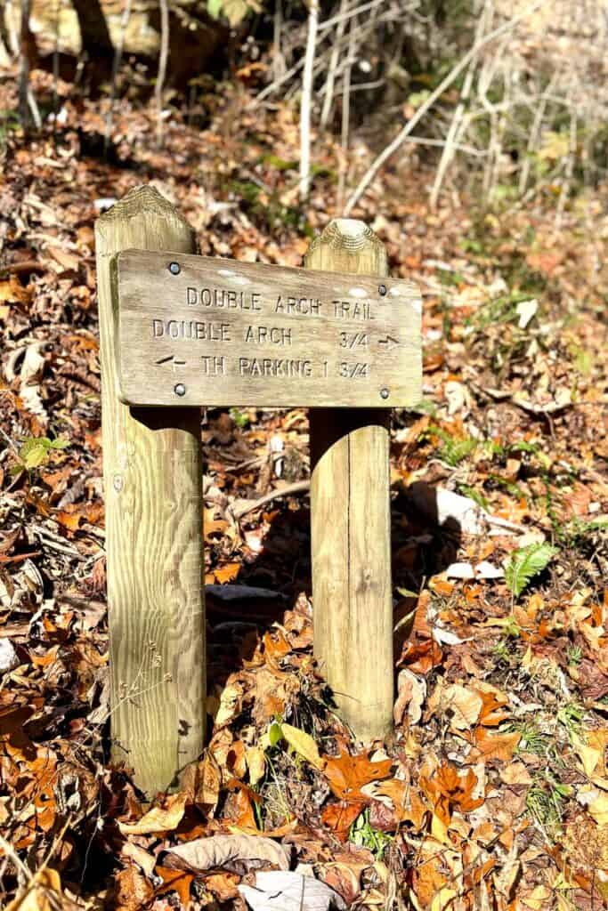
Turn right to reach Double Arch.
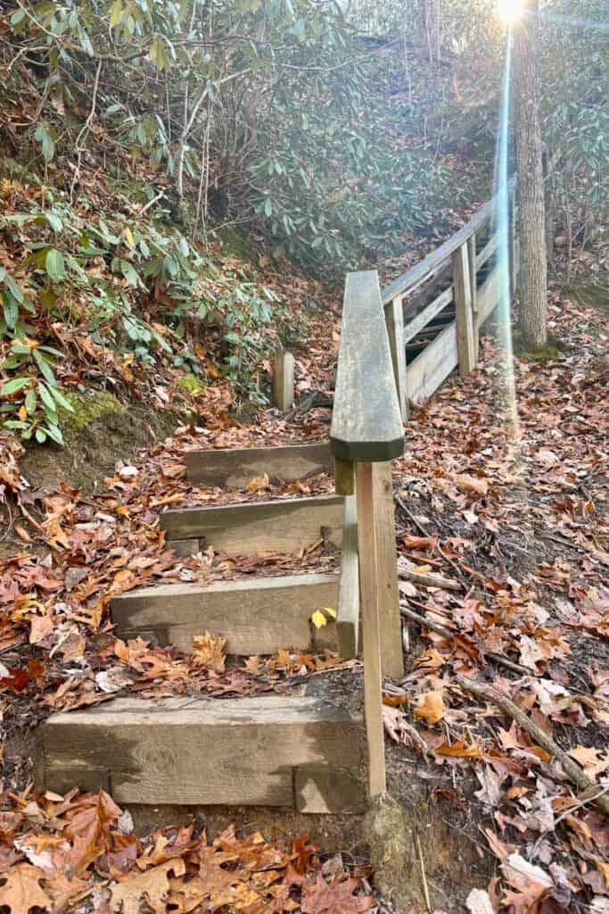
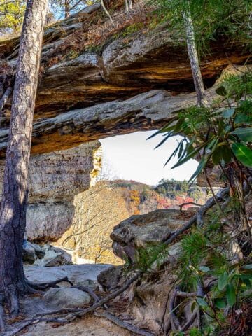
This section is fairly difficult. The trail ascends steeply, and eventually you’ll reach a staircase. Climb up to see the arch.
And suddenly, there it is! Double Arch is pretty impressive.
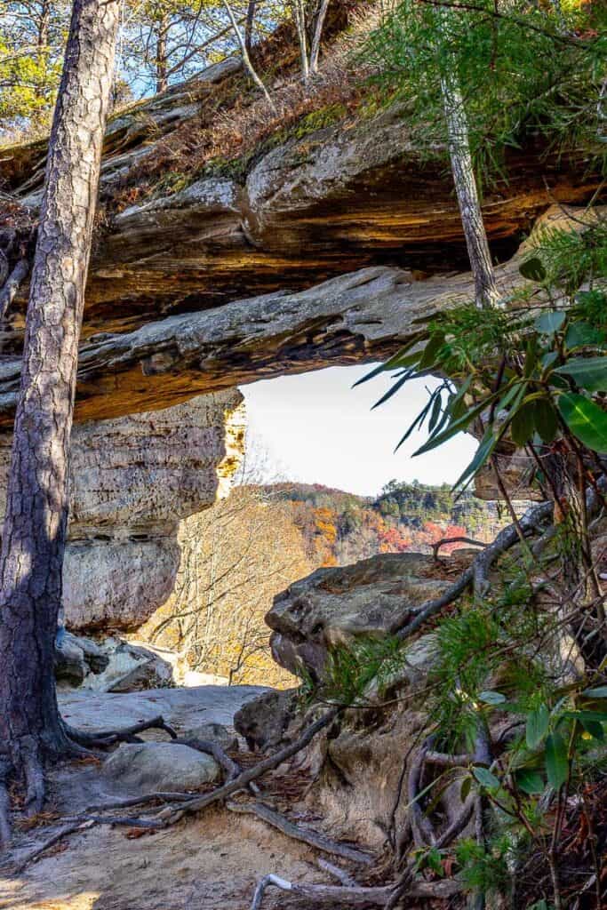
Once you’re at the arch, you may want to relax and enjoy a snack! Some hikers opt to scramble up to the top of the arch.
When you’re ready to leave, go back down the Double Arch spur trail.
When you reach the fork, head to the right and follow Trail #201 all the way to the parking lot.
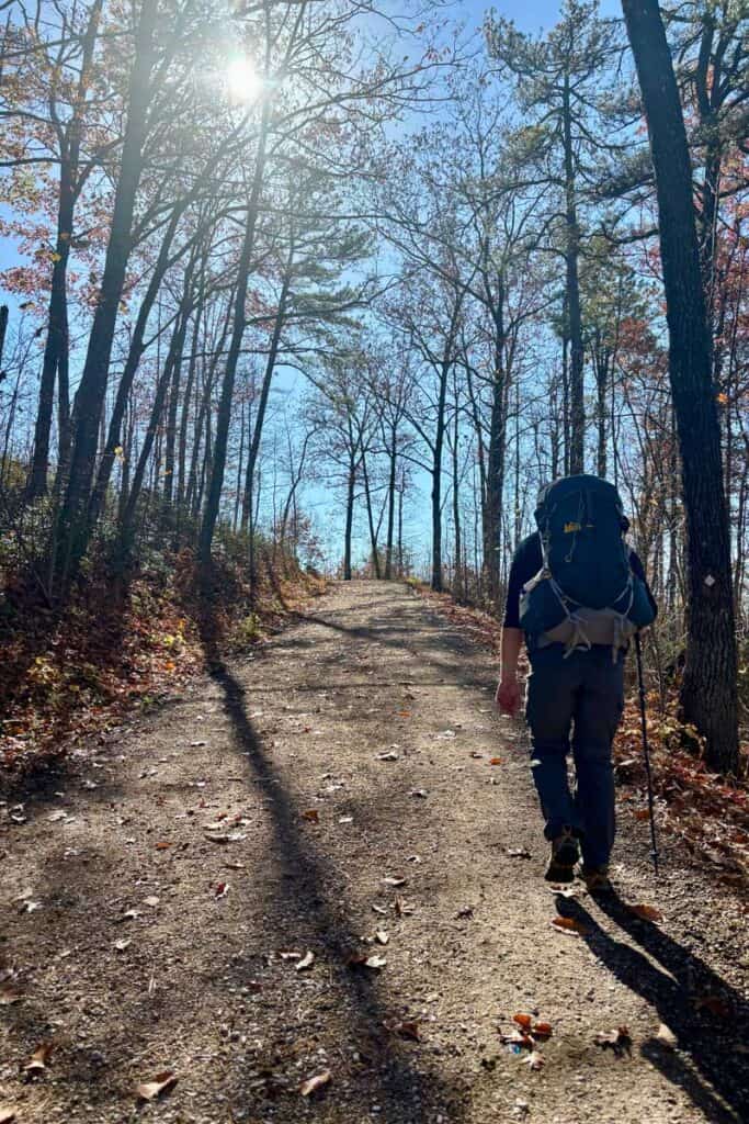
You’ll reach an intersection with a gravel path (the easiest part of this loop!). Turn left and continue walking until you reach the parking area.
In search of a delicious meal afterwards? The pizza at Miguel's or the platters at RedPoint BBQ are an amazing end to a day of hiking!


Leave a Comment: