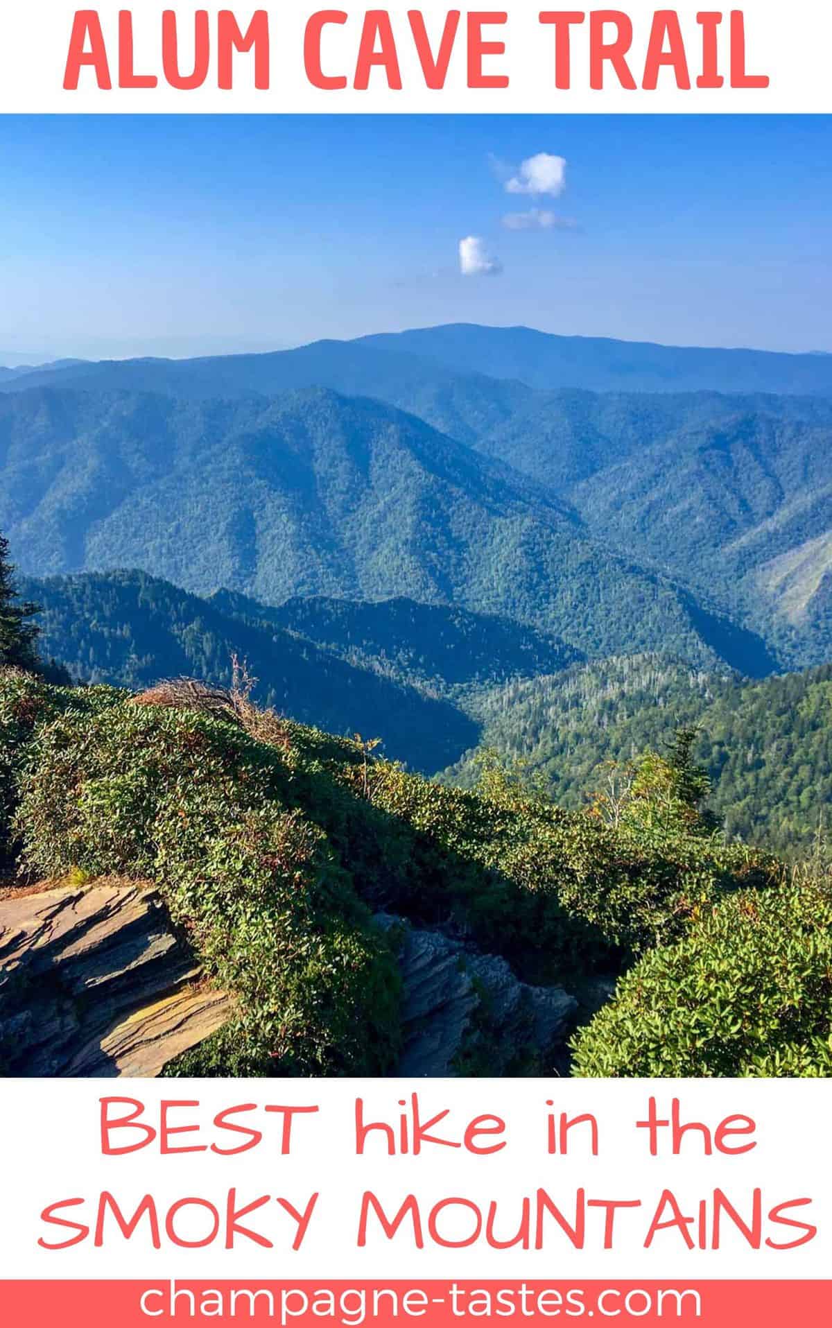
Are you visiting the Smoky Mountains for an epic hike? Hike the Alum Cave Trail to the summit of Mount LeConte, and visit LeConte Lodge, the cliff tops and Myrtle Point!
Are you going hiking in the Great Smoky Mountains National Park?
When I was planning our recent trip to the Smokies, I knew I wanted to do an epic hike. A hike I'd struggle to complete, but would be so overwhelmed by the views that I'd push through and finish.
I found my wonderful beast of a hike on the Alum Cave Trail.
Why Hike the Alum Cave Trail?
This is my favorite trail (so far!) in the Smoky Mountains.
It's a gorgeous trail that can be either short or very long, depending on how far you want to go, how much time you have, and how much energy you have.
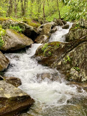
Weather Tip: Try to hike the Alum Cave trail on a clear, sunny day so that you can see the views at the top, and avoid hiking this trail in the rain because the rocks along the trail will become very slippery.
Is This Trail Difficult?
If you go the entire way to the top of Mount LeConte, yes.
From the trailhead to the summit, there's just over a 3,000 foot elevation change. That said, you don't have to do the hard part of the trail if you don't want to.
You can make it a short, moderately easy 2.8-mile trail by hiking to Arch Rock and back. The rock isn't clearly marked, but it's a big arch-shaped rock that the trail goes through, and it's pretty obvious when you've arrived.
Do a moderate 4.6-mile trail by hiking to the Alum Cave Bluffs and back. The bluffs aren't clearly marked with a sign, but you'll see a large, sandy overhang and a sign marking the distance to the Mount LeConte summit.
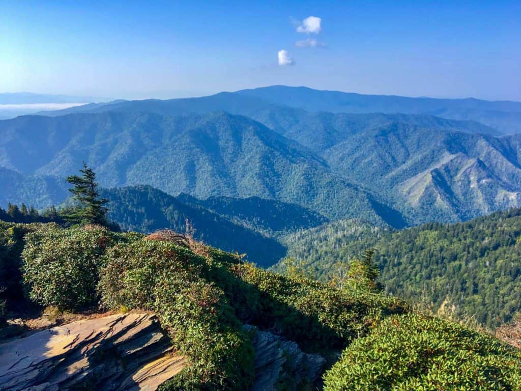
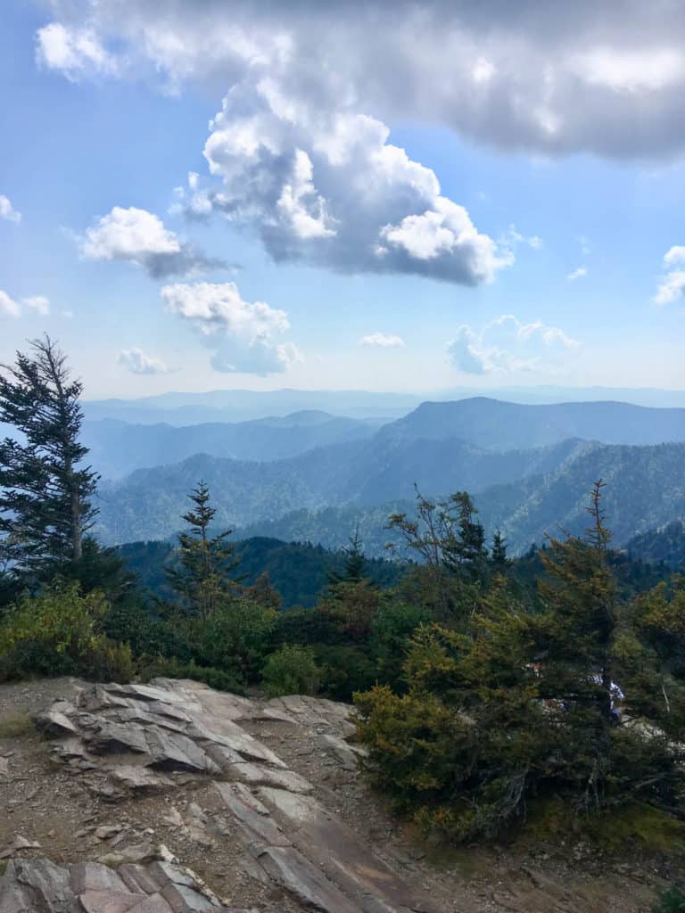
Set out early for a long strenuous 10.4-mile day hike by hiking past the bluffs, past LeConte Lodge, and onto the Cliff Tops for breathtaking views.
Or, if you're feeling extra ambitious (like we were), visit the Cliff Tops, and then continue to the mountain summit, then to Myrtle Point, and back down the mountain for a strenuous 12-mile hike.
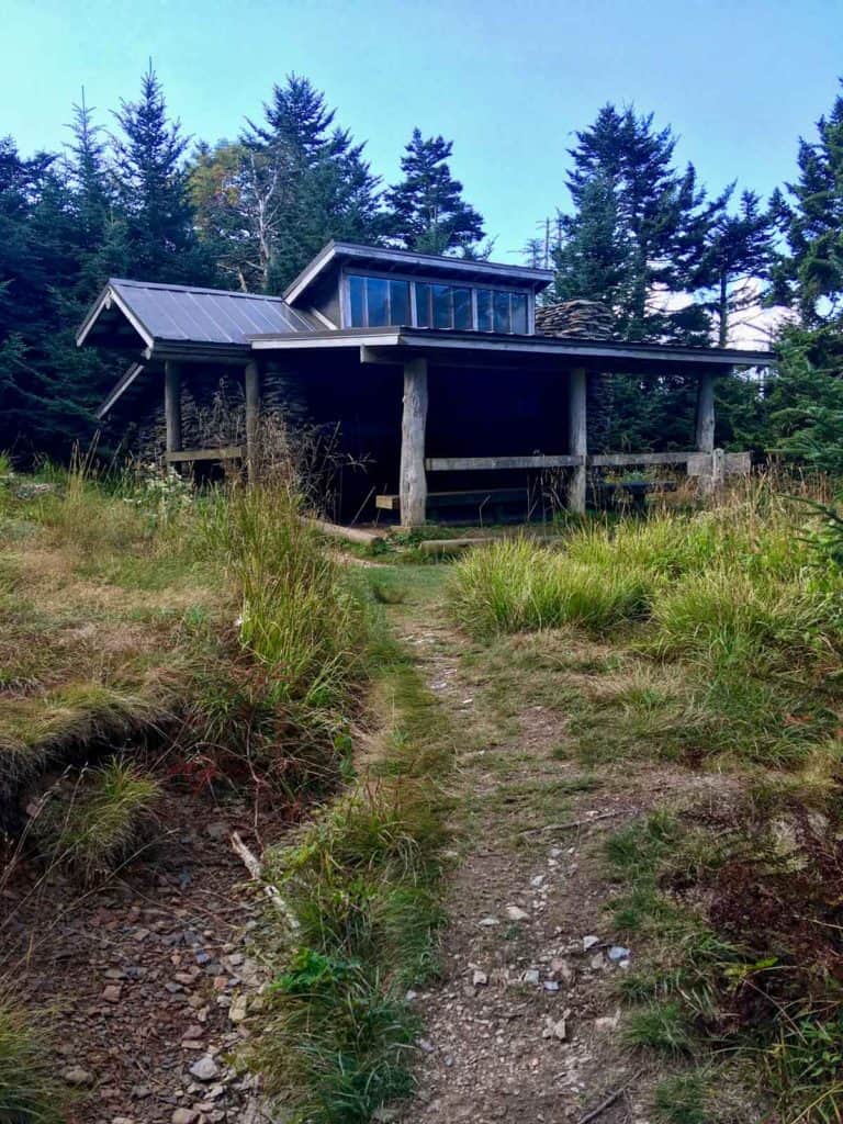
You can even turn the hike into a two-day trip by staying overnight at LeConte Lodge or at the backpacking shelter at the top of the mountain!
Want more hiking ideas for the Smokies? Check out Deep Creek, Charlies Bunion and the Jump Off, Andrews Bald, or Sweat Heifer Creek Trail!
Where is the Alum Cave Trail?
The Alum Cave trailhead is on Newfound Gap Road, 8.7 miles south of the Sugarlands Visitor Center. There are two parking lots for the Alum Cave Trail, along with some overflow side-of-the-road parking.
Parking fills up EARLY. Each time we drove past this trailhead in mid-September, both parking lots were packed by 8:30 am, even though the rest of the park was fairly uncrowded.
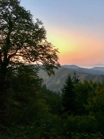
I recommend getting to the trailhead as early as possible. We started our hike just before dawn at 6:30 a.m.
Don't forget your paid parking pass, which is a requirement as of spring 2023.
You also might want to check out my other tips for how to avoid crowds in the Smokies!
Alum Cave Trail to Arch Rock
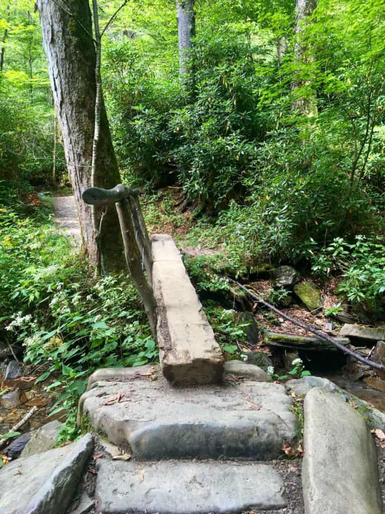
Start at the trailhead (just off the parking lot), and walk over the wide, wooden bridge. You'll walk through the woods and alongside the creek.
This section of the trail is fairly easy, but watch your footing for roots and rocks on the trail. Along the way to Arch Rock you'll cross several log bridges.
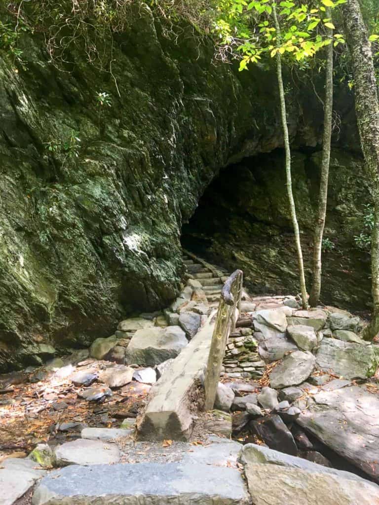
Eventually, you'll reach Arch Rock.
At Arch Rock, you'll cross another log bridge and walk up a staircase through the arch.
Arch Rock to Alum Cave Bluffs
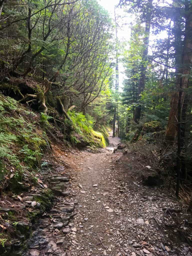
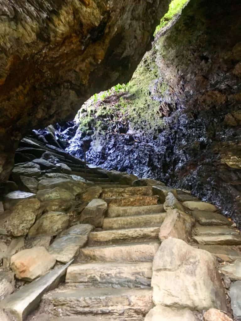
At this point, the trail begins to get a little harder.
You'll start to climb a lot of staircases, some wooden, some made from rock.
Even though you're moving mostly uphill, the grade isn't overly steep.
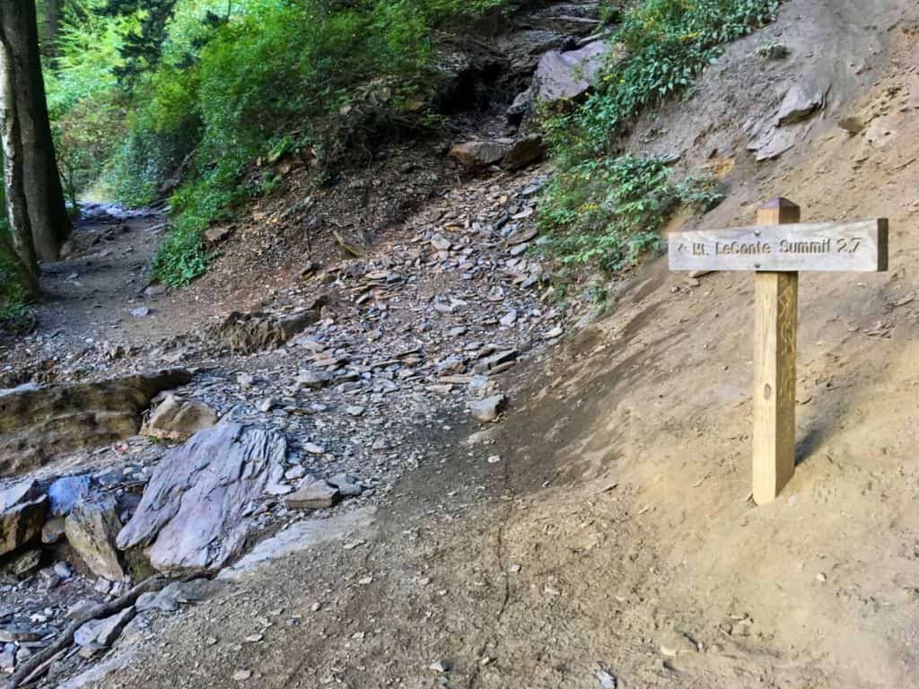
Eventually, you'll go up a long, steep staircase and arrive at the Alum Cave Bluffs.
This is a sandy area with lots of rocks and a sign marking the distance to the Mount LeConte summit-- a great place to stop and eat a snack.
Alum Cave Bluffs to the Cliff Tops
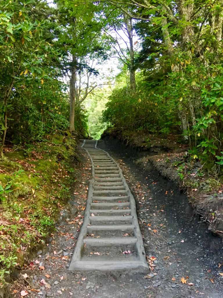
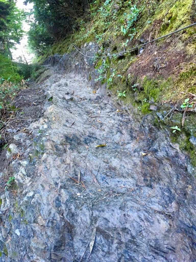
Once you pass the bluffs, the trail gets much harder.
The uphill grade gets steeper and is relentless. The remaining hike is almost entirely steep and uphill.
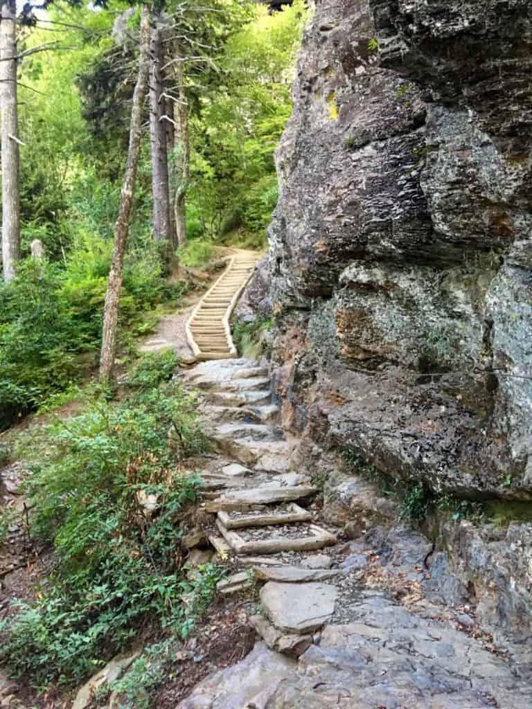
The trail itself becomes really rocky and sometimes very narrow.
From this point on you'll see large sections with cables to help you from slipping on the rocks.
The rocks weren't slippery at all on the day we hiked, but I'd imagine that they would be dangerously slick if it started to rain.
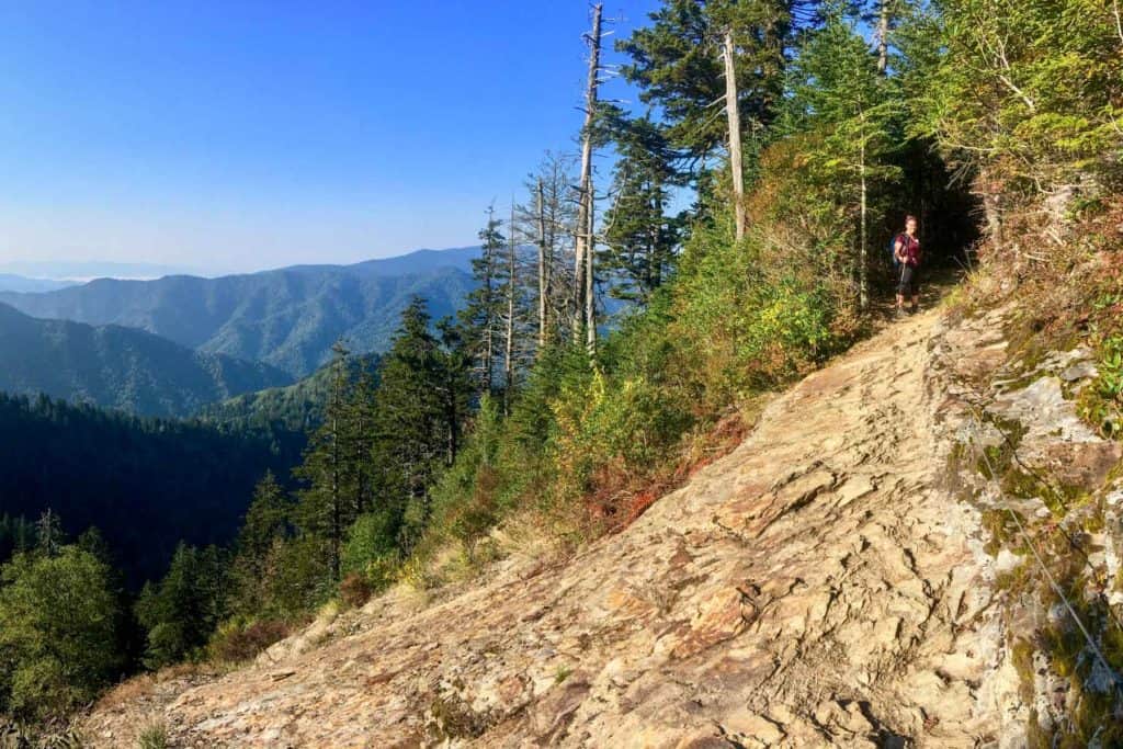
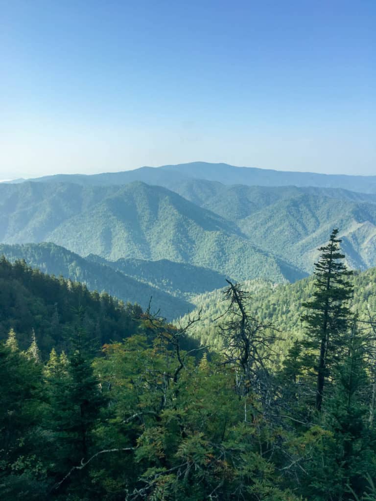
As you hike, make sure to take a look around you.
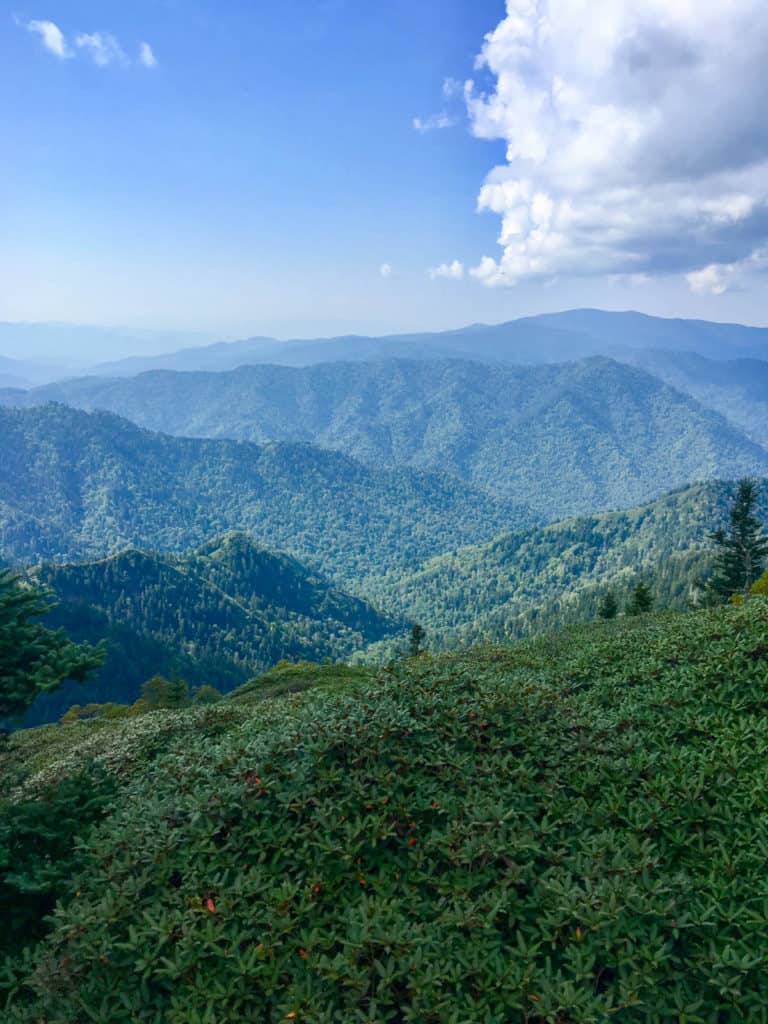
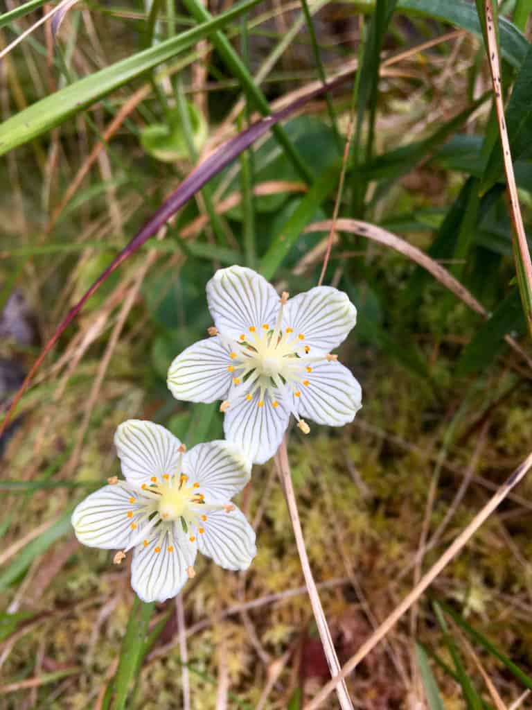
This section of the trail has sweeping views of the Smoky Mountains, as well as wildflowers along the path.
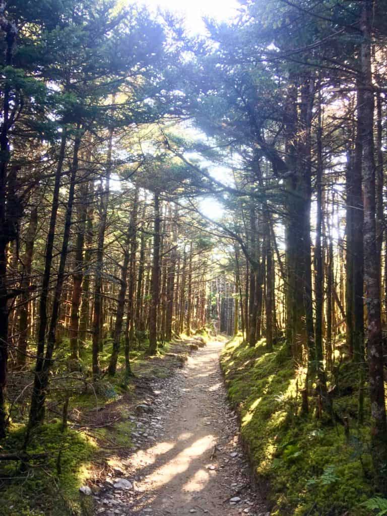
Eventually, you'll enter a flat portion of the trail that's lined with tall pine trees.
Keep going, you're getting close to the top!
When you reach the sign that marks LeConte Lodge in 0.1 miles, keep going!
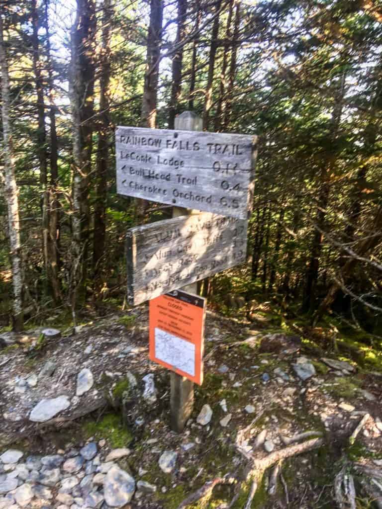
You'll see the lodge on your left.
Walk past it.
Or go ahead and stop at the lodge if you need a bathroom break! But know that you are SO CLOSE to the top!
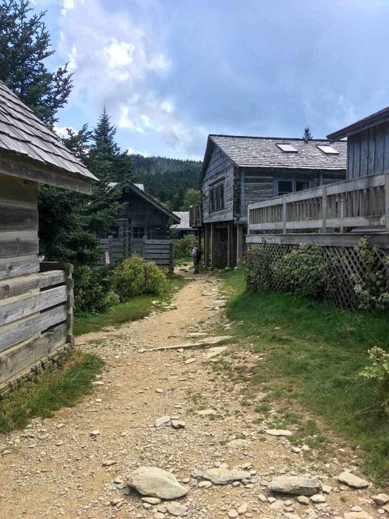
Just after the lodge, you'll see a sign for the Cliff Tops.
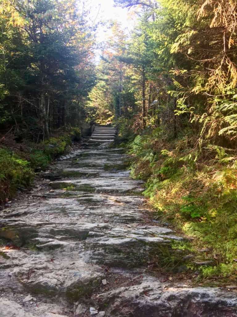
Cross the little wooden bridge, and begin climbing the 0.2 miles to the Cliff Tops.
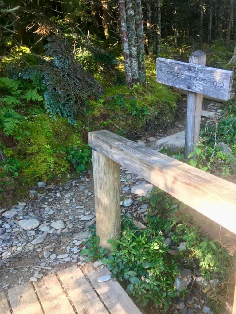
This section of the trail is rough and steep, but it's short!
When you get to the top of the Cliff Tops trail, you'll be at a junction where you can go either right or left.
Go right.
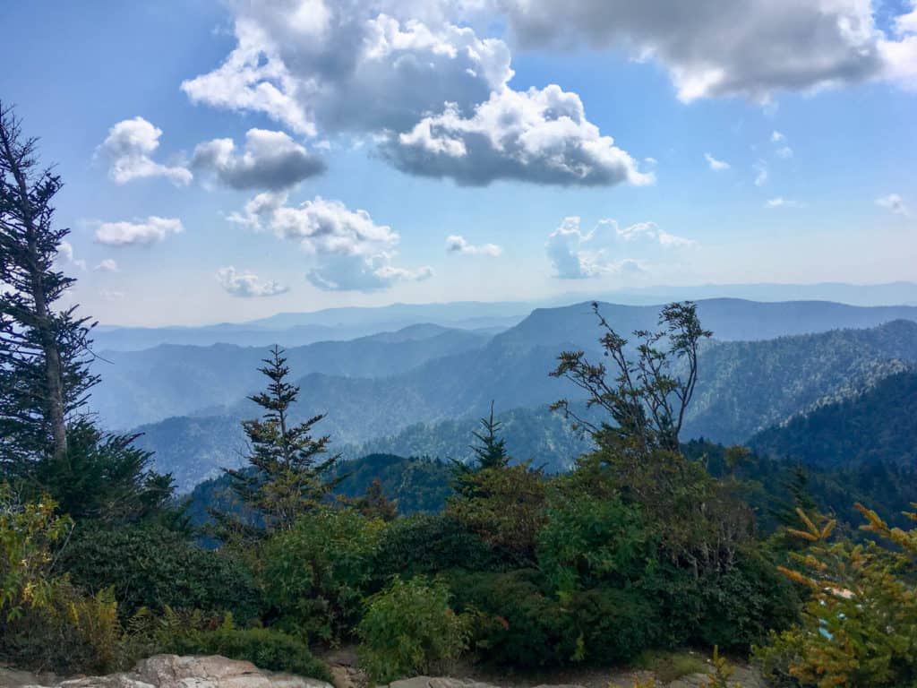
Congratulations, you've made it to the top!
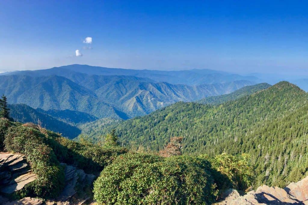
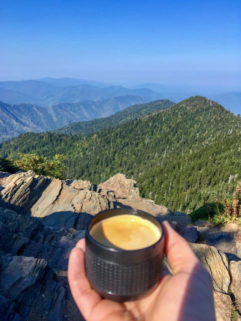
This is a great place to rest, enjoy the view, and have (another) snack.
We sat on the rocks and sipped freshly brewed espresso! Yes that's right, I said espresso!
My husband brought along coffee grounds (we love Illy coffee grounds), a backpacking stove (to heat water) and a hand-pump espresso machine.
It was delightful.
God's cafe, as my friend Melanie says.
Cliff Tops to Myrtle Point
Once you leave the Cliff Tops, here's what to do if you want to keep going to Myrtle Point.
Go back to the junction at the end of the Cliff Tops trail. You went right before; now walk the other direction.
From the Cliff Tops you're actually walking straight, but if you'd gone this way from the Cliff Tops trail you'd be turning left.
Continue on this trail for about a half mile.
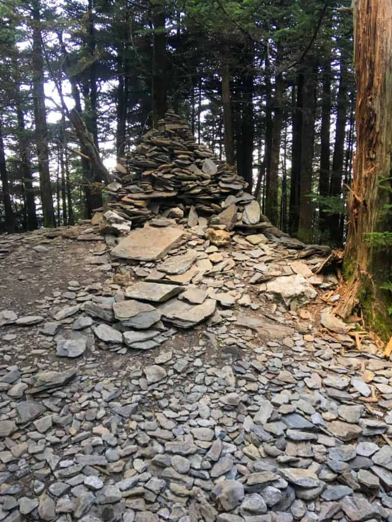
Along the way, you'll pass the backpacking shelter on top of Mount LeConte, as well as a pile of rocks marking the mountain summit.
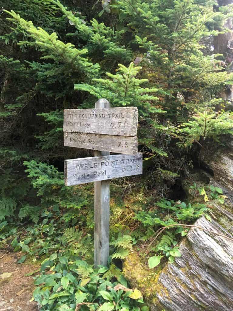
When you reach the next trail sign, turn towards Myrtle Point.
You'll hike out 0.2 miles along the ridge towards another overlook, but this time you'll have a view from the other side of the mountain.
This is Myrtle Point.
We didn't stay long at Myrtle Point, because the looming clouds were starting to make me nervous. I didn't want to hike back in the rain.
When you're ready to leave Myrtle Point, turn around and walk back to the last trail marker sign.
Follow the sign to LeConte Lodge, skipping the steep and rocky Cliff Tops trail. When you reach the lodge, stop and look around. LeConte Lodge has bathrooms (vault toilets) and potable water available.
Finally, head back down the mountain towards the Alum Cave Bluffs, Arch Rock, and then back to the trailhead.
Tip: I like to celebrate long hikes with pizza! We drove into Gatlinburg and ate a delicious meal at Big Daddy's Pizza. The beers at Gatlinburg Brewing Company are also fun. Check out these best restaurants in Gatlinburg for more food ideas!

Leave a Comment: