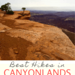
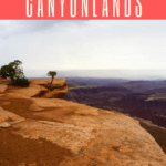
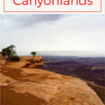
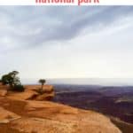
Are you planning to go hiking in Canyonlands National Park? Here are our picks for the best trails in Island in the Sky, Needles, and Maze districts!
Hiking in Canyonlands National Park can be a little intimidating.
Scratch that.
It can be majorly intimidating.
The park is notorious for The Maze district — the dangerous, poorly marked backcountry area made famous from the movie (and book) 127 Hours, the true story of a solo backpacker who became trapped under a fallen boulder.
Reading about the Maze is enough to scare me (and probably most people) away from the park.
But you do not have to be scared of Canyonlands National Park. Although, you should still be cautious and take care while hiking because, well... nature can be brutal.
If you want to go hiking in Canyonlands, know that it is a park that runs the gamut of trail types.
There are easy trails with gorgeous canyon views, harder trails with rock scrambling that are perfect for adventurous backpackers, and wild, remote intimidating trails (like the Maze).
Plus, Canyonlands is conveniently located about 30 minutes from one of my absolutely favorite parks, Arches.
If you're planning on going hiking in Arches National Park, spend some time on the Double O Arch trail, make the hike to Delicate Arch, and be sure to set at least one day (or more!!) aside for Canyonlands.
4 Districts in Canyonlands National Park
Canyonlands is divided into four areas: The Island in the Sky, The Needles, The Maze, and The River districts.
Island in the Sky is the most accessible area, and has lots of easy and moderate day hikes. If you only have one day in Canyonlands National Park, head to the Island in the Sky district. The Island in the Sky area is about a 30-minute drive from Arches and Moab, Utah.
The Needles area in Canyonlands has a few day hikes, and lots of interconnecting trails that are perfect for overnight backpacking trips. If you're coming from Arches or Moab, this section of the park is a longer drive.
The Maze area is only for hikers who want to backpack overnight, and you should plan on doing a lot of research and planning before venturing into this section of the park.
The park service doesn't have any official hiking trails in the River district, but you can go on commercial rafting tours inside the canyon!
Here are my top trail picks for hiking in Canyonlands National Park!
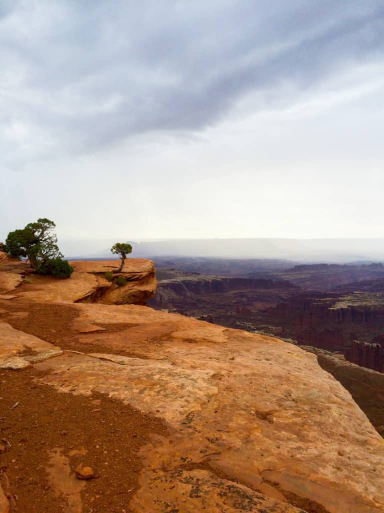
Hiking in the Island in the Sky District in Canyonlands National Park
Are you looking for easy hiking trails with gorgeous views? Head to the Island in the Sky district.
This district is a photographer's dream.
Since the trails in this area tend to be fairly short, you can see several in one day!
Island in the Sky is not an ideal spot for overnight backpacking, because there are very few reliable water sources.
Want help packing for your trip? Here's my recommended gear for Canyonlands!
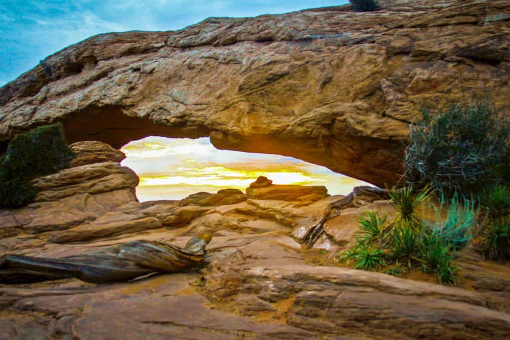
Mesa Arch Trail
Mesa Arch is famous among nature photographers because the sun rises directly behind the arch opening, illuminating the inside of the arch (and everything around it) in a gorgeous golden glow.
The trail to Mesa Arch is easy and short (0.5 miles round trip). It's beautiful.
This is an extra-popular spot to watch the sunrise. When we went, we arrived before sunrise, and I was surprised to see a crowd of photographers had already arrived (and snagged the best spots).
If you dislike crowds, try visiting Mesa Arch during the week, or visit later in the day (after the photographers have left).
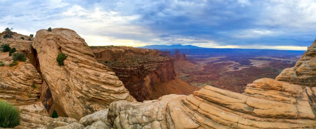
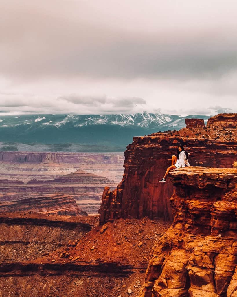
Grand View Point Trail
My favorite trail in the Island in the Sky district is Grand View Point Trail. It's an easy two-mile trail with grand views (get it?) the entire way.
This trail follows the edge of a canyon (so there are steep drop-offs), and on a clear day you can see both the Needles and Maze districts from afar.
We've hiked (or really, strolled along) this trail twice, and I'd happily go see it again.
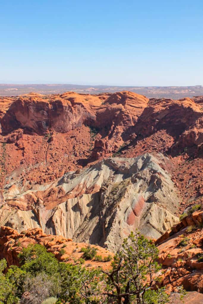
Upheaval Dome
Trail information from Op Reis Met Co
Upheaval Dome is a huge crater in Canyonlands National Park. We still don’t know if it was caused from erosion or a meteorite.
The hike to Upheaval Dome is a moderately easy trail with a 301-foot elevation change, and is a perfect hike if you don’t have a lot of hiking experience.
There are two different viewpoints for Upheaval Dome. The first viewpoint is only 0.3 miles from the trailhead, and the second is another 0.5 miles down the trail.
If you want to visit both, it will take you approximately 1 to 1.5 hours. Make sure to wear a hat and bring water, because there’s no shade and it can get really hot.
The hike starts very relaxed on a flat desert floor. The closer you get to the viewpoints, the more you have to climb. But it never gets overly steep.
Once you reach the viewpoints (the second one has a better view than the first one), you will be rewarded of an amazing view of the crater.
Shafer Canyon Overlook
Trail information from Ruhls of the Road.
Looking for the best views for the least amount of effort?
Shafer Canyon Overlook is home to a short and easy 0.2-mile (roundtrip) viewpoint trail to one of the most beautiful overlooks in all of Canyonlands National Park.
The path starts at the parking lot and continues a short way down to an absolutely stunning view.
You’ll be able to walk up to the canyon itself and drink in a jaw-dropping 360-degree view with every color of the rainbow. Pack along a picnic and grab lunch at this lovely spot.
On top of the incredible view, Shafer Canyon Overlook also marks the beginning of Shafer Trail, a 19-mile point-to-point trail.
Shafer Trail is typically used for scenic-drives rather than hikes; however, you should only drive this route if you have a 4-wheel-drive vehicle or a mountain bike.
All in all, Shafer Canyon Overlook is a must-see while in Canyonlands National Park. The hike is easy, the view is unbelievable, and there are options for further adventure!
The Needles District
If you're up for a challenge (but not quite ready for the Maze district), head to the Needles district.
The Needles district is ideal for overnight backpacking (and a much better backpacking spot than the Island in the Sky district), because this area has reliable water sources.
There's also a handful of day hikes in this district.
Slickrock Foot Trail
Trail information from Mind the Travel.
If you only have a half-day to spend in the Needles District, the Slickrock Foot Trail is your best bet.
Slickrock Foot Trail is a 2.7-mile moderately easy loop trail. There are several moderate inclines, but most sections of the trail are easy to follow for novice hikers.
While most hikes in Canyonlands National Park will take you through the canyon bottoms, Slickrock stays on the ridge and offers unobstructed views of the entire southeastern corner of the national park.
Take the hike counterclockwise about a half-mile up the trail to reach the first viewpoint. You'll get a good view of the Abajo Range to the south, as well as many of the major landmarks like the La Sal Mountains, Cathedral Butte, Ekker Butte, the Needles, and Island in the Sky sandstone mesa to the north.
At the second viewpoint, you can get far-reaching views over the Little Spring Canyon.
The third viewpoint looks out over Lower Little Spring Canyon, a limestone dominated area that's also a good place to watch wildlife. Then the trail turns west and then south.
Finally, the trail takes you to the fourth viewpoint overlooking the Big Spring Canyon. This is a lovely spot to visit when the spring wildflowers are in bloom.
After you leave the fourth viewpoint, the trail follows the east flank of Big Spring Canyon for about a mile back to the Slickrock Foot trailhead.
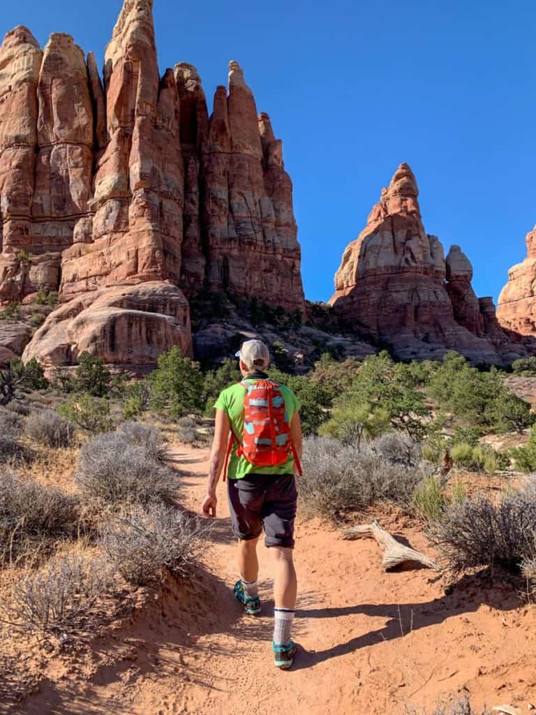
Chesler Park Loop Trail
Trail information from Meg at Fox in the Forest
The far southern-end of Canyonlands National Park is a remote redstone wonderland. The Needles District in Canyonlands National Park offers some of the best hikes near Moab, Utah.
If you're looking for a chance to wander among the hoodoos (surreal-looking, tall, thin rock formations), this is it.
Make the hour-and-a-half journey south of downtown Moab for an 11.6-mile hiking adventure on the Chesler Loop Trail.
There are several variations of this loop, but the hike we love is from the Elephant Hill Trailhead to the Chesler Park Trail, past the Devil's Kitchen and back to Elephant Hill.
Despite its long distance, this trail is relatively moderate in difficulty with only a 1,935-foot elevation gain. Bring plenty of water and sun protection as you wind your way through the endless sea of sandstone monoliths.
If the mileage is too much for you to do in one day, you can obtain a backpacking permit and camp in Canyonlands National Park overnight.
I highly recommend picking up this Needles District National Geographic Map so you stay found. The trail system is quite sandy, which can make it difficult on your knees (so bring a trekking pole), but the scenery is stunning.
Always bring a WAG bag, as defecating outdoors anywhere in Canyonlands is forbidden. You’ll need to carry out all human waste including toilet paper, snack wrappers, fruit peels, and other trash.
Keep in mind that you'll need a permit for all overnight backpacking trips into Canyonlands. Each permit costs $30 per trip (you can have multiple nights on one trip) and accommodates up to 7 people.
Hiking in the Maze District
The Maze district is made up of a confusing, maze-like series of trails.
You'll need a permit, a planned itinerary, food, water, and a water filter, and if you hope to contact anyone outside the park, you'll want a satellite communicator, such as a Garmin inReach.
You'll need a four-wheel-drive vehicle to access most of the trails. The trailheads are often hours away from the main roads, so getting to the trail and back will take a lot of time.
Plan on spending at least 3 or 4 days (minimum) in the Maze. Make sure to let someone reliable back home know where you'll be, what dates you'll be in the Maze, and when to call Search and Rescue if they don't hear from you.
Instead of recommending a specific trail in the Maze district, I'll recommend doing research and deciding what you're comfortable with.
Start by reading the park service's Maze Unit trail information, and buy a topographic map (like this National Geographic map of the Maze District). For photos of different areas in the Maze District, check out this step-by-step Maze District adventure.
If you're interested in visiting the Maze, but are worried you'll get lost, check out the guided park ranger hikes into Horseshoe Canyon.
Leave a Comment: