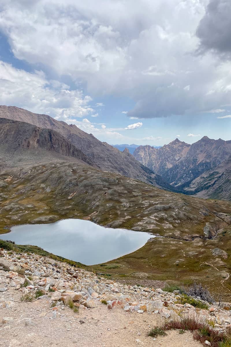
The Elk Park to Needleton backpacking loop near Silverton, Colorado, covers over 40 miles and features stunning mountain vistas. Here's an overview!
The crowning jewel on our recent vacation to Colorado was an epic backpacking trip.
The Elk Park to Needleton loop in the Weminuche Wilderness, to be precise.
We took our time getting there. Stops like Mesa Verde, Pikes Peak, Cheyenne Mountain State Park, Garden of the Gods, and Great Sand Dunes National Park — all were part of our plan to acclimatize ourselves to the altitude before embarking on the big one.
For more details on how we prepared to hike this loop, check out my guide on preparing for this trip with suggestions on the train ride, gear recommendations, etc. You might also find our backpacking gear guide helpful.
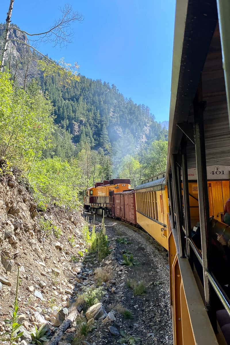
To access the trailhead, take the Durango-Silverton train to the trailhead at the Elk Park train stop. You’ll catch the train again at the end of the trail loop (at Needleton).
How Long and Difficult Is The Elk Park to Needleton Loop?
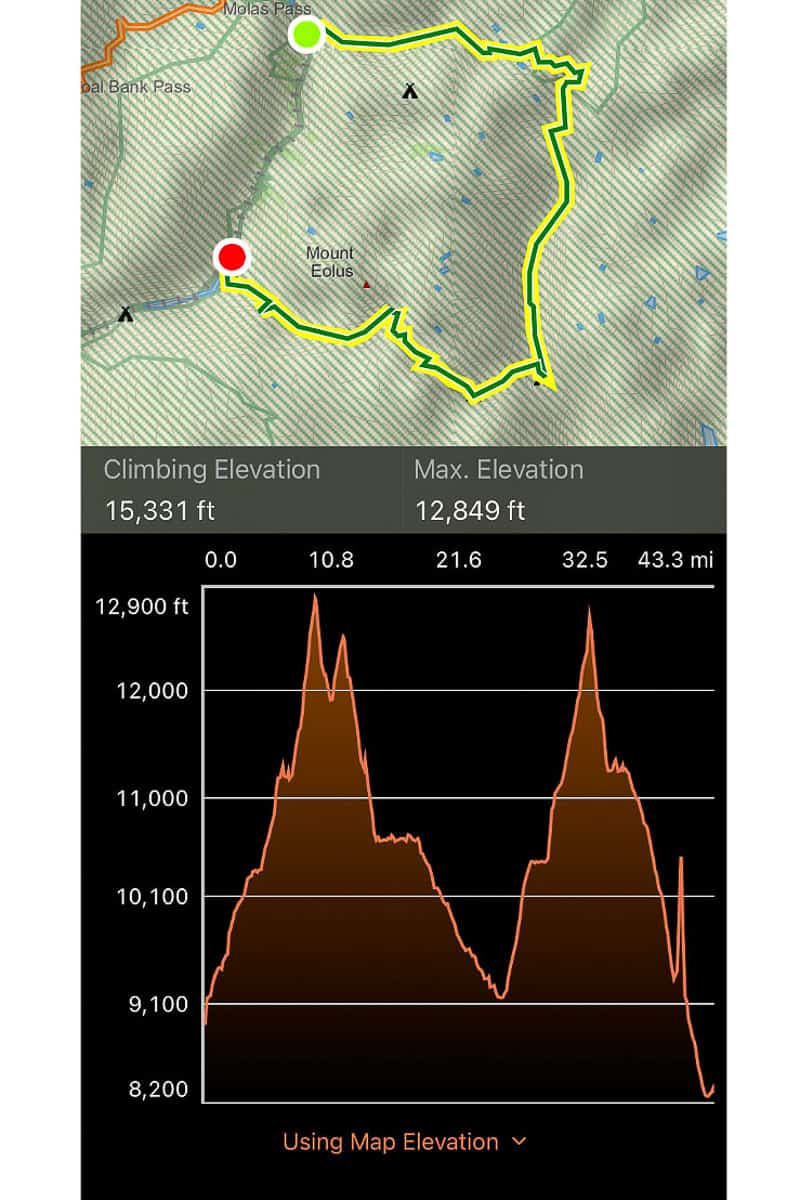
I’ve seen a few different estimates for the loop length. Our Garmin map said we walked about 43 miles.
As for the elevation, Garmin listed our elevation change as 15,331 feet.
This entire hike is at high elevation, with the lowest point just over 8,200 feet, and the highest point at 12,849 feet.
I’ve seen this trail listed as moderately difficult. If you’re not used to hiking at high elevation, that alone makes it somewhat difficult. That said, the trail isn’t technically difficult (though if you have a fear of heights, see the Columbine Pass section below).
How Many Days Will The Elk Park to Needleton Loop Take?
We did the hike in five days and four nights.
We probably could have finished a day early if we’d pushed ourselves — but I also think that taking it even slower – making it a 6-day trek – would have been even more enjoyable.
Here's a look at the segments of this loop.
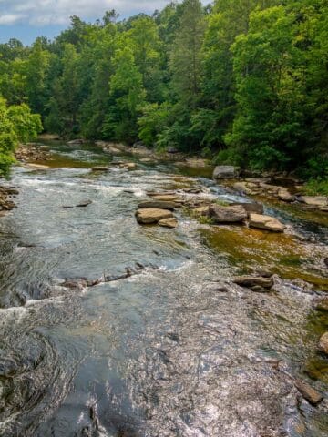
Elk Creek Trail (Colorado Trail)
Take the train to the Elk Park stop.
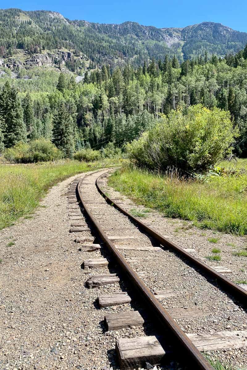
The trailhead isn’t obvious from the train stop.
Follow the train track "Y" ahead (on the right, not the one the Durango-Silverton train used) for just a couple hundred feet. You should see a trail through the grass on the left.
When we were there, the trail was fairly overgrown at this point, but don't worry! It will get better.
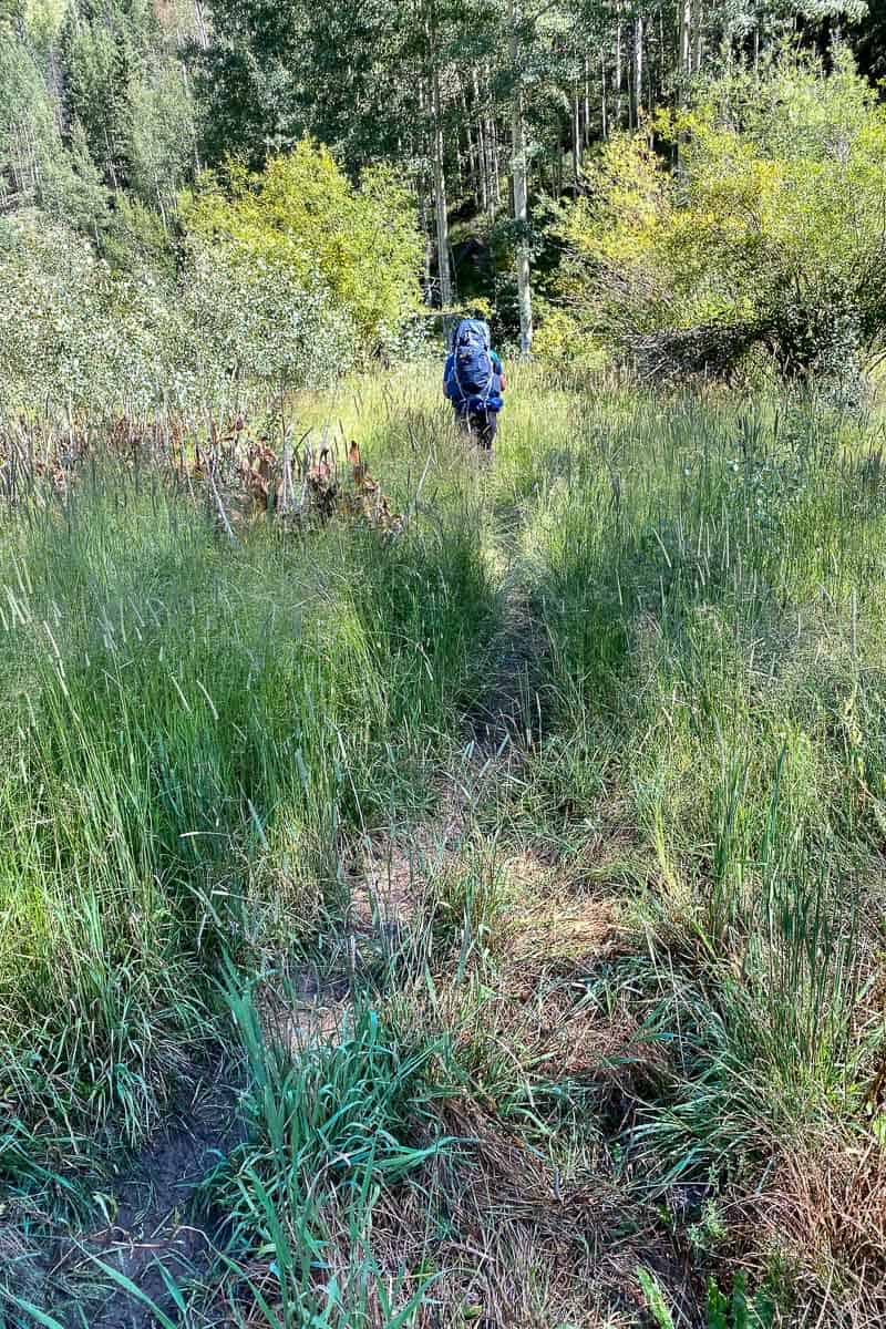
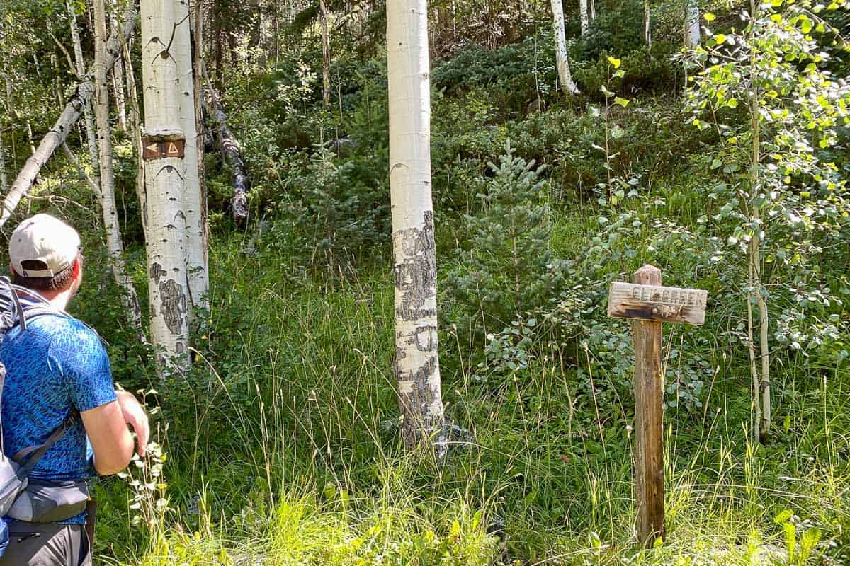
Within a few hundred feet, you should see a (fairly faded) sign for both Colorado Trail and Elk Creek. Continue following the trail and soon it will meet up with the Colorado Trail.
When you reach the official trailhead, make sure to register.
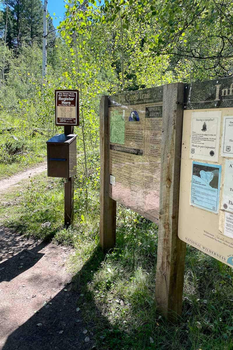
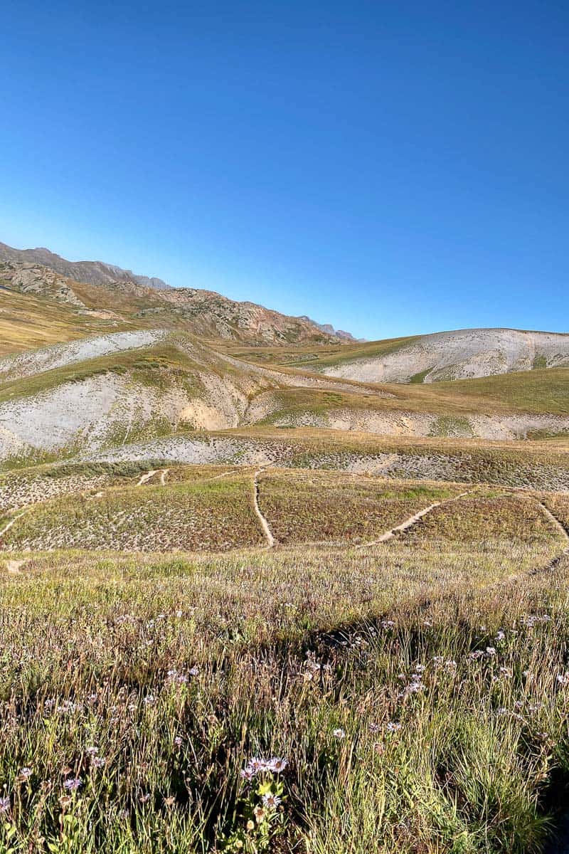
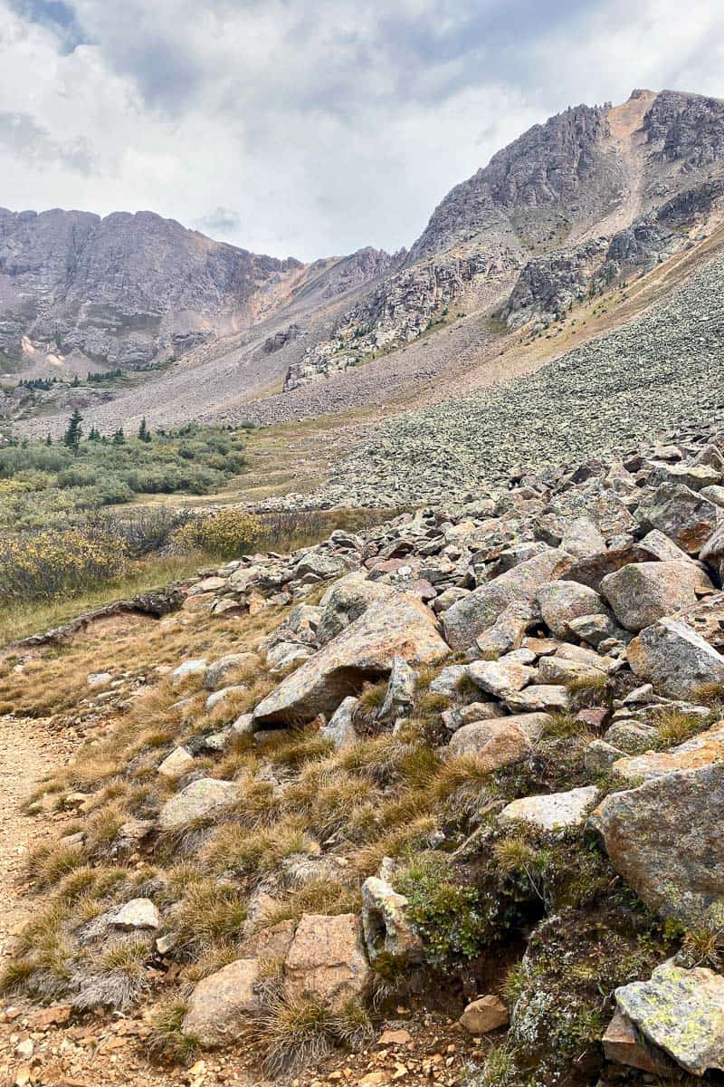
This section of the trail is about nine miles long.
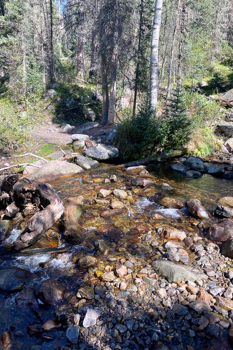
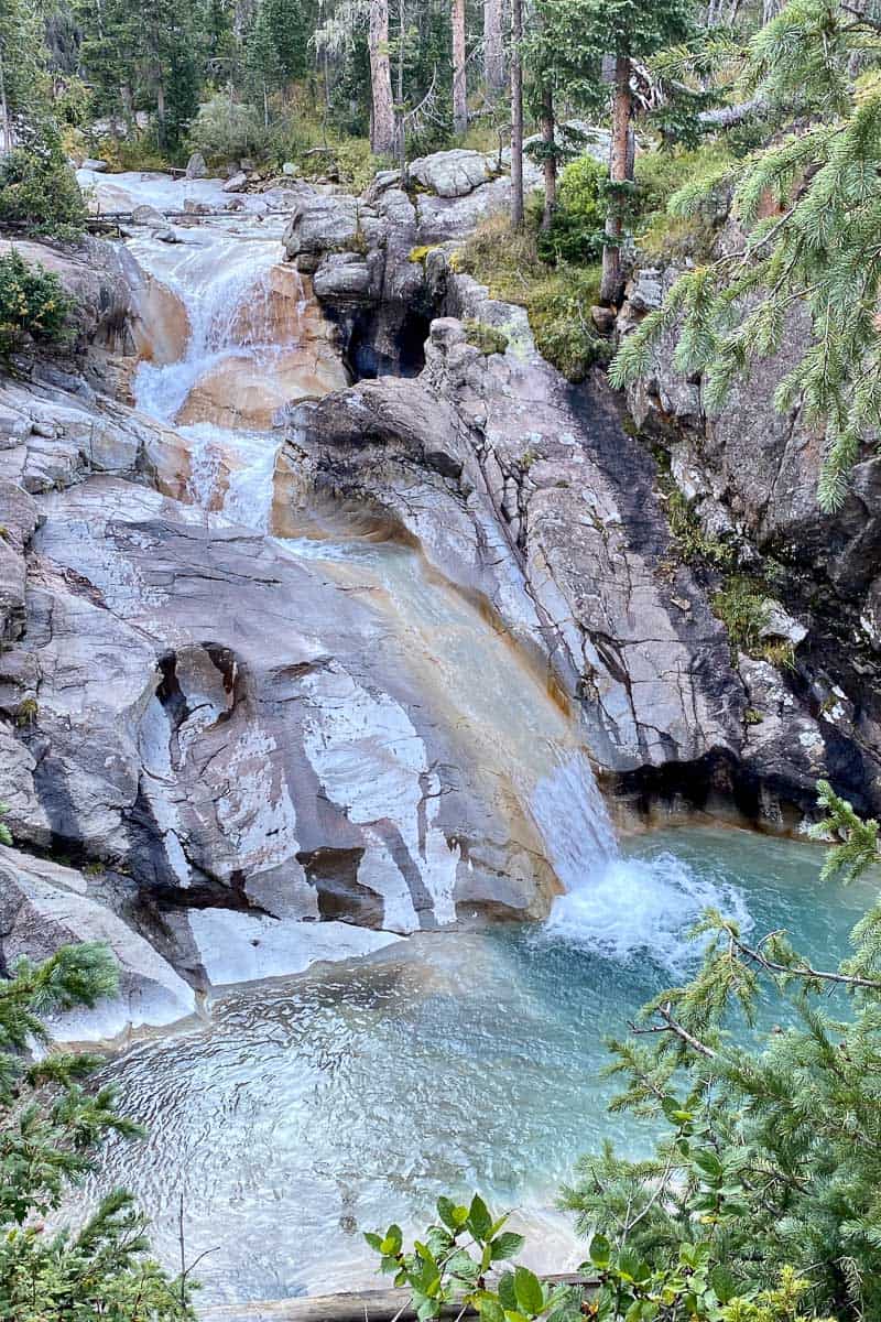
It's a gorgeous trail that follows the creek and has sweeping mountain views.
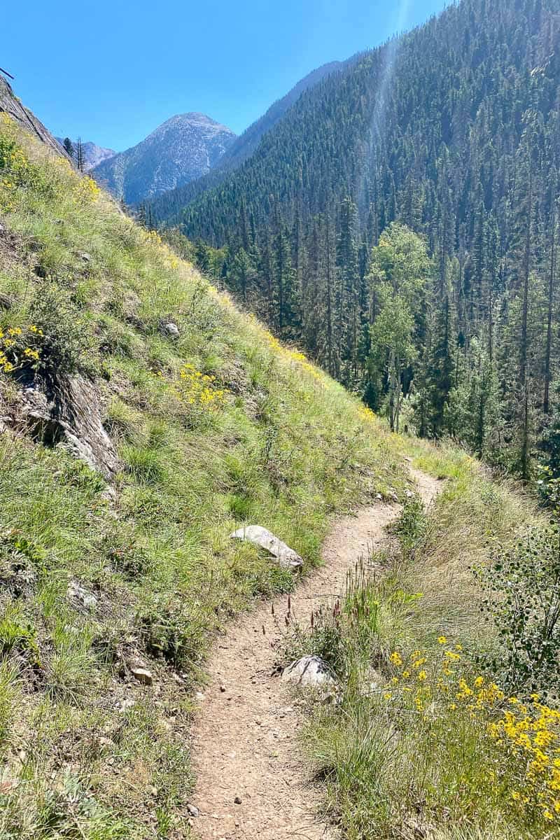
You’ll pass two small avalanche fields with lots of downed trees (but the trail had been cleared when we were there). Next, you’ll come to Beaver Pond.
There are lots of camping spots here, and we were told moose sightings are common at dusk and dawn.
Continue on the trail and you’ll pass a waterfall and eventually arrive at a meadow.
After the meadow, you’ll see a large avalanche debris field. (Again, the trail had been cleared when we were there! You can always check trail reviews to see current conditions.)
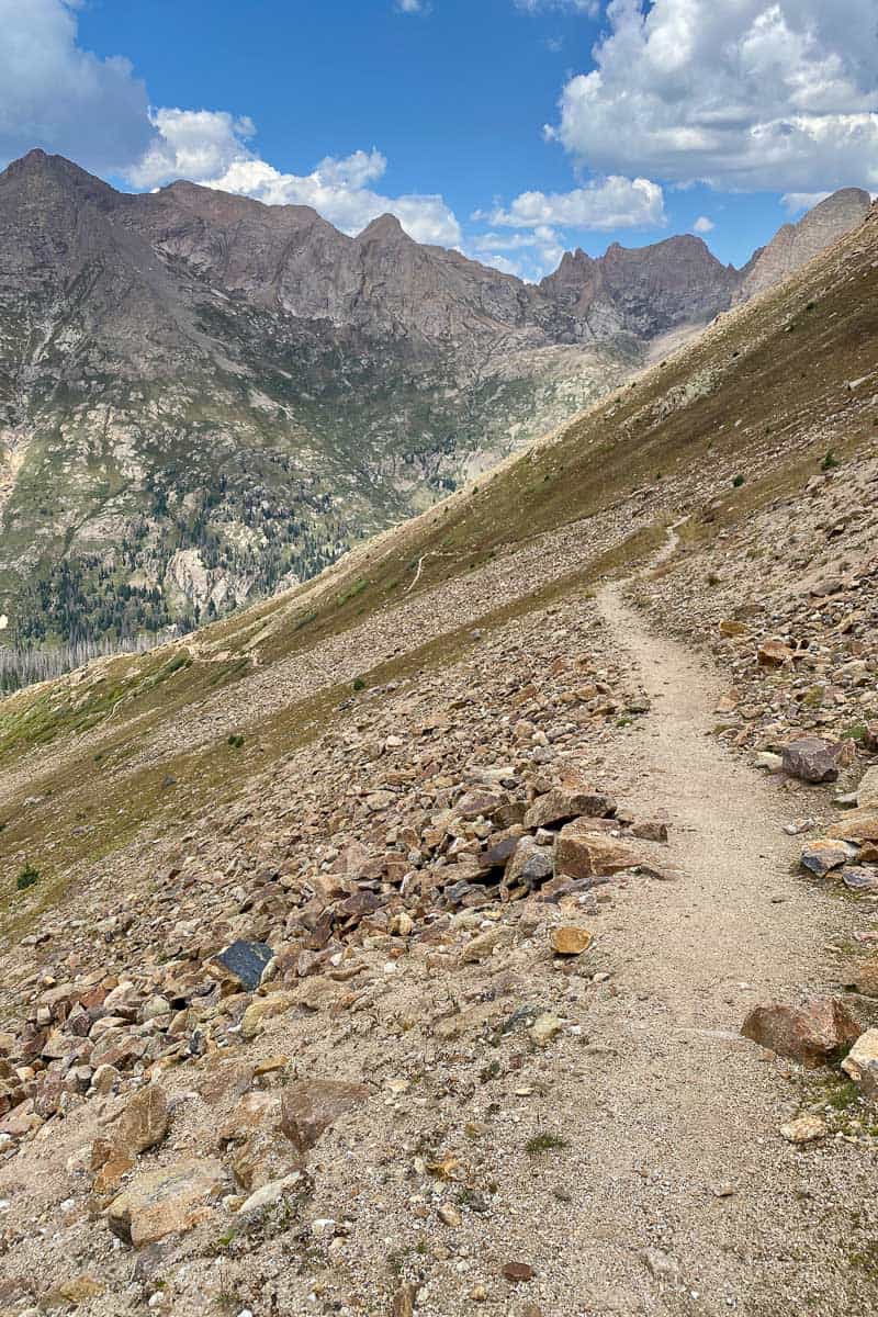
You’ll then have several miles of steep trail, followed by a meadow.
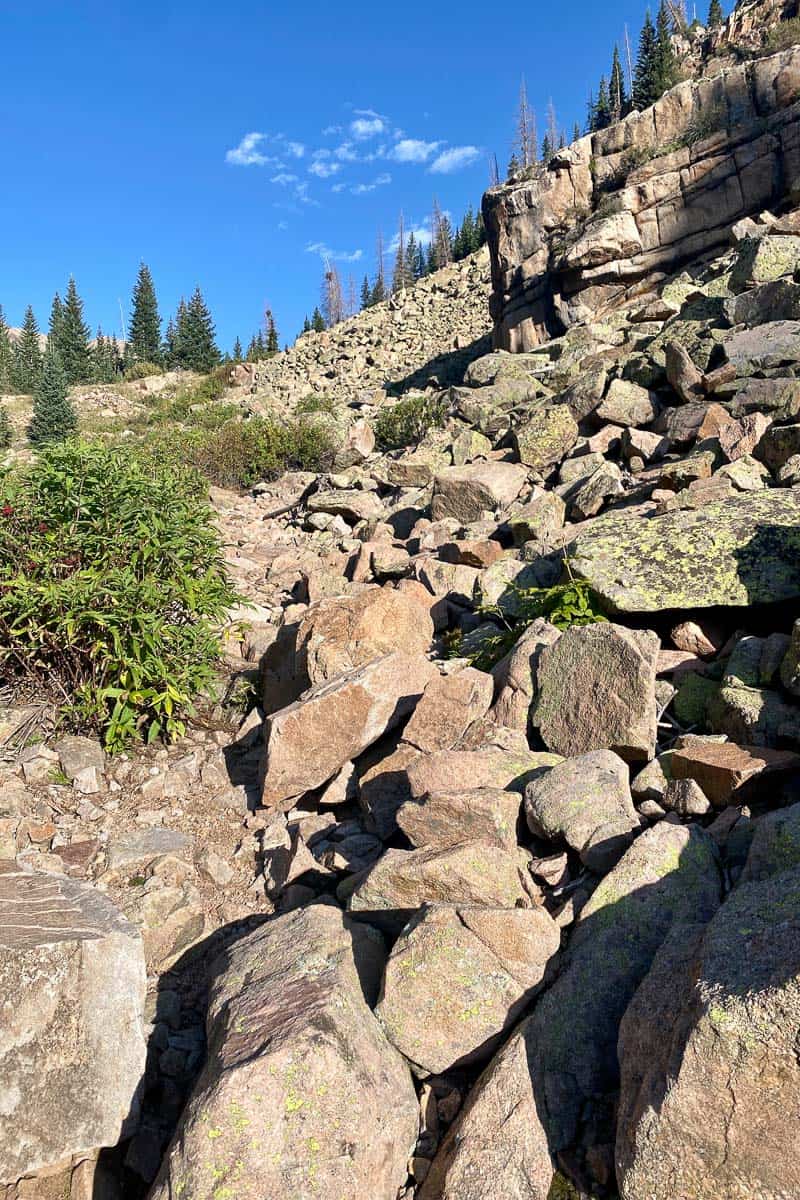
After the meadow, this trail really begins to climb.
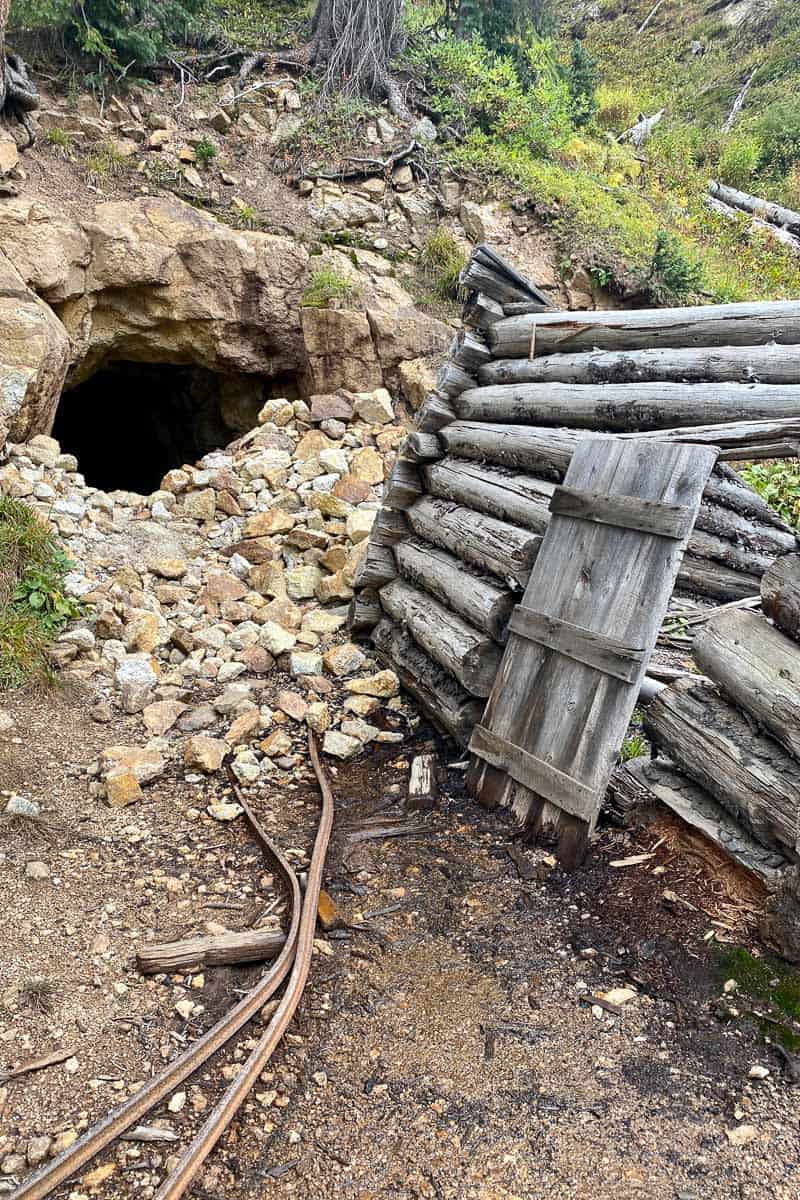
Along the way, you’ll pass a short (fairly easy) rock scramble, pictured above, as well as an old collapsed miner's cabin.
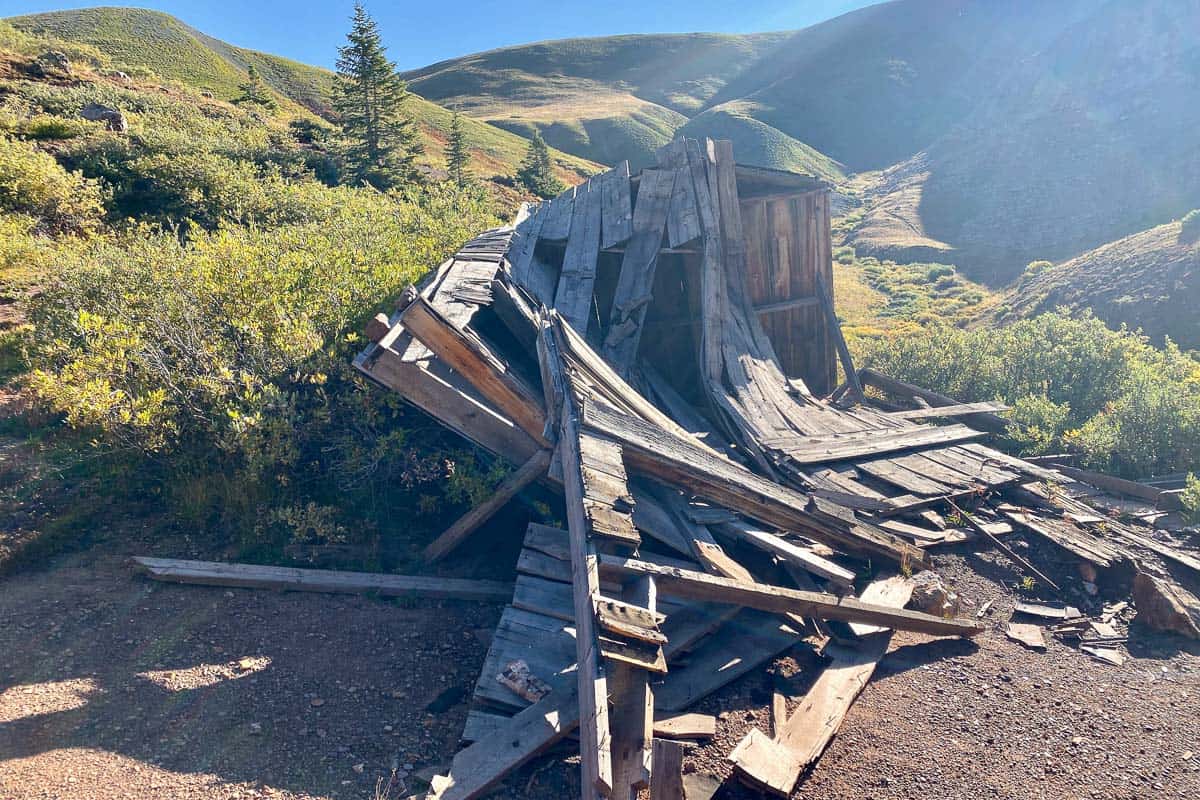
There are several campsites in this area.
As you hike, you’ll also see the entries for several old abandoned mines. (Do not try to explore these!)
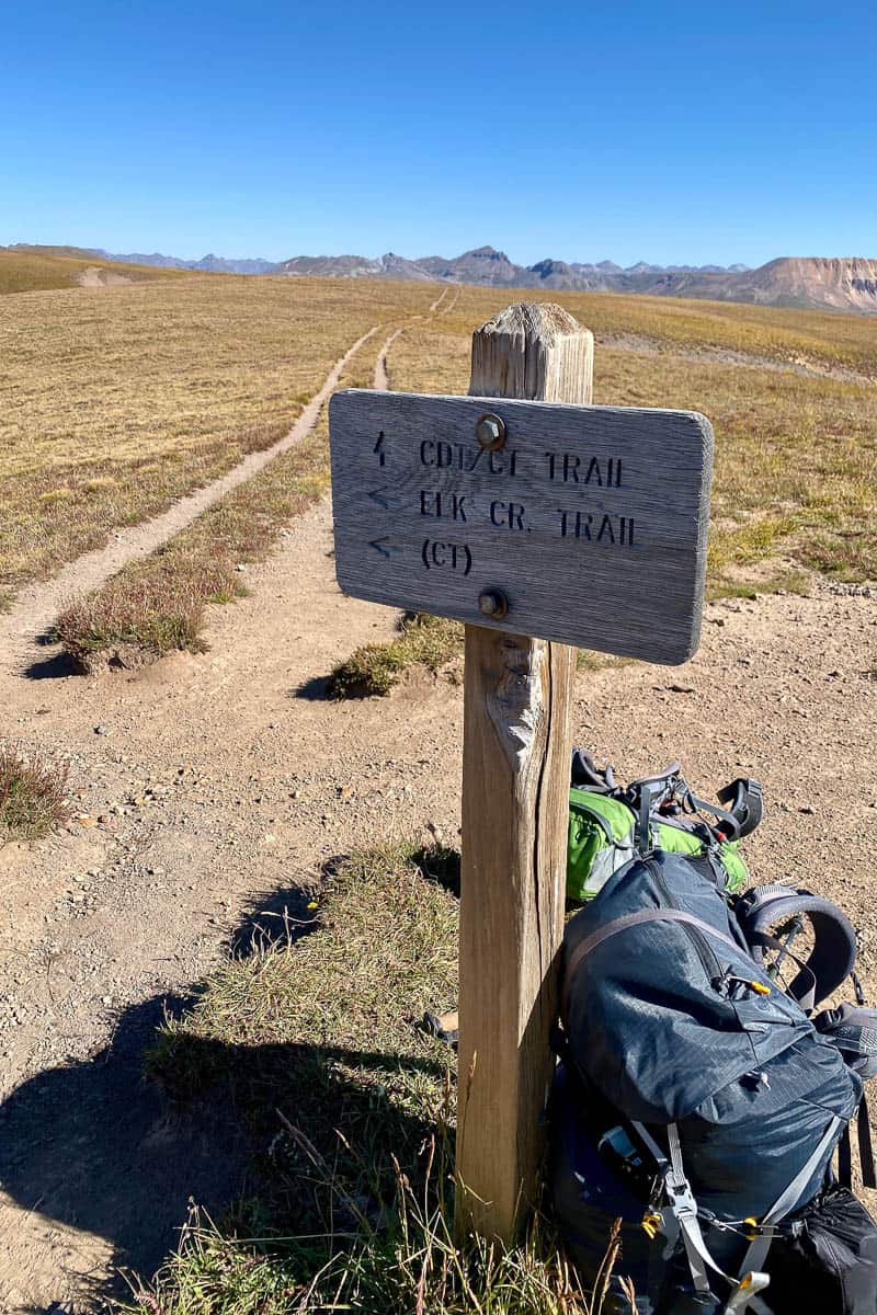
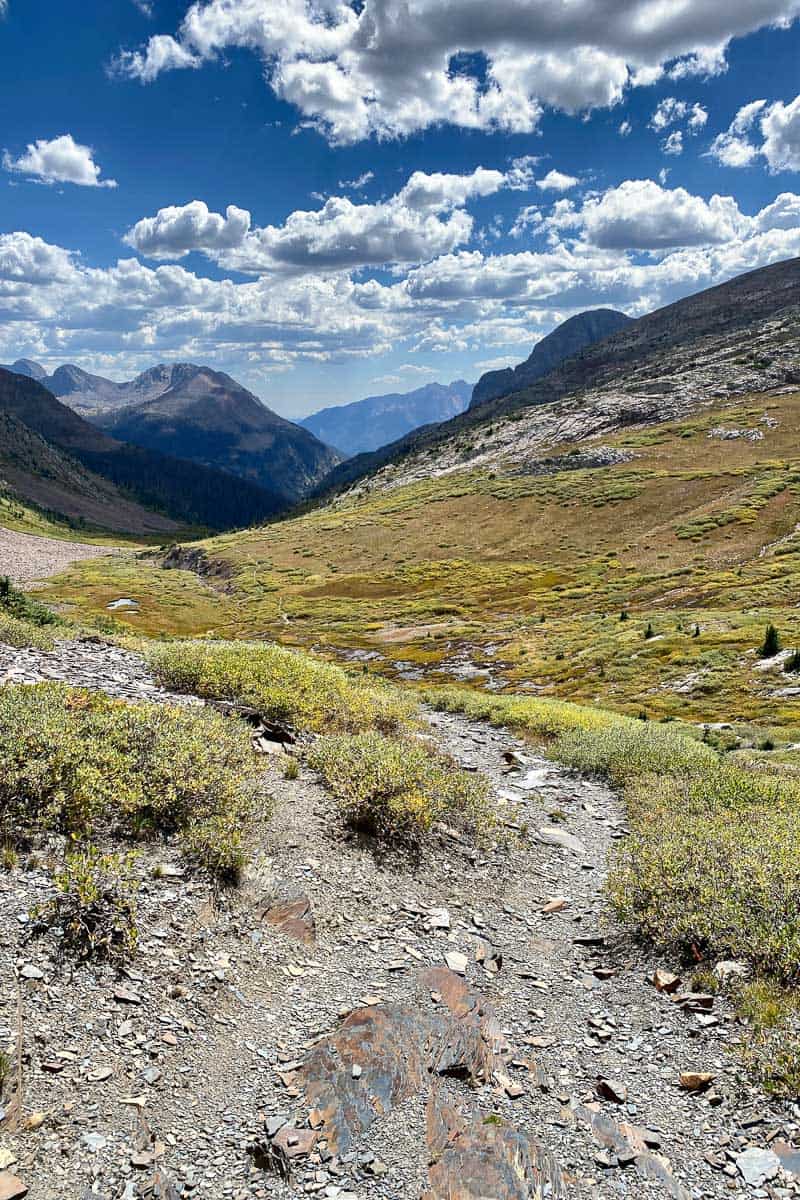
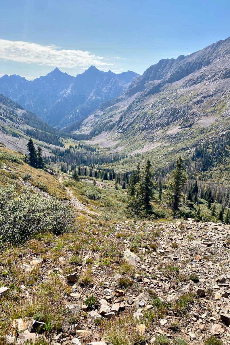
Next, you’ll hike a series of switchbacks that lead to the best view of the whole trip – the trail junction where the Colorado Trail meets the Continental Divide Trail (CDT).
Take a few moments here to enjoy the 360-degree views!
Then turn right onto the CDT.
The Continental Divide Trail
This section of the trail may be somewhat busy. We found out it was a smart idea to strike up conversations with fellow hikers.
They just might help you plan your next moves!
We spoke to a man who asked us what our camping plans were, and then helped guide us to the best spots along the way.
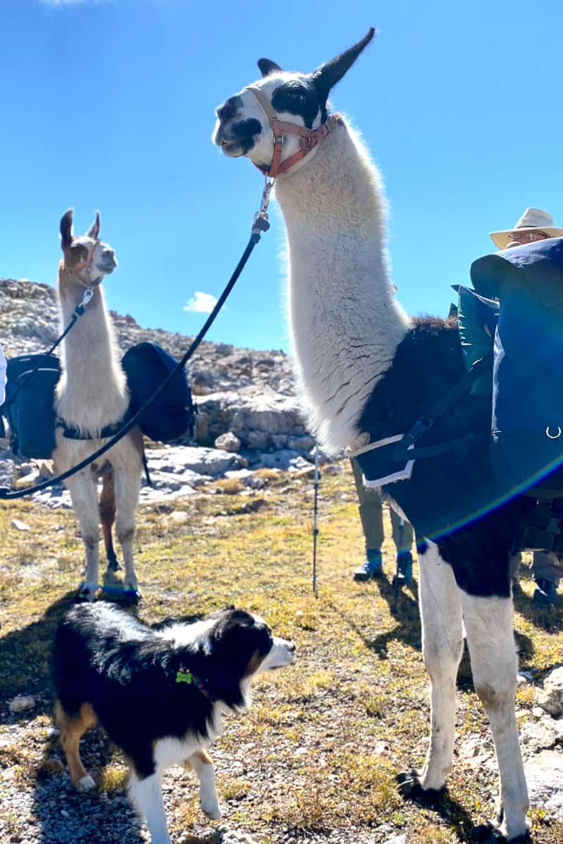
We also learned that you can rent pack llamas in nearby Silverton and take them on the trail!
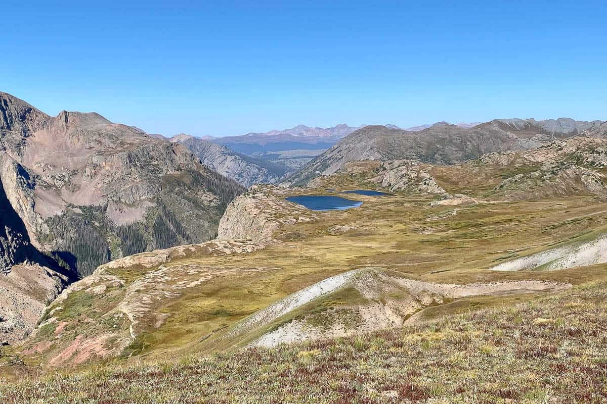
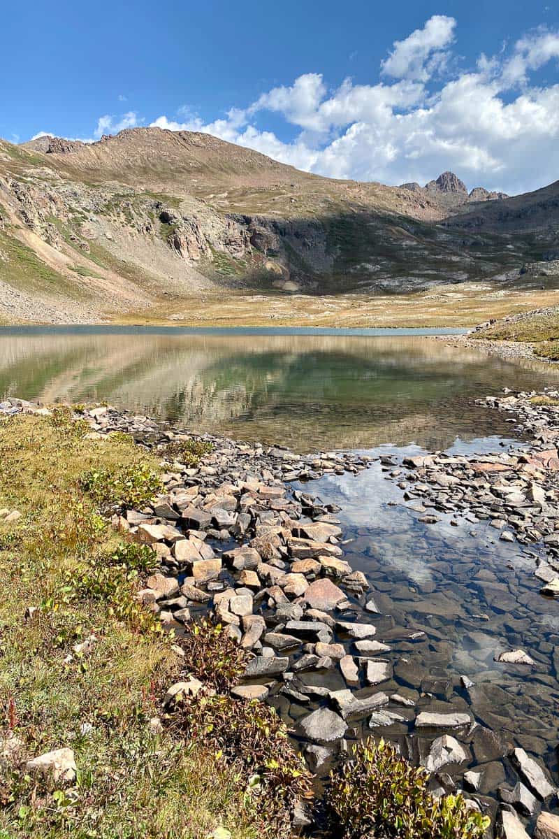
As you hike, you’ll pass Eldorado Lake in the distance on your right, and then the trail begins to steeply descend towards Kite Lake.
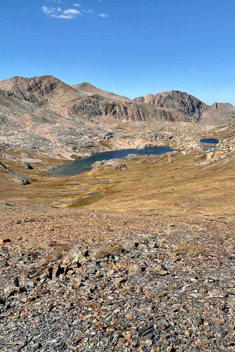
The trail goes almost right next to Kite Lake, and it’s a great spot for a lunch break or for camping.
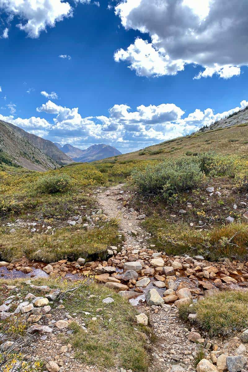
After passing Kite Lake, the trail gets wider and rockier. This section of the CDT is also an ATV trail.
Soon, you’ll come to a trail junction. On the right, you’ll notice the (currently very crooked) trailhead marker for Hunchback Pass, a section of the CDT. Turn right and head towards Hunchback Pass.
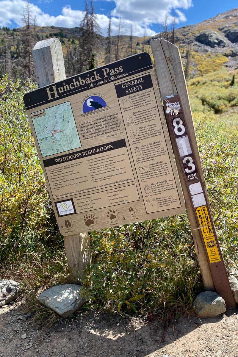
The Hunchback Pass trail will take you up, up, and up, and at the top you’ll see more great views.
The trail descends from there. Follow it until you reach Vallecito Creek Trail.
Vallecito Creek Trail
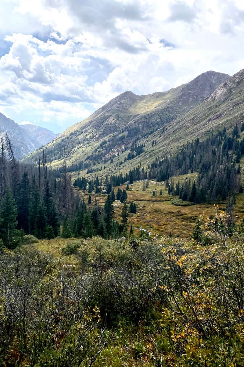
This is a connector trail on your trip, taking you from the fabulous views you just saw to another set of sweeping views.
You’ll follow this trail about 10 miles downhill on a not-terribly steep grade. This is mainly a shady, forested trail, but it does have some pretty views.
Technically this should be among the easiest parts of the route, but (as of September 2022) lots of large downed trees may slow you down. Update: trail reviews posted in September 2023 indicate that many of the downed trees on this trail may be cleared, so hopefully this section is easier now.
When you see a downed tree that’s too large to step over, take a moment to look around. Often there’s another trail that’s been forged either around the tree or over to a spot that’s easier to climb or step over.
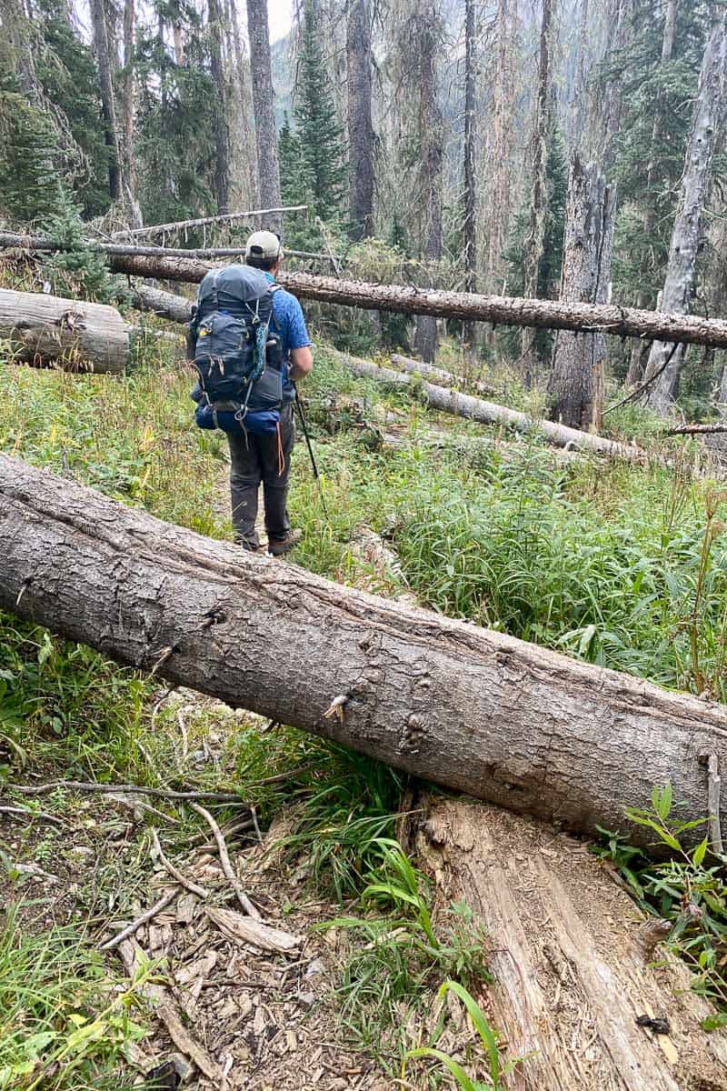
I recommend wearing long sleeves and pants on this trail, because climbing over downed cedar and pine trees can scratch your legs and arms. Also, there are a number of overgrown (sometimes thorny) bushes intruding over parts of the trail.
As with many “creek” trails, there are several stream crossings. Depending on the water flow the day you hike, some may be slippery with strong current, so watch your footing and use your trekking pole to help brace yourself when crossing.
Also, be aware that there are very few campsites along this trail. We ended up camping partway down at a campsite in the Stormy Gulch area, and we spotted another site near the Rock Creek crossing.
Most of the campsites are at the bridge crossing where Vallecito Creek Trail meets the Johnson Creek Trail. This trail junction is also a great place to filter water and eat lunch.
Johnson Creek Trail
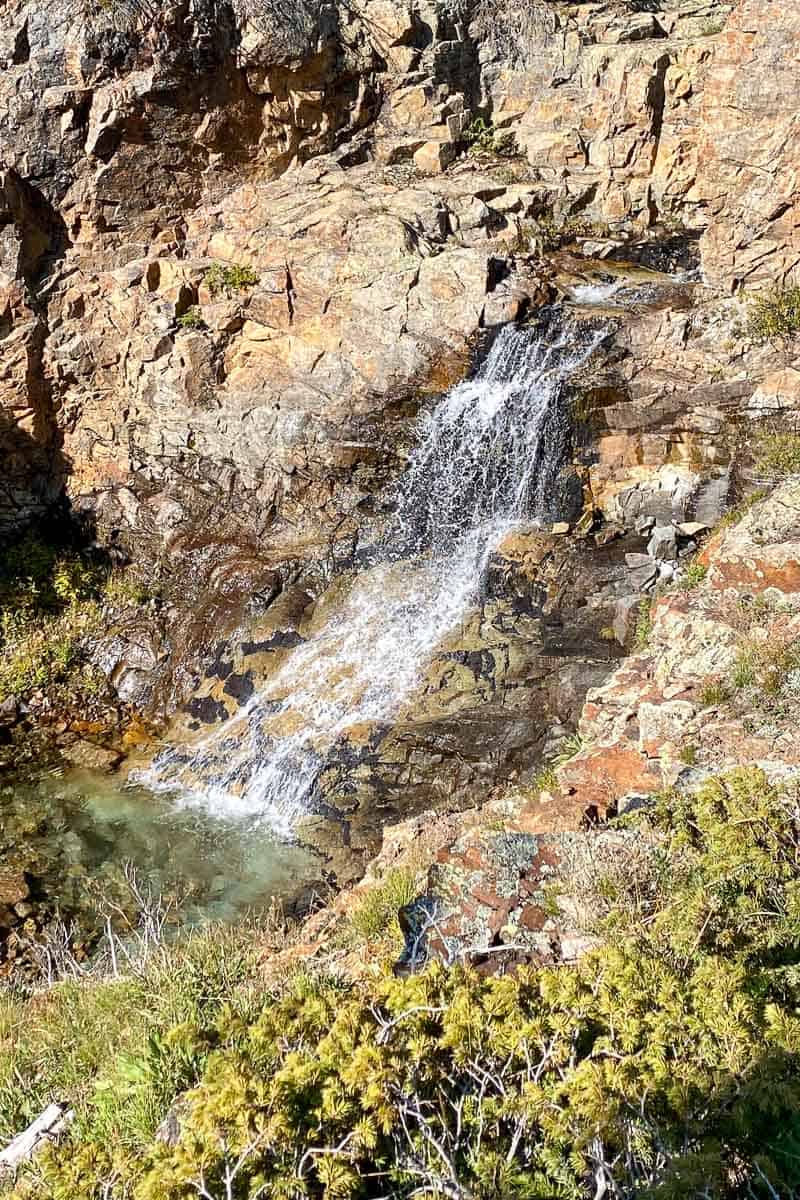
The Johnson Creek Trail is primarily an unrelenting 7.25-mile uphill hike (with almost no shade), but it more than makes up for its difficulties by providing waterfalls and (when you pass the tree line) great views.
There aren’t many camping areas along the steepest parts of this trail, and many of the flatter areas are swampy. Look for a group camping area about four miles up on the left. We stayed here and had the whole camp area to ourselves!
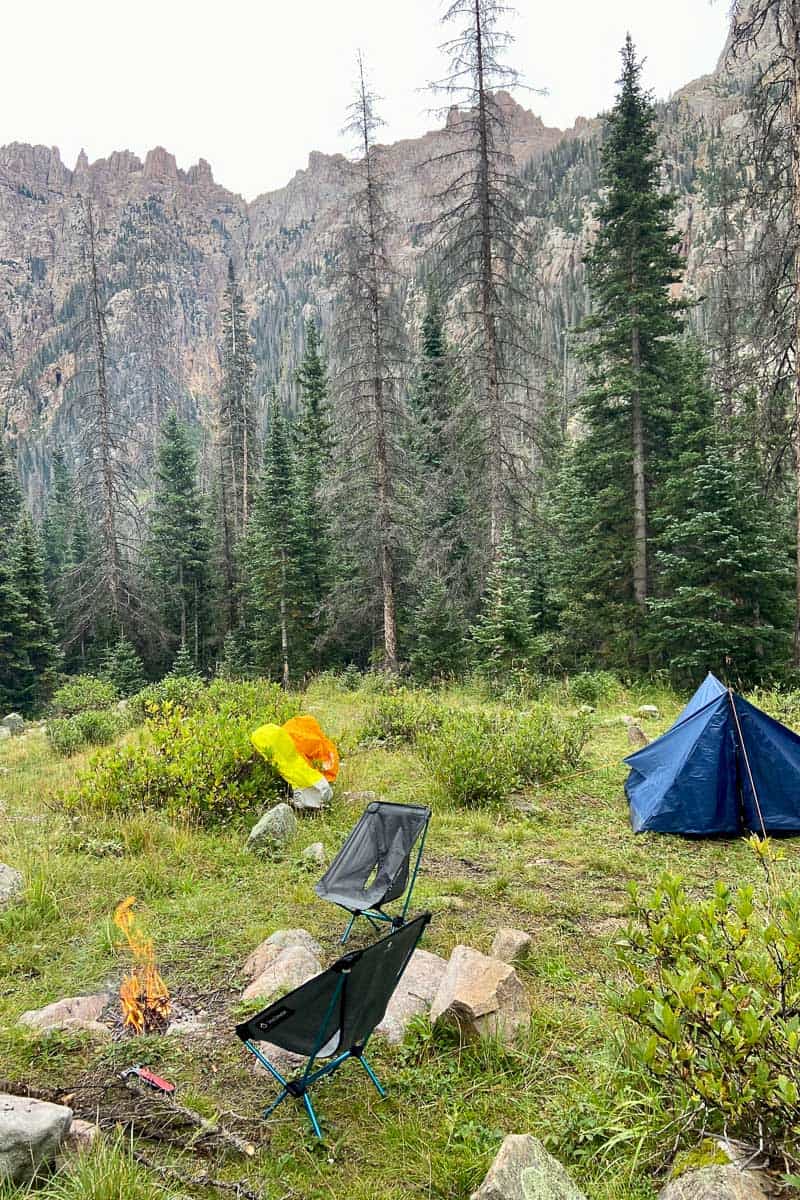
A few more miles uphill, just before a set of switchbacks, we found several pretty individual campsites on the right. Beyond those, there’s not much available until you’re nearly at the top.
Once you pass the tree line, the trail becomes very rocky. Have fun saying to yourself or your hiking buddy, “Wow, these Rocky Mountains are really rocky!”
These rocky sections were full of pikas, chirping at us constantly to (I think) cheer us on as we made our way to the top.
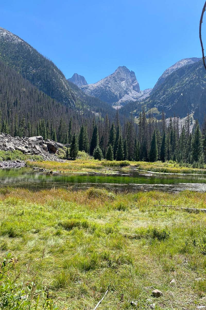
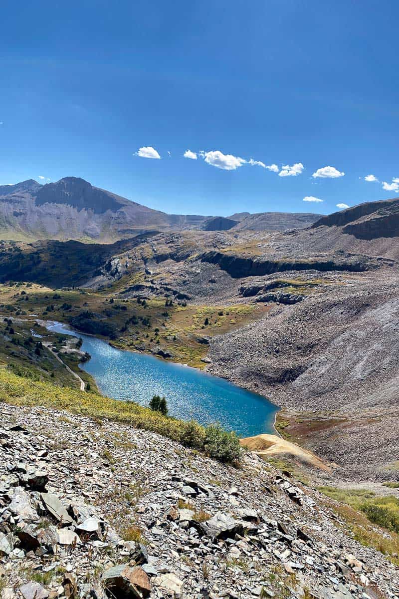
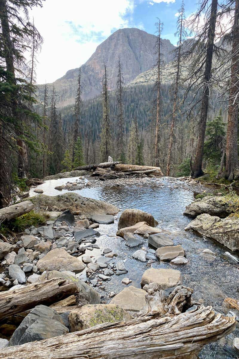
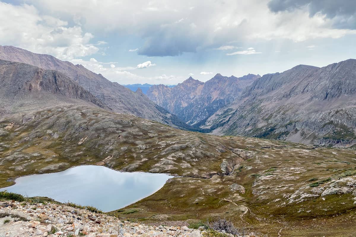
Just before the top of the trail (the Columbine Pass), you’ll reach Columbine Lake.
This is a perfect spot to rest up, eat lunch or a snack, and filter water. This would also be a great place to camp (as long as you’re at least 100 feet from the water).
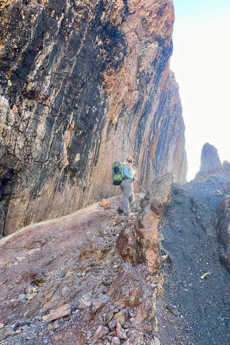
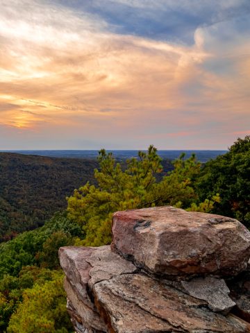
Columbine Pass
This pass provides more sweeping views of the Continental Divide.
It’s a breathtaking spot, and I would’ve enjoyed it more if my fear of heights hadn’t made the experience somewhat nerve-wracking.
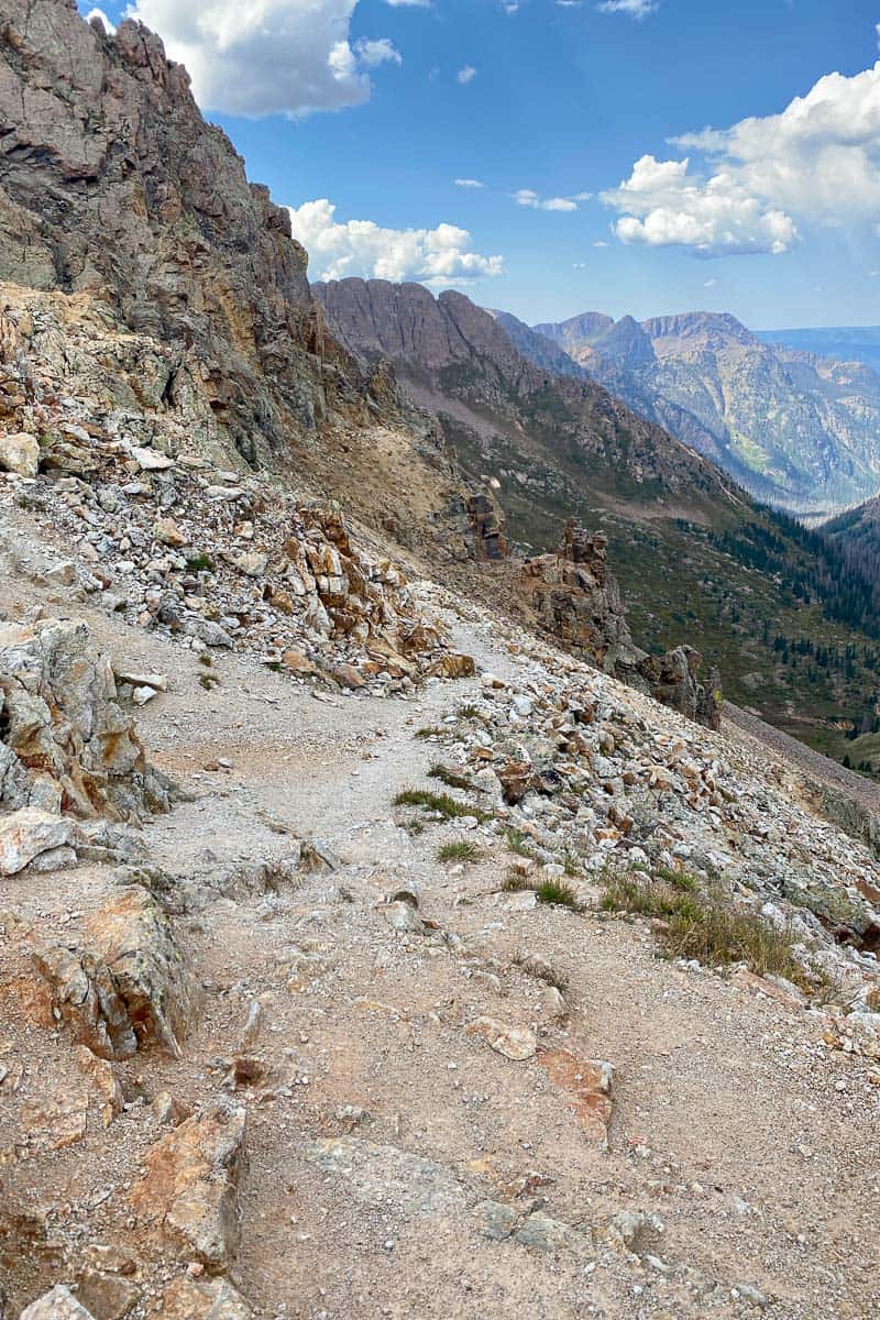
This is a steep pass, both up and down. The top sections are covered with loose pebbles, and there are steep drop-offs on one side.
If you’re afraid of heights, this may not be a trail for you.
Chicago Basin + Needle Creek Trail
Once you start heading downhill (carefully) on the Columbine Pass, you’ve entered the Chicago Basin on the Needle Creek Trail.
From the top of Columbine Pass to the Needleton train stop is about nine miles.
This is another gorgeous area, and it’s also a popular base camp area for hikers headed to any of the three 14-ers (14,000-foot elevation peaks) that surround the basin.
This area will likely be the most populated of the entire loop. (Evidently a lot of hikers opt to start from the Needleton train stop and do a shorter out-and-back hike in this area.)
There are no campfires (stove fires only) allowed within the Chicago Basin. Plan to dress warm enough to be comfortable without a campfire!
You’ll find lots of camping options when you get down off the mountain trail area onto the plateau. Once you begin going steeply downhill off the plateau, there are very few campsites available until you’re almost at the end of the trail.
As you hike through the basin, keep an eye out for mountain goats. We didn’t see any (even though I was assured that there were so many I’d be shoo-ing them away with my trekking pole), but some campers we passed saw one.
We did see a few more mine entrances.
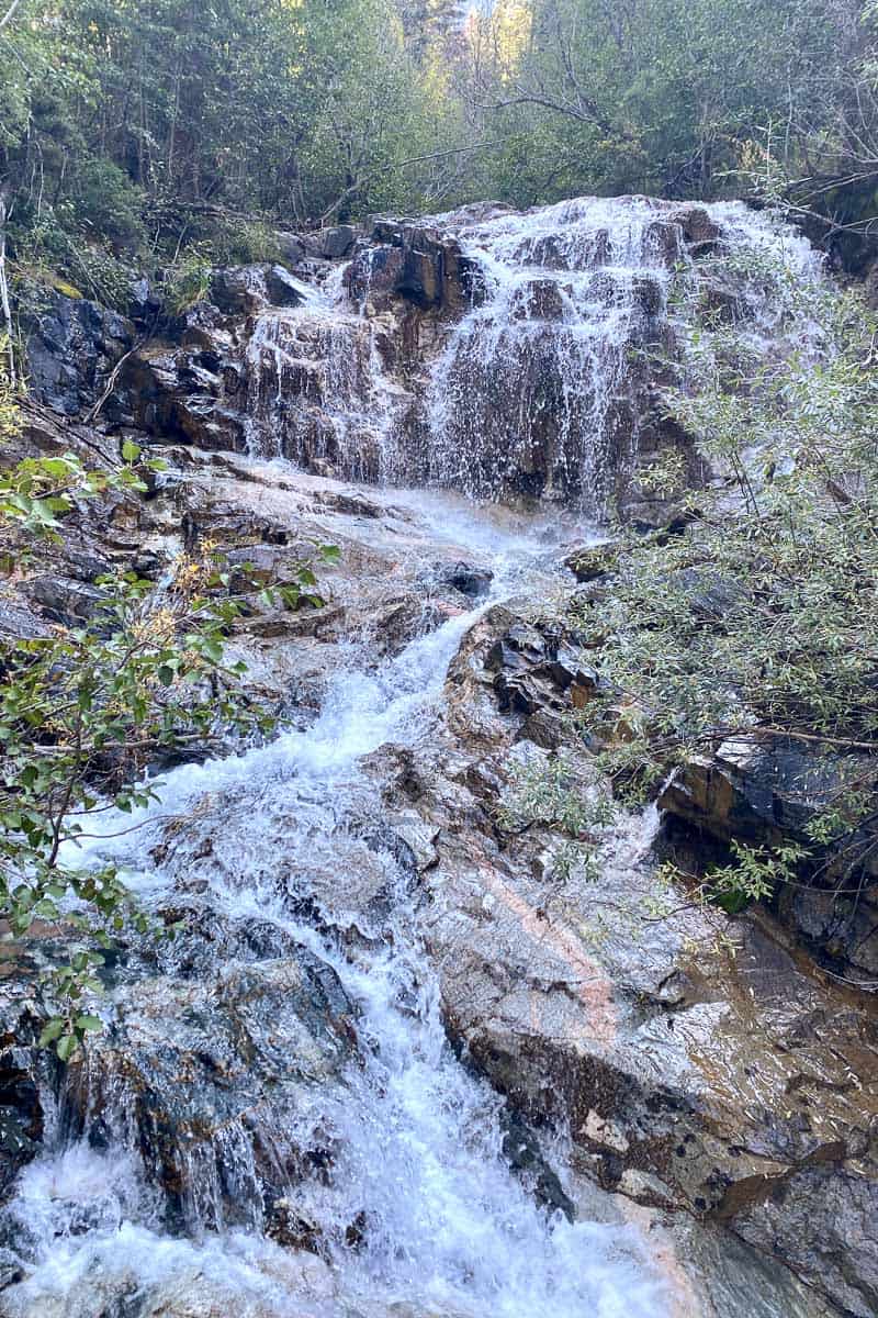
Follow the Needle Creek Trail downhill. As you hike, you’ll pass SO MANY waterfalls.
Keep going all the way downhill. When you reach the trail junction, go to the right all the way to the Animas River for the Needleton train stop.
Once you cross the bridge over the Animas River, you’ve made it!
Now it's time to relax a bit and wait for the train to take you back to civilization.
By the time we were finished with the Elk Park to Needleton loop, we were ready for a feast back in Durango – Himalayan Kitchen was amazing.
And our tired muscles were more than ready for a little pampering. So we headed over to Pagosa Springs to soak in the hot springs – a great way to celebrate the completion of this hike!
Have you ever done the Elk Park to Needleton loop, or a different nearby route? Or do you have any questions about backpacking in the Weminuche Wilderness? Let us know in the comments!
Steve says
Excellent write up, I especially appreciate the beta on campsites. Thanks for taking the time to post this.
Alisha Trenalone says
We're glad you found it helpful, thanks for letting us know!
-Alisha at Champagne Tastes
Richard says
Excellent write-up. I had a question regarding food storage….did most of the groups you ran into use bear cannisters, hang bear bags or use ursacks? Were there generally good places throughout the trip to hang bear bags?
Alisha Trenalone says
Thanks! We used bear canisters, but it was (for the most part) very forested, so bear hangs should also work well for the majority of the hike. (Obviously if you camp above tree line that won’t work.)
We haven’t tried ursacks yet.
Have an awesome time!
-Alisha at Champagne Tastes
Richard says
Thanks so much for the info