A few different factors might make you look for how to shorten the challenging Tour du Mont Blanc. Here are your options!
The Tour du Mont Blanc is an iconic multi-day hike through France, Italy and Switzerland around the Mont Blanc massif. When planning your trek, there are many options, including the option to make the 105+ mile route shorter.
Why might you want to shorten the Tour du Mont Blanc instead of doing the full circuit?
Some reasons may include:
- The entire length is too long for your physical ability (or that of your hiking group), or for your allotted hiking time
- You only want to see the highlights
- You want to do as much of the full circuit as possible, but would like to make a few of the less scenic days a bit easier
- You become ill or injured and need an escape route off the trail
- Bad weather is looming and you want to get off the trail quickly or avoid an exposed section
Whether or not you intend to shorten your TMB hike, it’s good to be aware of the options in case you need to change plans quickly. Whatever your plans are, I also recommend downloading a good map (we used FarOut Guides) to help adjust your route as needed.
Here are a few more lessons learned on this particular hike, food and drink recommendations on the trail, and gear ideas!
Options We Took to Shorten the Tour du Mont Blanc
Initially we planned this hike with lots of shortcuts included. Once we got on the trail, though, we felt up to attempting the whole route and only ended up using a couple of shortcuts.
Shortcut 1: Col des Fours Stage 2 Variant
We did opt to take the Col des Fours variant (stage 2) to cut off about two miles. We had great weather and the views were incredible.
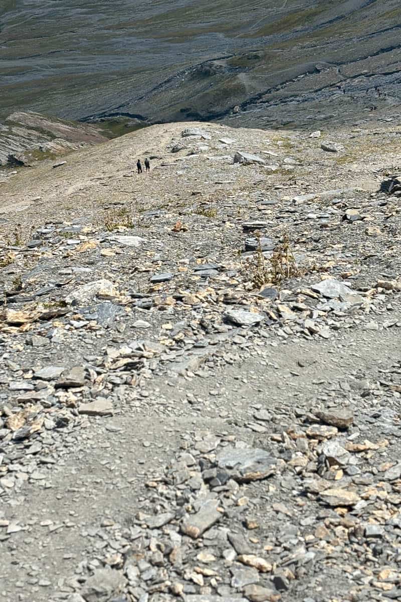
Later we met a woman who had to end her hike on day 2 because she slipped and broke her wrist on this path, so consider carefully before choosing this route. It's quite difficult terrain, includes one of the highest points on the whole route, and tends to hold snow longer than other areas.
Shortcut 2: Plan Prez (Brévent mid-station) Cable Car (Stage 11)
On our final day, I was feeling incredibly ill and was moving much more slowly than normal. We needed to hike about 14 miles from Lacs des Chéserys to Les Houches. About 7 miles in, it became clear that I wasn’t going to be able to make it all 14 miles before the looming thunderstorm arrived.
We ended up taking the cable car from the Brévent mid-station down into Chamonix.
I was a little disappointed that I didn’t walk the entire route by foot, but at the same time felt we made the right decision. (I especially felt that way when I was watching the thunderstorm from the safety of the indoors later that day.)
Why Are There So Many Shortcut Options?
Unlike many wilderness backpacking routes we have in the United States, the TMB has many, many access points and includes lots of ways to shorten the loop.
Various options include:
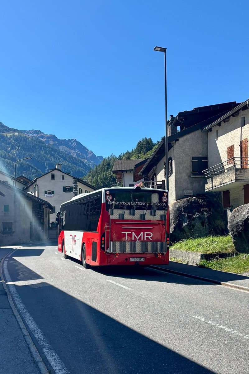
- City buses
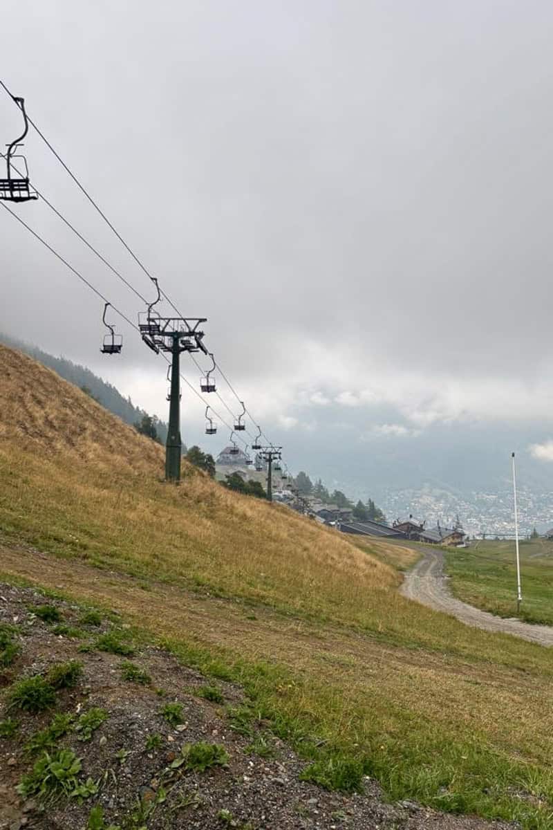
- Cable cars and chair lifts (there for ski season, but many are available in summer as well!)
- Taking harder variants that shave off miles
Things to keep in mind when considering a shortcut:
- City buses are often seasonal and times may change. They often only run from mid June to early September
- When we were on the trail, we saw a city bus canceled because of bad weather
- Cable cars and chairlifts may stop running in bad weather
- Variants may be impassable because of weather
So these shortcuts are nice options, but be prepared to go the longer way if needed.
How to Shorten the Tour du Mont Blanc: Your Options Stage By Stage
It’s important to know that there are MANY, many ways you could exit or shorten the Tour du Mont Blanc, especially in an emergency.
The options listed below are the ones that seem most common, and include options we saw others using, or that we considered or did end up using.
Also, the links below to bus routes are intended to be helpful, but be aware that bus companies do not always update their websites regularly. We’ve found the best way to check specific bus routes is to use the public transportation option on Google Maps.
Stage 1
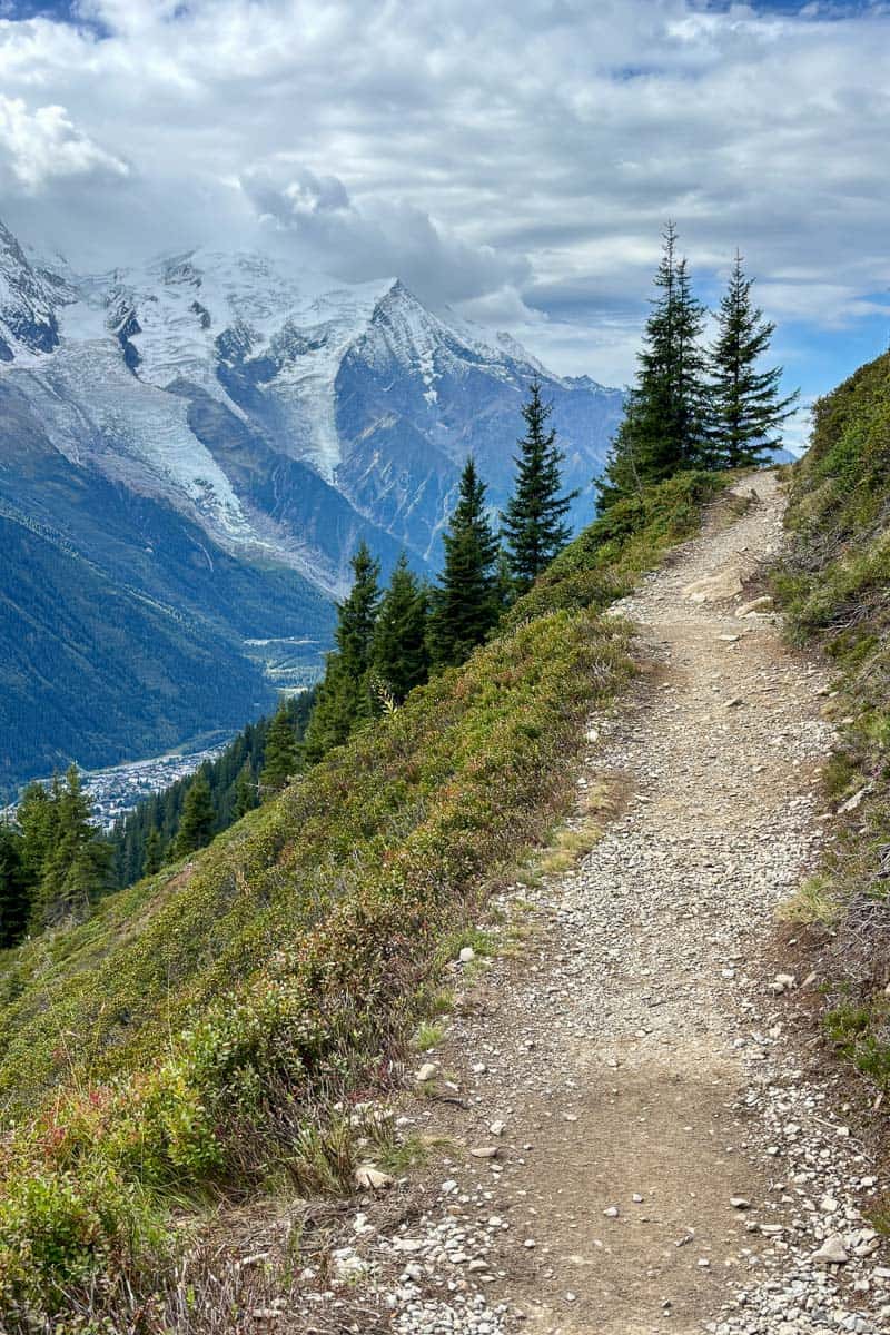
Only a half-mile or so from the trail departure point in Les Houches, you can take the Bellevue cable car (Télécabine de Bellevue) to skip about five miles of steep uphill ascent with road walking.
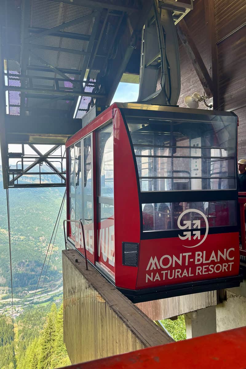
Just walk up and purchase the ticket; no pre-buying needed.
Make sure to check the cable car timetable to ensure it's running when you need it.
Stage 2
Stage 2 has (appropriately!) two shortcut options.
Take a Shuttle Through Les Contamines
There's a free shuttle from Les Contamines to Notre Dame de la Gorge. Using the shuttle skips a few miles of road walking.
Take the Stage 2 variant over Col des Fours
Taking the Col des Fours variant cuts off about two miles of the total loop. We liked this option because it had great views and still allowed us to (possibly) complete a full TMB loop on foot.
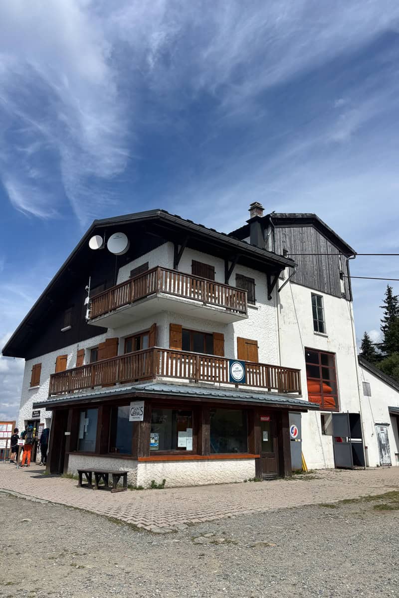
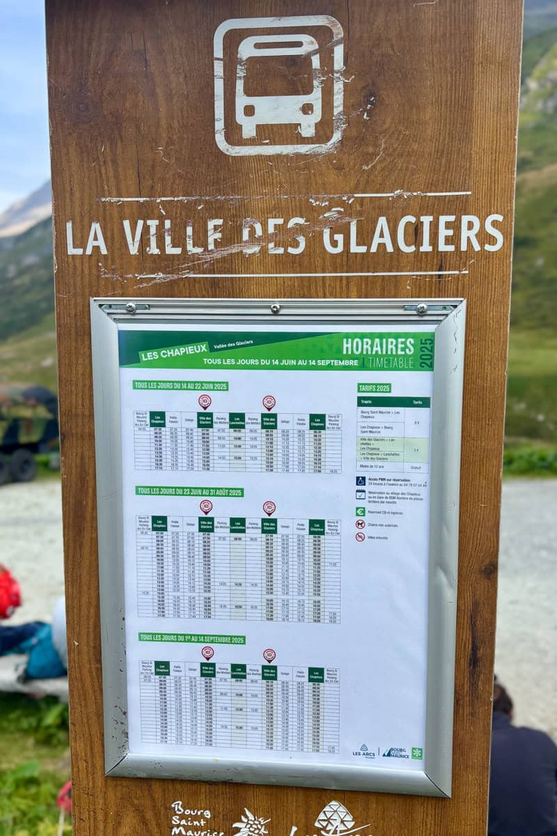
The Col des Fours variant takes off from Refuge de la Croix du Bonhomme. You'll skip Les Chapieux entirely and end at Ville des Glaciers instead.
If your accommodation is in Les Chapieux, you can take the shuttle from La Ville des Glaciers to Les Chapieux (and back again.) The shuttle cost 5 euros per person when we took it in 2025.
As noted above, this variant is quite steep and rough to traverse, and weather conditions can make it even harder, so take all that into account before deciding to use it.
Stage 3
Whether or not you took the Col des Fours variant, you can take a shuttle from Les Chapieux to Ville des Glaciers as a shortcut on Stage 3.
To get the shuttle from Les Chapieux, you can use the digital terminal at the campground and Refuge de la Nova area to pre-purchase tickets for your desired time slot.
I recommend buying the tickets when you arrive at Les Chapieux instead of waiting, as the earliest tickets sell out first. Lots of hikers use this shortcut.
Stage 4
This stage has a multiple shortcut options! That said, I only recommend taking the first shortcut (and thereby missing Col Chécrouit) if absolutely necessary, since it was a spectacular hike.
Skip Col Chécrouit
Between Refuge Elisabetta and the ascent to Col Chécrouit (near the Cabane du Combal refuge), you can opt to take a different route. Instead of turning right at the junction to climb Col Chécrouit, continue straight.
This road eventually (after about an hour of walking) meets up with a La Visaille city bus that can take you to Courmayeur. So it’s still a lot of walking, but a bit shorter and definitely easier.
This shortcut skips one of my favorite sections of the trail with spectacular views. I’d only skip this part if weather is bad or you feel it’s necessary.
Skip the Descent into Courmayeur
If you opted to hike over Col Chécrouit, continue on the trail up towards Courmayeur until you reach La Maison Vielle.
From here you can take a chairlift and then switch to a gondola, completely avoiding the steep, two-mile-ish descent into Courmayeur. This section did not have spectacular views, so if you need to skip it, don't feel bad!
Stage 5
Stage 5 also has (at least) one shortcut and two ways to exit the trail. Again, I don't recommend the first shortcut unless it's absolutely necessary, because this section was stunningly beautiful.
Use a Bus to Skip from Courmayeur to Val Ferret
In Courmayeur, take the Arriva city bus on the green Val Ferret line to the Arp Nouvaz (stop 29) to skip the section between Courmayeur and Val Ferret.
If the weather is beautiful I do not recommend this unless absolutely necessary, as this section of trail was gorgeous and, in my opinion, one of the highlights of the Tour du Mont Blanc.
Use the Mont Blanc Tunnel to Return to Chamonix from Courmayeur
From Courmayeur, there’s a tunnel that goes under Mont Blanc and connects Courmayeur to Chamonix. If you needed to end your hike here, you could get transportation back this way.
Note that the tunnel is closing from September 1 until December for multiple years for construction.
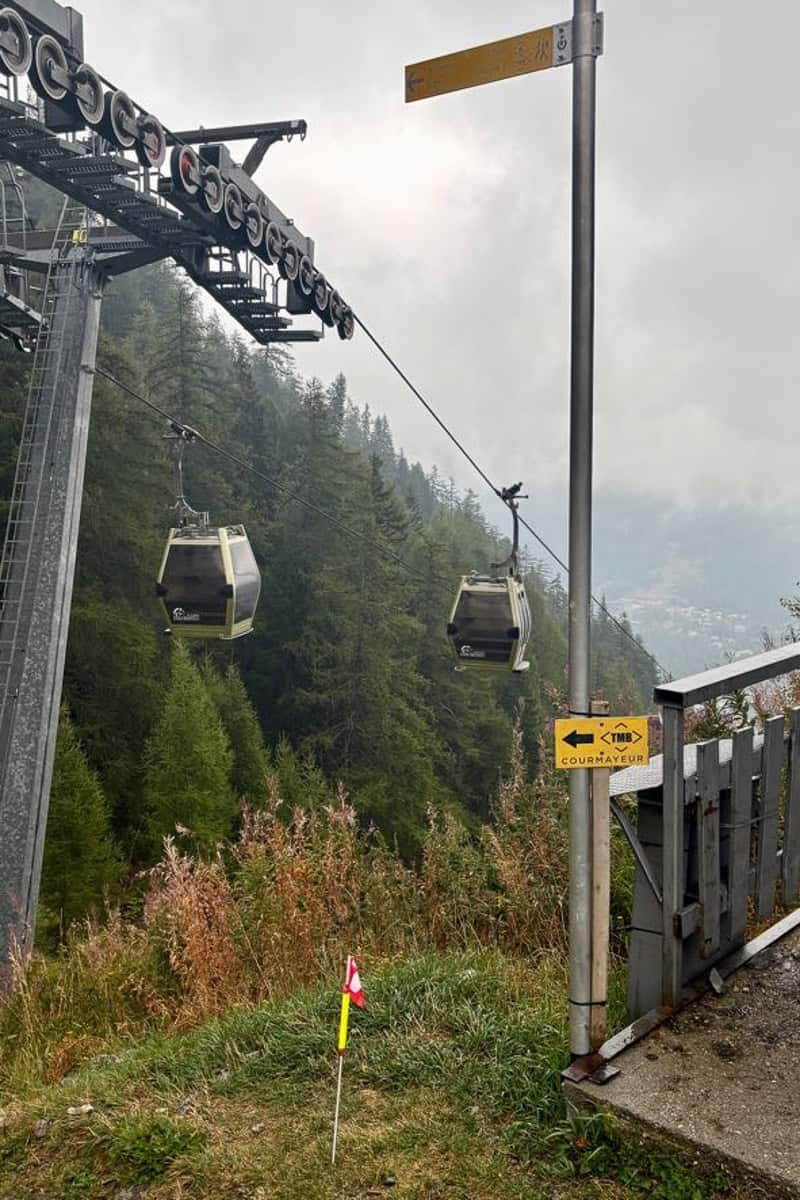
Use Gondolas to Return to Chamonix from Courmayeur
A very expensive alternative to the Courmayeur to Chamonix tunnel would be to take the Monte Bianca cable car, switch to the Aiguille du Midi cable car, and ride down into Chamonix.
This option only works in good weather and (as mentioned) would be extraordinarily expensive. That said, we heard it mentioned multiple times as a possible exit strategy after September 1 when the Mont Blanc tunnel closed.
Stage 7
You can take city buses to skip part or all of Stage 7 from La Fouly to Champex Lac. For this shortcut, I definitely recommend checking the public transportation option on Google maps, since it can involve a bus transfer.
If you take a bus partway, you can skip road walking and begin again at the uphill forested section.
If you want to skip the entire section from La Fouly to Champex Lac, you'd skip both the road walking and the forested uphill. To take the bus the entire way, you’ll likely need to change buses partway in Orsières (a nearby city).
This is one of the most-skipped sections of the TMB, since it's lacking much of the big views on the other sections.
Stage 8
The Fenêtre d’Arpette variant shaves off about one mile of hiking compared to the original route, but likely does not save time because it’s more difficult.
This variant should only be hiked in good weather because it involves rock scrambling and route finding.
Stage 9
Stage 9 includes a walk across the gorgeous Posettes ridge, which (again for me) was a highlight of my Tour du Mont Blanc hike. However, if the weather is stormy (particularly if there are thunderstorms or a chance of lightening), it may be wise to skip this ridge walk.
If needed, from Col de Balme, you can skip the ridge walk by taking the Autannes chair lift to the Charamillon gondola. From the base of the gondola, it's an easy walk from La Tour to Tré-le-Champ, where you can rejoin the trail.
Stage 11
Stage 11 offers zero "shortcuts," but provides multiple opportunities to exit the trail and return to Chamonix.
Gondola from Le Flégère to Les Praz
From Le Flégère, you can take the gondola down to Les Praz. From Les Praz, it's about a 30-minute walk to Chamonix, or you can take a city bus.
Many, many hikers end their hike at Le Flégère.
Gondola from Plan Prez (Brevent Mid-Station) to Chamonix
After beginning the ascent to Brevent, you'll arrive at the Brevent mid-station just before the really steep section of trail begins.
Going to this point allows you to hike the balcony walk between Le Flégère and Brevent, but doesn’t require you to climb all the way up to Brevent.
Gondola from Brevent to Chamonix
From the peak at Brevent, take the gondola down to Chamonix. This allows you to avoid the steep descent back down into Les Houches, as well as the 20-minute bus ride back to Chamonix (if that’s where you’re staying).
Need to figure out where to sleep on the route without spending too much? My guide to camping the Tour du Mont Blanc can help!

Leave a Comment: